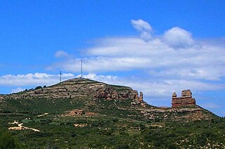
Teruel is a province of Aragon, in the northeast of Spain. The capital is Teruel.

Berge is a little village and municipality in Bajo Aragón, Teruel Province, Aragon, Spain. According to the 2010 census the municipality has a population of 274 inhabitants.

Pancrudo is a municipality in the Teruel Community comarca, Teruel province, Aragon, Spain. According to the 2010 census the municipality had a population of 136 inhabitants. Its postal code is 44720. Its distance from the provincial capital, Teruel is 56 kilometres.
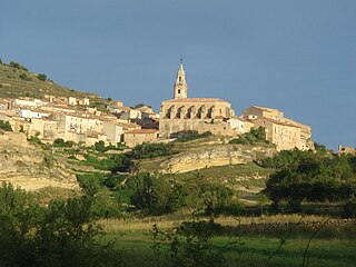
Tronchón is a town located in the province of Teruel in the autonomous community of Aragon, Spain. The town is near the border with Castellón, a province in the autonomous community of Valencia. It is situated in Teruel’s mountainous area known as Maestrazgo.
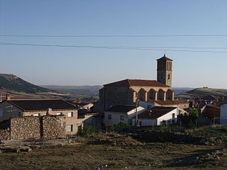
Ababuj is a municipality located in the Comunidad de Teruel comarca, province of Teruel, Aragon, Spain. According to the 2010 census the municipality had a population of 77 inhabitants. Its postal code is 44155.
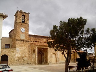
Bordón is a municipality located in the province of Teruel, Aragon, Spain. According to the 2010 census the municipality has a population of 141 inhabitants.

Cantavieja is a municipality located in the province of Teruel, Aragon, Spain. According to the 2004 census (INE), the municipality had a population of 740 inhabitants. It is the capital of the Maestrazgo comarca.
Lidón is a municipality located in the province of Teruel, Aragon, Spain. According to the 2010 census the municipality has a population of 57 inhabitants.

Villarluengo is a municipality at the heart of the mountainous Maestrazgo comarca, province of Teruel, Aragon, Spain. According to the 2010 census the municipality has a population of 188 inhabitants.

Villarroya de los Pinares is a municipality located in the Maestrazgo region, province of Teruel, Aragon, Spain. According to the 2004 census (INE), the municipality had a population of 190 inhabitants.
Cucalón is a municipality located in the province of Teruel, Aragon, Spain. According to the 2010 census the municipality has a population of 102 inhabitants. This town gives its name to the Sierra de Cucalón system of mountain ranges.

Seno is a municipality located in the Bajo Aragon area, close to Maestrazgo in province of Teruel, Aragon, Spain, at an altitude of 792 m. According to the 2018 census the municipality has a population of 39 inhabitants.
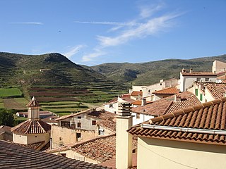
Ejulve is a municipality located in the Andorra-Sierra de Arcos comarca, province of Teruel, Aragon, Spain. According to the 2022 census (INE), the municipality has a population of 186 inhabitants.

The Maestrazgo or Maestrat is a natural and historical mountainous region, located at the eastern end of the Sistema Ibérico mountain range, in Spain. It encompasses the north of the Autonomous Community of Valencia, in Castellón province, and parts of the east of the Aragonese province of Teruel. The area is mountainous and sparsely populated with a rich mixture of flora and fauna.
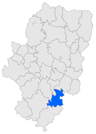
Maestrazgo is a comarca in southeastern Aragon, Spain. Its names derives from the Maestrat/Maestrazgo mountain massif that extends to the east to the Comarques of the Valencian Community Alt Maestrat and Baix Maestrat. The most important town is Cantavieja. It is bordered by the Aragonese comarcas of Andorra-Sierra de Arcos, Cuencas Mineras, Comunidad de Teruel and Bajo Aragón, in the north and in the west and Gúdar-Javalambre in the south, as well as with the Castellón Province in the east. Some municipal terms of this comarca are part of the historical region of Lower Aragon.

Lower Aragon, also known as Tierra Baja, is a natural and historical region in Aragon, Spain. The name "Lower Aragon" refers to the areas of the lowest altitude within the Ebro river basin, but the historical region encompasses only the river basins of several right tributaries of the Ebro River, namely the Matarranya, Guadalope, Regallo, Martín and Aguas, located between the Ebro and the Iberian mountain range.

Sierra de Gúdar is a mountain range in the Gúdar-Javalambre and Maestrazgo comarcas of Aragon and the Alto Mijares comarca of the Valencian Community, Spain. The highest point in the range is Peñarroya (2,019 m).

Sierra Carrascosa is a mountain range in the Maestrazgo comarca of Aragon, Teruel Province, Spain. The highest point in the range is Muela Carrascosa (1,214 m). The Guadalope River flows along the NW side of the range.

Sierra de Caballos or Sierra de los Caballos is a mountain range in the Maestrazgo and Bajo Aragón comarcas of Aragon, Teruel Province, Spain. The highest point in the range is Las Artigas (1,205 m). The Guadalopillo River flows along the northern side of the range.


