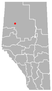
Deadwood is a hamlet in Alberta, Canada within the County of Northern Lights. It is located on Highway 690, approximately 10 kilometres (6.2 mi) east of the Mackenzie Highway, 80 kilometres (50 mi) north of Peace River and 34 kilometres (21 mi) southeast of Manning.
The Mackenzie Highway is a Canadian highway in northern Alberta and the Northwest Territories. It begins as Alberta Highway 2 at Mile Zero in Grimshaw, Alberta. After the first 4.0 km (2.5 mi), it becomes Alberta Highway 35 for the balance of its length through Alberta and then becomes Northwest Territories Highway 1.

Turin is a hamlet in Alberta, Canada within the Lethbridge County. It is located approximately 56 kilometres (35 mi) northeast of Lethbridge on Highway 25 and along a Canadian Pacific Railway line.

Klecin is a village in the administrative district of Gmina Marcinowice, within Świdnica County, Lower Silesian Voivodeship, in south-western Poland. Prior to 1945 it was in Germany.

Cleardale is a hamlet in northern Alberta, Canada within Clear Hills County. It is located on Highway 64 approximately 29 kilometres (18 mi) east of the British Columbia border and 98 kilometres (61 mi) northwest of Fairview.

Bąkowo is a village in the administrative district of Gmina Warlubie, within Świecie County, Kuyavian-Pomeranian Voivodeship, in north-central Poland. It lies approximately 3 kilometres (2 mi) south of Warlubie, 21 km (13 mi) north-east of Świecie, 60 km (37 mi) north of Toruń, and 65 km (40 mi) north-east of Bydgoszcz.

Boczkowice is a village in the administrative district of Gmina Włoszczowa, within Włoszczowa County, Świętokrzyskie Voivodeship, in south-central Poland. It lies approximately 12 kilometres (7 mi) south-east of Włoszczowa and 43 km (27 mi) west of the regional capital Kielce.

Smolary is a village in the administrative district of Gmina Trzcianka, within Czarnków-Trzcianka County, Greater Poland Voivodeship, in west-central Poland. It lies approximately 8 kilometres (5 mi) west of Trzcianka, 22 km (14 mi) north-west of Czarnków, and 81 km (50 mi) north-west of the regional capital Poznań.

Stęgosz is a village in the administrative district of Gmina Żerków, within Jarocin County, Greater Poland Voivodeship, in west-central Poland. It lies approximately 5 kilometres (3 mi) south-west of Żerków, 9 km (6 mi) north of Jarocin, and 58 km (36 mi) south-east of the regional capital Poznań.

Gałowo-Majątek is a village in the administrative district of Gmina Szamotuły, within Szamotuły County, Greater Poland Voivodeship, in west-central Poland. It lies approximately 2 kilometres (1 mi) south-west of Szamotuły and 32 km (20 mi) north-west of the regional capital Poznań.

Głodowo is a village in Gmina Miastko, Bytów County, Pomeranian Voivodeship, in northern Poland. It lies approximately 23 kilometres (14 mi) south-west of Bytów and 100 km (62 mi) south-west of Gdańsk.

Odcinek is a village in the administrative district of Gmina Rudniki, within Olesno County, Opole Voivodeship, in south-western Poland. It lies approximately 4 kilometres (2 mi) north-west of Rudniki, 24 km (15 mi) north-east of Olesno, and 63 km (39 mi) north-east of the regional capital Opole.

Blueberry Mountain is an unincorporated community in northwestern Alberta in Saddle Hills County, located on Highway 725, 91 kilometres (57 mi) north of Grande Prairie.

Marshall Junction is an unincorporated community in Fresno County, California. It lies at an elevation of 1224 feet.

Cherry Point is an unincorporated community in northern Alberta in Clear Hills County, located 12 kilometres (7.5 mi) south of Highway 64, 134 kilometres (83 mi) northwest of Grande Prairie.

Chinook Valley is an unincorporated community in northern Alberta under the jurisdiction of the County of Northern Lights.

Demmitt is a hamlet in northern Alberta, Canada within the County of Grande Prairie No. 1. It is located on Highway 43, approximately 77 kilometres (48 mi) northwest of Grande Prairie. The Northern Alberta Railway was built through the area in 1930 as it extended westwards towards Dawson Creek, British Columbia.

Faust is a hamlet in northern Alberta within Big Lakes County, located 1 kilometre (0.62 mi) north of Highway 2, approximately 241 kilometres (150 mi) northwest of Edmonton.

Huallen is a hamlet in northern Alberta, Canada within the County of Grande Prairie No. 1. It is located on Highway 43, approximately 35 kilometres (22 mi) west of Grande Prairie.

Ranfurly is a hamlet in central Alberta, Canada within the County of Minburn No. 27. Previously an incorporated municipality, Ranfurly dissolved from village status on January 1, 1946 to become part of the Municipal District of Birch Lake No. 484.


