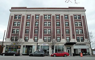
Woodlawn, on the South Side of Chicago, Illinois, is one of Chicago's 77 community areas. It is bounded by Lake Michigan to the east, 60th Street to the north, Martin Luther King Drive to the west, and 67th Street to the south. Both Hyde Park Career Academy and the all-boys Catholic Mount Carmel High School are in this neighborhood; much of its eastern portion is occupied by Jackson Park. The Woodlawn section of the park includes the site of the planned Obama Presidential Center, an estimated $500 million investment. The northern edge of Woodlawn contains a portion of the campus of the University of Chicago.

Streeterville is a neighborhood in the Near North Side community area of Chicago, Illinois, United States, north of the Chicago River. It is bounded by the river on the south, the Magnificent Mile portion of Michigan Avenue on the west, and Lake Michigan on the north and east, according to most sources, although the City of Chicago only recognizes a small portion of this region as Streeterville. Thus, it can be described as the Magnificent Mile plus all land east of it. The tourist attraction of Navy Pier and Ohio Street Beach extend out into the lake from southern Streeterville. To the north, the East Lake Shore Drive District, where the Drive curves around the shoreline, may be considered an extension the Gold Coast. The majority of the land in this neighborhood is reclaimed sandbar.

Norwood Park is one of the 77 Chicago community areas. It encompasses the smaller neighborhoods of Big Oaks, Norwood Park East, Norwood Park West, Old Norwood Park, Oriole Park, and Union Ridge.

Beverly, officially Beverly Hills, is the 72nd of Chicago's 77 community areas. Located 12 miles (19 km) from the Loop, it is on the city's far south side. Beverly is considered part of the Blue Island Ridge, along with the nearby community areas of Morgan Park and Mount Greenwood, and Washington Heights, and the City of Blue Island. As of 2020, Beverly had 20,027 inhabitants.

Humboldt Park, one of 77 designated community areas, is on the West Side of Chicago, Illinois. The Humboldt Park neighborhood is known for its dynamic social and ethnic demographic change over the years. The Puerto Rican community has identified strongly with the area since the 1970s. Humboldt Park is also the name of a 207-acre (0.8 km2) park adjacent to the community area.

Logan Square is an official community area, historical neighborhood, and public square on the northwest side of the City of Chicago. The Logan Square community area is one of the 77 city-designated community areas established for planning purposes. The Logan Square neighborhood, located within the Logan Square community area, is centered on the public square that serves as its namesake, located at the three-way intersection of Milwaukee Avenue, Logan Boulevard and Kedzie Boulevard.

Parks in Chicago include open spaces and facilities, developed and managed by the Chicago Park District. The City of Chicago devotes 8.5% of its total land acreage to parkland, which ranked it 13th among high-density population cities in the United States in 2012. Since the 1830s, the official motto of Chicago has been Urbs in horto, Latin for "City in a garden" for its commitment to parkland. In addition to serving residents, a number of these parks also double as tourist destinations, most notably Lincoln Park, Chicago's largest park, visited by over 20 million people each year, is one of the most visited parks in the United States. Notable architects, artists and landscape architects have contributed to the 570 parks, including Daniel Burnham, Frederick Law Olmsted, Jens Jensen, Dwight Perkins, Frank Gehry, and Lorado Taft.
Avondale is one of Chicago's 77 officially designated community areas. It is on the Northwest Side of the city. The northern border is Addison Street from the north branch of the Chicago River in the east to Pulaski Road in the west. The neighborhood extends further west along Belmont Avenue to the Union Pacific/Northwest Line. Its southern border is Diversey Avenue from the Union Pacific/Northwest Line to the Chicago River.

West Town, northwest of the Loop on Chicago's West Side, is one of the city's officially designated community areas. Much of this area was historically part of Polish Downtown, along Western Avenue, which was then the city's western boundary. West Town was a collection of several distinct neighborhoods and the most populous community area until it was surpassed by Near West Side in the 1960s. The boundaries of the community area are the Chicago River to the east, the Union Pacific railroad tracks to the south, the former railroad tracks on Bloomingdale Avenue to the North, and an irregular western border to the west that includes the city park called Humboldt Park. Humboldt Park is also the name of the community area to West Town's west, Logan Square is to the north, Near North Side to the east, and Near West Side to the south. The collection of neighborhoods in West Town along with the neighborhoods of Bucktown and the eastern portion of Logan Square have been referred to by some media as the "Near Northwest Side".
The Almighty InsanePopesNation is a Chicago, Illinois street gang, formed in the late 1950s on the north side of Chicago, primarily building membership from a Greek greaser gang that hung out at the corner of Lawrence and Rockwell. This small group had problems with the much larger Latin Kings gang on the north side, and so they began to associate with the Almighty Simon City Royals in an attempt to protect themselves. However, rather than joining the Royals outright, they eventually decided to form their own gang, which they named the Popes: this stood for "Protecting Our People Eliminating Spics".

Washington Heights is the 73rd of Chicago's 77 community areas. Located 12 miles (19 km) from the Loop, it is on the city's far south side. Washington Heights is considered part of the Blue Island Ridge, along with the nearby community areas of Beverly, Morgan Park and Mount Greenwood, and the village of Blue Island. It contains a neighborhood also known as Washington Heights, as well as the neighborhoods of Brainerd and Fernwood. As of 2017, Washington Heights had 27,453 inhabitants.

Calumet Park is a 198-acre (79-hectare) park in Chicago, Illinois. It provides access to Lake Michigan from the East Side neighborhood on the city's Southeast Side. The park contains approximately 0.9 miles (1.5 km) of lake frontage from 95th Street to 102nd Street. The park is listed on the National Register of Historic Places.
The Simon City Royals, also known as the Almighty Simon City Royal Nation, are a street and prison gang which began in Chicago during 1952 as Simon City, a greaser gang. They named themselves for Simons Park, which is located on the corner of Drake and Wabansia in the Humboldt Park neighborhood where they originally formed. The gang had a major influence on other gangs around Chicago and the wider gang culture in Humboldt Park. The Royals are one of the oldest and largest white gangs in the US.
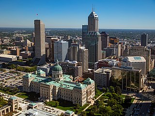
Downtown Indianapolis is a neighborhood area and the central business district of Indianapolis, Indiana, United States. Downtown is bordered by Interstate 65, Interstate 70, and the White River, and is situated near the geographic center of Marion County. Downtown has grown from the original 1821 town plat—often referred to as the Mile Square—to encompass a broader geographic area of central Indianapolis, containing several smaller historic neighborhoods.
The following is a list of neighborhoods and commercial districts in Sioux City, Iowa.
North Sacramento is a well-established community that is part of the city of Sacramento, California, United States. It was a city from its incorporation in 1924 until it was merged in 1964 into the City of Sacramento. Incorporation was led by the North Sacramento Chamber of Commerce, incorporated the year before, in 1923.

Saint Paul, Minnesota, consists of 17 officially defined city districts or neighborhoods.
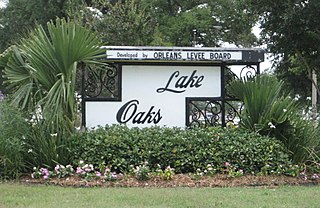
Lake Terrace/Lake Oaks is a neighborhood of the city of New Orleans, Louisiana. A sub-district of the city's Gentilly District, its boundaries as defined by the City Planning Commission are: Lake Pontchartrain to the north; the Industrial Canal to the east; Leon C. Simon Drive, Elysian Fields Avenue, New York Street, the London Avenue Canal, and Allen Toussaint Boulevard to the south; and Bayou St. John to the west. The neighborhood comprises the Lake Terrace and Lake Oaks subdivisions, the principal campus of the University of New Orleans, and the University of New Orleans Research & Technology Park — all built on land reclaimed from Lake Pontchartrain.
The Maniac Latin Disciples Nation is a Hispanic street gang in Chicago and one of the largest in the Folks Nation alliance. Originally known as the Latin Scorpions, the gang was founded by Albert "Hitler" Hernandez and other Puerto Rican teenagers in the Humboldt Park community in approximately 1966. They were influential in the culture and history of gangs in Humboldt Park, and continue to be active there today.

The Chicago neighborhood of Humboldt Park is the founding grounds for several major gangs, including the Latin Kings, Simon City Royals, and Maniac Latin Disciples, among a number of other gangs with active chapters in the area as of 2023. With its roots dating back to the 1950s, the continuous presence and activity of gangs around the neighborhood has caused it to be a frequent subject of law enforcement, media, and residents over the years.
