Pulaski Park (Chicago)

Last updated
Pulaski Park and Fieldhouse
Pulaski Park Fieldhouse Chicago IL.jpg
Chicago central map.png
Red pog.svg
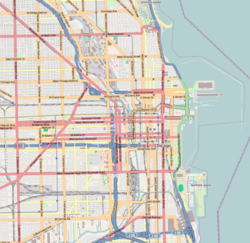
Location of Pulaski Park in Central Chicago
Location1419 W Blackhawk Street, Chicago, Illinois
Coordinates 41°54′21″N87°39′47″W / 41.90583°N 87.66306°W / 41.90583; -87.66306
Area3.8 acres (1.5 ha)
Built1912–14
ArchitectW.C. Zimmerman
Architectural styleTudor Revival
NRHP reference No. 81000217 [1]
Significant dates
Added to NRHPAugust 13, 1981
Designated CLJuly 29, 2003
Pulaski Park and Fieldhouse Chicago IL.jpg

Pulaski Park is a park in the West Town neighborhood of Chicago, Illinois. It was founded in 1912, and was named after American Revolutionary War hero Casimir Pulaski.

Contents

Pulaski Park derives its name from the historic park and fieldhouse that was designed by Jens Jensen between 1912 and 1914. 1,200 people were displaced, leading to the razing of a number of buildings while others were moved to nearby locations in the neighborhood. [2]

The park and fieldhouse were listed on the National Register of Historic Places on August 13, 1981. [3] It became an official Chicago Landmark on July 29, 2003. [4]

The neighborhood in the park's vicinity within West Town is called Pulaski Park after the park.

See also

Related Research Articles

<span class="mw-page-title-main">Logan Square, Chicago</span> Community area in Chicago

Logan Square is an official community area, historical neighborhood, and public square on the northwest side of the City of Chicago. The Logan Square community area is one of the 77 city-designated community areas established for planning purposes. The Logan Square neighborhood, located within the Logan Square community area, is centered on the public square that serves as its namesake, located at the three-way intersection of Milwaukee Avenue, Logan Boulevard and Kedzie Boulevard.

<span class="mw-page-title-main">Parks in Chicago</span>

Parks in Chicago include open spaces and facilities, developed and managed by the Chicago Park District. The City of Chicago devotes 8.5% of its total land acreage to parkland, which ranked it 13th among high-density population cities in the United States in 2012. Since the 1830s, the official motto of Chicago has been Urbs in horto, Latin for "City in a garden" for its commitment to parkland. In addition to serving residents, a number of these parks also double as tourist destinations, most notably Lincoln Park, Chicago's largest park, visited by over 20 million people each year, is one of the most visited parks in the United States. Notable architects, artists and landscape architects have contributed to the 570 parks, including Daniel Burnham, Frederick Law Olmsted, Jens Jensen, Dwight Perkins, Frank Gehry, and Lorado Taft.

<span class="mw-page-title-main">Avondale, Chicago</span> Community area in Chicago

Avondale is one of Chicago's 77 officially designated community areas. It is on the Northwest Side of the city. The northern border is Addison Street from the north branch of the Chicago River in the east to Pulaski Road in the west. The neighborhood extends further west along Belmont Avenue to the Union Pacific/Northwest Line. Its southern border is Diversey Avenue from the Union Pacific/Northwest Line to the Chicago River.

<span class="mw-page-title-main">Irving Park, Chicago</span> Community area in Chicago

Irving Park is one of 77 officially designated Chicago community areas, and is located on the Northwest Side. It is bounded by the Chicago River on the east, the Milwaukee Road railroad tracks on the west, Addison Street on the south and Montrose Avenue on the north, west of Pulaski Road stretching to encompass the region between Belmont Avenue on the south and, roughly, Leland Avenue on the north. It is named after the American author Washington Irving.

<span class="mw-page-title-main">West Town, Chicago</span> Community area in Chicago

West Town, northwest of the Loop on Chicago's West Side, is one of the city's officially designated community areas. Much of this area was historically part of Polish Downtown, along Western Avenue, which was then the city's western boundary. West Town was a collection of several distinct neighborhoods and the most populous community area until it was surpassed by Near West Side in the 1960s. The boundaries of the community area are the Chicago River to the east, the Union Pacific railroad tracks to the south, the former railroad tracks on Bloomingdale Avenue to the North, and an irregular western border to the west that includes the city park called Humboldt Park. Humboldt Park is also the name of the community area to West Town's west, Logan Square is to the north, Near North Side to the east, and Near West Side to the south. The collection of neighborhoods in West Town along with the neighborhoods of Bucktown and the eastern portion of Logan Square have been referred to by media as the Near Northwest Side.

<span class="mw-page-title-main">West Garfield Park, Chicago</span> Community area in Chicago

West Garfield Park on the West Side of Chicago, Illinois, is one of 77 officially designated Chicago community areas. It is directly west of Garfield Park.

<span class="mw-page-title-main">Old Town, Chicago</span> United States historic place in Chicago, Illinois

Old Town is a neighborhood and historic district in Near North Side and Lincoln Park, Chicago, Illinois, home to many of Chicago's older, Victorian-era buildings, including St. Michael's Church, one of seven buildings to survive the Great Chicago Fire.

<span class="mw-page-title-main">National Register of Historic Places listings in Iowa</span>

This is a list of properties and historic districts in Iowa that are listed on the National Register of Historic Places. There are listings in all of Iowa's 99 counties, adding up to over 2,300 total.

<span class="mw-page-title-main">Calumet Park</span> United States historic place

Calumet Park is a 198-acre (79-hectare) park in Chicago, Illinois. It provides access to Lake Michigan from the East Side neighborhood on the city's Southeast Side. The park contains approximately 0.9 miles (1.5 km) of lake frontage from 95th Street to 102nd Street. The park is listed on the National Register of Historic Places.

<span class="mw-page-title-main">Hillcrest (Little Rock)</span> United States historic place

Hillcrest Historic District is an historic neighborhood in Little Rock, Arkansas that was listed on the National Register of Historic Places on December 18, 1990. It is often referred to as Hillcrest by the people who live there, although the district's boundaries actually encompass several neighborhood additions that were once part of the incorporated town of Pulaski Heights. The town of Pulaski Heights was annexed to the city of Little Rock in 1916. The Hillcrest Residents Association uses the tagline "Heart of Little Rock" because the area is located almost directly in the center of the city and was the first street car suburb in Little Rock and among the first of neighborhoods in Arkansas.

There are more than 350 places listed on the United States National Register of Historic Places in Chicago, Illinois, including 83 historic districts that may include numerous historic buildings, structures, objects and sites. This total is documented in the tables referenced below. Tables of these listings may be found in the following articles:

<span class="mw-page-title-main">Columbus Park (Chicago)</span> United States historic place

Columbus Park is a 135-acre (55 ha) park located on the far West Side of Chicago, Illinois in the Austin neighborhood. It is considered the finest work by landscape architect Jens Jensen and was consequently named a National Historic Landmark in 2003.

<span class="mw-page-title-main">Pullman National Historical Park</span> Historic district and national monument in Chicago

Pullman National Historical Park is a historic district located in Chicago and was the first model, planned industrial community in the United States. The district had its origins in the manufacturing plans and organization of the Pullman Company and became one of the most well-known company towns in the United States, as well as the scene of the violent 1894 Pullman strike. It was built for George Pullman as a place to produce the famous Pullman sleeping cars.

<span class="mw-page-title-main">Prairie Avenue District</span> Historic district in Illinois, United States

The Prairie Avenue District is a historic district in the Near South Side community area of Chicago, Illinois. It includes the 1800 and 1900 blocks of South Prairie Avenue and the 1800 block of South Indiana, and 211-217 East Cullerton. It was the site of the Battle of Fort Dearborn and became the city's most fashionable residential district after the Great Chicago Fire. It was designated a Chicago Landmark on December 27, 1979. The district was added to the National Register of Historic Places on November 15, 1972. The John J. Glessner House, designed and built by Henry Hobson Richardson in 1885–1886 at 1800 S. Prairie Avenue, has been restored as a historic house museum, and is open for public tours. In 2006, the Prairie District Neighborhood Alliance, a non-profit organization was formed to provide representation for thousands of South Loop residents, including the Prairie Avenue District, Central Station, Museum Park, Motor Row, and the South Michigan Avenue Corridor, as well as other areas of the Near South Side.

<span class="mw-page-title-main">Villa District</span> Historic district in Illinois, United States

The Villa District, also known as Villa Historic District, is a historic district in Chicago, Illinois, United States. It is located on Chicago's Northwest Side within the community area of Irving Park. Its borders are along Pulaski Road to the west, the Union Pacific/Northwest rail line to the north, Hamlin Avenue to the east, and Addison Street to the south. Located directly north of the Wacławowo area of Avondale, the Villa District is serviced by the Blue Line's Addison street station.

<span class="mw-page-title-main">National Register of Historic Places listings in Pulaski County, Arkansas</span>

This is a list of the National Register of Historic Places listings in Pulaski County, Arkansas.

<span class="mw-page-title-main">Indian Boundary Park</span> United States historic place

Indian Boundary Park is a 13-acre (5.3 ha) urban park in the West Ridge neighborhood of North Side, Chicago, Illinois.

<span class="mw-page-title-main">Austin Town Hall Park</span> United States historic place

Austin Town Hall Park is a park at 5610 W. Lake Street in the Austin neighborhood of Chicago, Illinois. The site was formerly used for the town hall of Cicero Township. The Austin subdivision of Cicero was annexed to the City of Chicago in 1899, and the town hall site eventually became part of the Chicago Park District. The park's fieldhouse, designed by Michaelsen and Rognstad in the 1920s, is influenced largely by Philadelphia's Independence Hall.

References

  1. "National Register Information System". National Register of Historic Places . National Park Service. March 13, 2009.
  2. "Chicago Park District: Pulaski Park". Archived from the original on 2011-06-14. Retrieved 2010-10-30.
  3. Chicago listings on the National Register of Historic Places Archived 2010-03-23 at the Wayback Machine
  4. "Chicago Landmarks | Pulaski Park Fieldhouse". Archived from the original on 2010-02-12. Retrieved 2007-04-13.