Anston is a civil parish in South Yorkshire, England, formally known as North and South Anston. The parish of Anston consists of the settlements of North Anston and South Anston, divided by the Anston Brook.

The West Riding of Yorkshire is one of three historic subdivisions of Yorkshire, England. From 1889 to 1974 the administrative county, County of York, West Riding, was based closely on the historic boundaries. The lieutenancy at that time included the City of York and as such was named West Riding of the County of York and the County of the City of York.
Dinnington is a town in South Yorkshire, England. It is part of the Metropolitan Borough of Rotherham, as a border town, it is almost equidistant from Sheffield to Rotherham, and about 5 miles (8 km) from Worksop.

The Metropolitan Borough of Rotherham is a metropolitan borough of South Yorkshire, England. It is named after its largest town, Rotherham, but also spans the outlying towns of Maltby, Swinton, Wath-upon-Dearne, Dinnington and also the villages of Rawmarsh and Laughton. A large valley also spans the entire borough. Locally known as the Rother Valley.

Royston is a suburban village within the Metropolitan borough of Barnsley, in South Yorkshire, England. Historically part of the West Riding of Yorkshire, but was incorporated into the Metropolitan borough of Barnsley in 1974 and is now on the border with West Yorkshire. It is part of the Barnsley Central borough constituency, and has a population of 9,375, increasing to 10,728 at the 2011 Census. It is situated 4 miles (6.4 km) north-east of Barnsley, and 6 miles (9.7 km) south-east of Wakefield.

Thorpe Salvin is a village and a civil parish in the Metropolitan Borough of Rotherham in South Yorkshire, England, on the border with Nottinghamshire. It lies between Worksop and Harthill, and is located at an elevation of around 110 metres above sea level. At the 2011 Census, it had a population of 476, down from 502 in 2001.

Strafforth and Tickhill, originally known as Strafforth, was the southernmost wapentake in the West Riding of Yorkshire, England. The west of the district, plus a detached area in the east, constituted the Upper Division, while the central area and a detached part in the extreme east constituted the Lower Division.

Dinnington High School is a secondary school in Dinnington, in the Metropolitan Borough of Rotherham, South Yorkshire, England. It is a coeducational comprehensive school for day pupils between the ages of 11 and 18, and takes in approximately 1,200 pupils from Dinnington and surrounding settlements.
Staincross was a Wapentake (Hundred), which is an administrative division, in the historic county of the West Riding of Yorkshire. It consisted of seven parishes, and included the towns of Barnsley and Penistone
Laughton en le Morthen is a small dormitory village and civil parish in the Metropolitan Borough of Rotherham lying to the south of Rotherham, South Yorkshire, England, and its main attraction is the All Saints Church with its tower and spire of 185 feet. The village had a population of 1,241 at the 2011 Census. The parish also includes the hamlets of Carr, Slade Hooton and Brookhouse.
Roger de Busli was a Norman baron who participated in the conquest of England in 1066.
Thurcroft is a village and civil parish situated south-east of Rotherham in the Metropolitan Borough of Rotherham in South Yorkshire, England. From 1902 to 1991, it was a mining community. It has a population of 5,296, increasing to 6,900 at the 2011 Census.
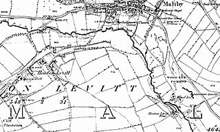
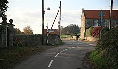
Hooton Levitt is a village and civil parish in the Metropolitan Borough of Rotherham in South Yorkshire, England; one of four villages in the county that carry the name of Hooton, meaning 'farmstead on a spur of land'. It has a population of 110, increasing to 132 at the 2011 Census.
Morthen is a hamlet in South Yorkshire in England, lying between Brampton-en-le-Morthen and Laughton-en-le-Morthen. The population of the hamlet as taken at the 2011 Census was less than 100. Details are included in the civil parish of Thurcroft.
Carr is a hamlet in the civil parish of Laughton-en-le-Morthen, in the Rotherham district lying to the south of Rotherham, South Yorkshire, England.

Brampton-en-le-Morthen is a small dormitory village and former civil parish, now in the parish of Thurcroft, in the Rotherham district lying to the south of Rotherham, South Yorkshire, England. In 1911, the parish had a population of 148.
Laughton en le Morthen is a civil parish in the Metropolitan Borough of Rotherham, South Yorkshire, England. The parish contains 27 listed buildings that are recorded in the National Heritage List for England. Of these, one is listed at Grade I, the highest of the three grades, two are at Grade II*, the middle grade, and the others are at Grade II, the lowest grade. The parish contains the village of Laughton en le Morthen, the smaller settlements of Brookhouse, Carr, and Slade Hooton, and the surrounding countryside. Most of the listed buildings are houses, cottages and associated structures, farmhouses and farm buildings. The other listed buildings include a church and its vicarage, a school, a cascade, and a telephone kiosk.

Wigtwizzle is a hamlet in the civil parish of Bradfield, in South Yorkshire, England. The hamlet is 6 miles (9.7 km) south of Penistone, and 12 miles (19 km) north west of Sheffield.