
Elvetham Heath is a residential area and civil parish, containing around 2000 homes on a 311-acre (1.26 km2) site, just outside the north western boundary of the town of Fleet in the English county of Hampshire. Construction of Elvetham Heath began in the summer of 1999 and ended in June 2008. The population of the civil parish at the 2011 Census was 5,183.

Haddenham is a village and civil parish in west Buckinghamshire, England. It is about 5 miles (8 km) south-west of Aylesbury and 4 miles (6 km) north-east of Thame in neighbouring Oxfordshire. At the 2011 Census, the population of the civil parish was 4,502.

Thame is a market town and civil parish in Oxfordshire, about 13 miles (21 km) east of the city of Oxford and 10 miles (16 km) southwest of Aylesbury. It derives its name from the River Thame which flows along the north side of the town and forms part of the county border with Buckinghamshire. The parish includes the hamlet of Moreton south of the town. The 2011 Census recorded the parish's population as 11,561. Thame was founded in the Anglo-Saxon era and was in the kingdom of Wessex.
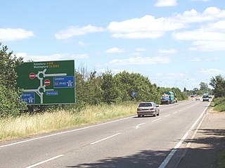
The A418 road is a main trunk road in Buckinghamshire and Oxfordshire, England. It begins at a roundabout with the A4146 just north of Ascott, near Leighton Buzzard. It then runs south as a single carriageway through Wing to Aylesbury. This stretch is proposed for a dual carriageway bypass. After diving through Aylesbury the road runs past Aylesbury College before heading out into Stone. From there it runs past Haddenham to the M40 near Thame. The road has been rerouted in two locations so that it no longer runs through Hulcott and Haddenham.

Haddenham & Thame Parkway railway station is a station in Buckinghamshire serving the village of Haddenham and town of Thame in the neighbouring county of Oxfordshire, England. The station is on the western edge of Haddenham, about 2 miles (3 km) north east of Thame, and is served by Chiltern Railways.

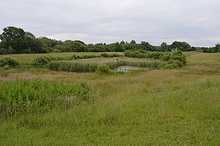
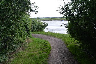
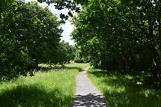
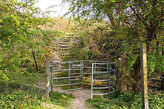
Cuttle Brook is a 13-hectare (32-acre) Local Nature Reserve in Thame in Oxfordshire. It is owned and managed by Thame Town Council.

Ali's Pond is a 0.4-hectare (0.99-acre) Local Nature Reserve in Sonning in Berkshire. It is owned by Sonning Parish Council and managed by the Friends of Ali's Pond.

Chorleywood Common is a 75.6 hectare Local Nature Reserve in Chorleywood in Hertfordshire. It is owned and managed by Chorleywood Parish Council, and the declaring authority is Hertfordshire County Council. The common is part of the Chilterns Area of Outstanding Natural Beauty.

Marshalls Heath is a hamlet and a 4-hectare (10-acre) Local Nature Reserve in Wheathampstead parish, Hertfordshire, England. The nature reserve is owned by Wheathampstead Parish Council and managed by the council together with the Friends of Marshalls Heath. It was purchased from The Queen's College, Oxford, in 1966.

Chairborough Road is a 3.9 hectares Local Nature Reserve in High Wycombe in Buckinghamshire. It is owned and managed by Wycombe District Council.

Cuckoo Wood is a 2.5 hectare Local Nature Reserve in Braintree in Essex. It is owned by Braintree District Council and managed by Essex County Council as an educational resource.

Gosfield Sandpits is an 8.3 hectare Local Nature Reserve in Gosfield, north of Braintree in Essex. It is owned by Gosfield Parish Council, and managed by the Parish Council and Braintree District Council.
Church Lane Flood Meadow is a 3.3 hectare Local Nature Reserve in North Weald Bassett in Essex. It is owned and managed by Epping Forest District Council.
Kendal Park or Hullbridge Foreshore is a 2.8 hectare Local Nature Reserve in Hullbridge in Essex. It is owned by Rochford District Council and managed by Hullbridge Parish Council.
Marylands is a 3.7 hectare Local Nature Reserve in Hockley in Essex. It is owned by Rochford District Council and managed by Hockley Parish Council.

Brockwell Meadows is a 4.3 hectare Local Nature Reserve in Kelvedon in Essex. It is owned by Kelevdon Parish Council and managed by the Council together with a group of local residents called the Brockwell Group.

Crecy Hill is a 0.8-hectare (2.0-acre) Local Nature Reserve north of Tackley in Oxfordshire. It is owned by Oxford County Council and managed by Tackley Parish Council.
Watlington Chalk Pit is a 1.6-hectare (4.0-acre) Local Nature Reserve east of Watlington in Oxfordshire. It is owned by South Oxfordshire District Council and managed by Watlington Parish Council and Watlington Environment Group. It is part of Watlington and Pyrton Hills Site of Special Scientific Interest.
