
Windsor Hill is a 61.8-hectare (153-acre) biological Site of Special Scientific Interest in Princes Risborough in Buckinghamshire. It lies within the Chilterns Area of Outstanding Natural Beauty, and it is featured in the Nature Conservation Review. A small part is managed by the Berkshire, Buckinghamshire and Oxfordshire Wildlife Trust, and access to this area requires a permit.

The Blue Lagoon Local Nature Reserve is a Local Nature Reserve in Bletchley, Milton Keynes in Buckinghamshire, United Kingdom. The Blue Lagoon is the only Local Nature Reserve in the City of Milton Keynes. The diverse habitat, including shallow and deep water, grassland, scrubland and woodland, hosts an abundance of fauna and flora. The Blue Lagoon is also extensively used as a recreational facility.

Kings and Bakers Woods and Heaths is a 212.8-hectare (526-acre) Site of Special Scientific Interest (SSSI) between Heath and Reach in Bedfordshire and Great Brickhill in Buckinghamshire. The site is mainly in Bedfordshire but includes Rammamere Heath in Buckinghamshire. It was notified in 1984 under Section 28 of the Wildlife and Countryside Act 1981, and the local planning authorities are Central Bedfordshire Council and Aylesbury Vale Council. Part of it is a National Nature Reserve, and part of it is a nature reserve managed by the Wildlife Trust for Bedfordshire, Cambridgeshire and Northamptonshire. it is also a Nature Conservation Review site.
Bramley Bank is a 10.3 hectare local nature reserve in Upper Shirley in the London Borough of Croydon. It is owned by Croydon Council and managed by the London Wildlife Trust.

Hutchinson's Bank is 21.8 hectare Local Nature Reserve and Site of Metropolitan Importance for Nature Conservation in New Addington in the London Borough of Croydon. It is owned by Croydon Council and managed by the London Wildlife Trust.
Foxley Wood is an 11.36 hectare Local Nature Reserve and Site of Borough Importance for Nature Conservation, Grade 1, in Purley in the London Borough of Croydon. It is owned and managed by Croydon Council. The site was purchased by Coulsdon and Purley Urban District Council under the Green Belt Act in the 1930s.

Bacombe and Coombe Hills is a 76.4-hectare (189-acre) biological Site of Special Scientific Interest in Upper Bacombe in Buckinghamshire. Bacombe Hill was formerly owned by Buckinghamshire County Council, which transferred it to Berkshire, Buckinghamshire and Oxfordshire Wildlife Trust in 2014. Coombe Hill is owned by the National Trust.

Bradenham Woods, Park Wood and The Coppice is a 129.1-hectare (319-acre) biological Site of Special Scientific Interest in Bradenham in Buckinghamshire. It is in the Chilterns Area of Outstanding Natural Beauty, and it is described in A Nature Conservation Review. The site is part of the Bradenham Estate, which is owned by the National Trust. It is also designated a Special Area of Conservation. Grim's Ditch, a Scheduled Monument, runs through the site.

Garston Park is a park in Garston, Hertfordshire, a suburb of Watford in Hertfordshire. An area of 6.4 hectares, about half of the park, is a Local Nature Reserve. It is owned and managed by Watford Borough Council.

Weston Hills is a 17 hectare Local Nature Reserve in Baldock in North Hertfordshire. It is owned by Hertfordshire County Council and North Hertfordshire District Council (NHDC) and managed by NHDC.
Aston Clinton Ragpits is a 2.9-hectare (7.2-acre) biological Site of Special Scientific Interest in Aston Clinton in Buckinghamshire. It is a former chalk quarry, which is now a nature reserve managed by the Berkshire, Buckinghamshire and Oxfordshire Wildlife Trust. It is in the Chilterns Area of Outstanding Natural Beauty.

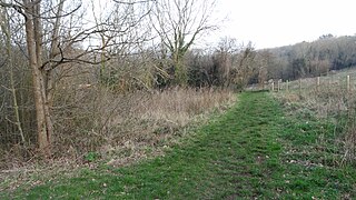
Brush Hill is a 14.7 hectares Local Nature Reserve east of Princes Risborough in Buckinghamshire. It has been managed since 2013 by the Chiltern Society, and it is part of the Chilterns Area of Outstanding Natural Beauty.

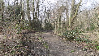
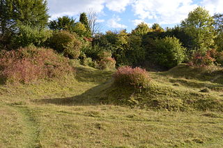
Whiteleaf Hill is an 11 hectares Local Nature Reserve near Princes Risborough in Buckinghamshire. It is owned by Buckinghamshire County Council and managed by the Chiltern Society. it is in the Chilterns Area of Outstanding Natural Beauty, and it has five scheduled ancient monuments, including some dating to the Neolithic and Bronze Ages, and the Whiteleaf Cross, a chalk carving thought to date to the eighteenth century.

Prestwood Local Nature Reserve or Prestwood (Picnic Site) is a 2.1 hectares (5.2 acres) Local Nature Reserve in Prestwood in Buckinghamshire. It is in the Chilterns Area of Outstanding Natural Beauty. The site is owned by Wycombe District Council and leased to the Chiltern Society.

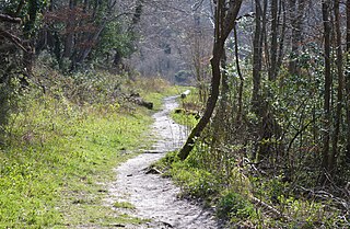
Yoesden, often known as Yoesden Bank, is a 13-hectare (32-acre) nature reserve in Bledlow Ridge in Buckinghamshire. It is managed by the Berkshire, Buckinghamshire and Oxfordshire Wildlife Trust. It is in the Chilterns Area of Outstanding Natural Beauty.
Gomm's Wood is an 18.1 hectares Local Nature Reserve in High Wycombe in Buckinghamshire. It is owned and managed by Wycombe District Council.
Home Mead is a 1.8 hectare Local Nature Reserve in Loughton in Essex. It is owned and managed by Epping Forest District Council.

Maiden Erlegh Lakes is a 10.2-hectare (25-acre) Local Nature Reserve Earley, a suburb of Reading in Berkshire. It is owned and managed by Earley Town Council.

Cocksherd Wood is a 4.8-hectare (12-acre) Local Nature Reserve in Slough in Berkshire. It is owned by Slough Borough Council and managed by Evergreen 2000. The reserve is known locally as Bluebell Wood.
