South Bucks

Last updated

South Bucks District
South Bucks District Council Offices.jpg
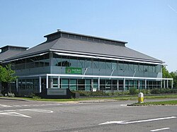
Capswood, Oxford Road, Denham: South Bucks District Council headquarters 2004-2020.
South Bucks UK locator map.svg
South Bucks shown within Buckinghamshire
Sovereign state United Kingdom
Constituent country England
Region South East England
Non-metropolitan county Buckinghamshire
Status Non-metropolitan district
Admin HQ Denham
Incorporated1 April 1974
Government
  TypeNon-metropolitan district council
  BodySouth Bucks District Council
  LeadershipLeader & Cabinet
Area
  Total54.55 sq mi (141.28 km2)
  Rank187th (of 309)
Population
 (mid-2018)
  Total70,043
  Density1,300/sq mi (500/km2)
  Ethnicity
89.3% White
6.0% S.Asian
1.6% Black
1.4% Chinese or Other
1.7% Mixed Race
Time zone UTC0 (GMT)
  Summer (DST) UTC+1 (BST)
ONS code 11UE (ONS)
E07000006 (GSS)
OS grid reference TQ0486
Website www.southbucks.gov.uk

South Bucks was one of four local government districts in the non-metropolitan county of Buckinghamshire, in South East England.

Contents

The district was formed on 1 April 1974 by the Local Government Act 1972, by the amalgamation of the area of Beaconsfield Urban District with part of Eton Rural District. The district was originally named Beaconsfield; it was renamed to South Bucks on 1 April 1980, following the passing of a resolution by the district council. [1] The name was formally 'South Bucks' rather than 'South Buckinghamshire'. The district was abolished on 31 March 2020 and its area is now administered by the unitary Buckinghamshire Council.

See List of civil parishes in South Bucks.
South Bucks District Council
Type
Type
Non-Metropolitan District
Leadership
Leader of the Council
Nick Naylor, Conservative
Deputy Leader of the Council
John Read, Conservative
Structure
Seats28 councillors
South Bucks District Council.svg
Political groups
Administration
  Conservative (26)
Other parties
  Independent (2)
Length of term
4 years
Elections
Last election
7 May 2015
Next election
7 May 2021 (as part of Buckinghamshire Council)
Website
www.southbucks.gov.uk

Transport

A large part of the district was sandwiched between the M40 and M4 motorways, both of which had junctions within the district. The major M40/M25 interchange is located near Gerrards Cross and is the M25's only junction in the district. South Bucks contained the greatest length of motorway in any Buckinghamshire district. Railway lines follow the motorways: they were the Great Western Main Line and the Chiltern Main Line, with important stations in Beaconsfield and Gerrards Cross. Denham Aerodrome in the southeast of the district had a small number of chartered flights running out of it.

Premises

From its creation in 1974 until 2004 the council was based at the former Eton Rural District Council's offices on Windsor Road in Slough, outside the district's administrative area. In 2004 the council moved to a modern office building at Capswood, Oxford Road, Denham, within its administrative area. Since the local government reorganisation in 2020, the building at Capswood serves as one of the area offices of Buckinghamshire Council.

Education

The Japanese international boarding school Teikyo School United Kingdom is located in Wexham, South Bucks. [2]

The former district was also home to comprehensive Beaconsfield School as well as the grammar schools, Beaconsfield High School and Burnham Grammar School.

Related Research Articles

<span class="mw-page-title-main">Buckinghamshire</span> County of England

Buckinghamshire, abbreviated as Bucks, is a ceremonial county in South East England that borders Greater London to the south-east, Berkshire to the south, Oxfordshire to the west, Northamptonshire to the north, Bedfordshire to the north-east and Hertfordshire to the east.

<span class="mw-page-title-main">High Wycombe</span> Town in Buckinghamshire, England

High Wycombe, often referred to as Wycombe, is a market town in Buckinghamshire, England. Lying in the valley of the River Wye surrounded by the Chiltern Hills, it is 29 miles (47 km) west-northwest of Charing Cross in London, 13 miles (21 km) south-southeast of Aylesbury, 23 miles (37 km) southeast of Oxford, 15 miles (24 km) northeast of Reading and 8 miles (13 km) north of Maidenhead.

<span class="mw-page-title-main">Upton, Slough</span> Human settlement in England

Upton is a suburb of Slough, in the Slough district, in the ceremonial county of Berkshire, England. Until the local government reforms of 1974 it was in Buckinghamshire. It was one of the villages that developed into the town.

<span class="mw-page-title-main">Wexham</span> Human settlement in England

Wexham is a civil parish in the county of Buckinghamshire in southern England. It is on the boundary of the unitary authority of Slough, its post town. Wexham Park Hospital is a large hospital on the parish border and Burnham Beeches, a forest takes in small parts of its northern land.

<span class="mw-page-title-main">M40 motorway</span> British motorway connecting London and Birmingham

The M40 motorway links London, Oxford, and Birmingham in England, a distance of approximately 89 miles (143 km).

<span class="mw-page-title-main">Beaconsfield</span> Human settlement in England

Beaconsfield is a market town and civil parish within the unitary authority of Buckinghamshire, England, 23+12 miles west-northwest of central London and 16 miles south-southeast of Aylesbury. Three other towns are within five miles : Gerrards Cross, Amersham and High Wycombe.

Farnham Common is a village in Buckinghamshire, England, 3 miles north of Slough and 3 miles south of Beaconsfield, on the A355 road. It adjoins the ancient woodland of Burnham Beeches, has an area of 2.5 miles and a population of around 6,000. It is in the civil parish of Farnham Royal.

<span class="mw-page-title-main">Gerrards Cross</span> Human settlement in England

Gerrards Cross is a town and civil parish in south Buckinghamshire, England, separated from the London Borough of Hillingdon at Harefield by Denham, south of Chalfont St Peter and north bordering villages of Fulmer, Hedgerley, Iver Heath and Stoke Poges. It spans foothills of the Chiltern Hills and land on the right bank of the River Misbourne. It is 19.3 miles (31.1 km) west-north-west of Charing Cross, central London. Bulstrode Park Camp was an Iron Age fortified encampment.

<span class="mw-page-title-main">Chiltern District</span> Former non-metropolitan district in England

Chiltern District was one of four local government districts of Buckinghamshire in south central England from 1974 to 2020. It was named after the Chiltern Hills on which the region sits.

<span class="mw-page-title-main">Amersham Rural District</span>

Amersham Rural District was a rural district in the administrative county of Buckinghamshire, England from 1894 to 1974, covering an area in the south-east of the county.

<span class="mw-page-title-main">Beaconsfield (UK Parliament constituency)</span>

Beaconsfield is a constituency in Buckinghamshire represented in the House of Commons of the UK Parliament since 2019 by Joy Morrissey of the Conservative Party. She succeeded Independent and former Conservative Dominic Grieve, whom she defeated following his suspension from the party. The constituency was established for the February 1974 general election.

Eton Rural District was a rural district in the administrative county of Buckinghamshire, England, covering an area in the south-east of the county. It was named after but did not contain Eton, which was an urban district.

<span class="mw-page-title-main">Beaconsfield Urban District</span>

The town of Beaconsfield formed a local government district in the administrative county of Buckinghamshire, England from 1850 to 1974. It was administered as a local board district from 1850 to 1894, and as an urban district from 1894 to 1974.

<span class="mw-page-title-main">Municipal Borough of Slough</span> Former municipal borough

Slough was, from 1863 to 1974, a local government district in southern Buckinghamshire, England. It became an urban district in 1894 and was incorporated as a municipal borough in 1938. It was abolished in 1974 and now forms part of the borough of Slough in Berkshire.

<span class="mw-page-title-main">Teikyo School United Kingdom</span> Private boarding school in Buckinghamshire, England

Teikyo School United Kingdom is a Japanese international school in Wexham, Buckinghamshire, 20 miles to the west of London. It educates 59 students aged between 15 and 18 years. It is affiliated with Teikyo University, and the Japanese government classifies the school as a Shiritsu zaigai kyoiku shisetsu or an overseas branch of a Japanese private school.

<span class="mw-page-title-main">Aylesbury Vale</span> Geographic region in Buckinghamshire, England

The Aylesbury Vale is a geographical region in Buckinghamshire, England, which is bounded by the City of Milton Keynes and West Northamptonshire to the north, Central Bedfordshire and the Borough of Dacorum (Hertfordshire) to the east, the Chiltern Hills to the south and South Oxfordshire to the west. It is named after Aylesbury, the county town of Buckinghamshire. Winslow and Buckingham are among the larger towns in the vale.

<span class="mw-page-title-main">Beaconsfield Town Hall</span> Municipal building in Beaconsfield, Buckinghamshire, England

Beaconsfield Town Hall is a municipal building in Penn Road, Beaconsfield, Buckinghamshire, England. The structure accommodates the offices and meeting place of Beaconsfield Town Council.

<span class="mw-page-title-main">Borough of Slough</span> Borough and unitary authority in England

The Borough of Slough is a borough with unitary authority status in the ceremonial county of Berkshire, Southern England. The borough is centred around the town of Slough and includes Langley. It forms an urban area with parts of Buckinghamshire and extends to the villages of Burnham, Farnham Royal, George Green, and Iver. Part of the district's area was in Buckinghamshire prior to the district's formation and in Middlesex until 1965.

References

  1. "No. 48075". The London Gazette . 23 January 1980. p. 1130.
  2. "Head's Welcome." (Archive) Teikyo School United Kingdom. Retrieved on 8 January 2014. "Framewood Road, Wexham, Buckinghamshire SL2 4QS UK"

Coordinates: 51°34′35″N0°38′20″W / 51.5764°N 0.6390°W / 51.5764; -0.6390