| Boveney | |
|---|---|
 St Mary Magdalene Church, Boveney | |
 Boveney Location within Buckinghamshire | |
| OS grid reference | SU938777 |
| Civil parish | |
| Unitary authority | |
| Ceremonial county | |
| Region | |
| Country | England |
| Sovereign state | United Kingdom |
| Post town | Windsor |
| Postcode district | SL4 |
| Dialling code | 01753 |
| Police | Thames Valley |
| Fire | Buckinghamshire |
| Ambulance | South Central |
| UK Parliament | |
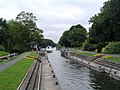
Boveney is a village in the civil parish of Dorney, in Buckinghamshire, England. It is situated near Windsor, between the villages of Eton Wick in Berkshire, and Dorney and Dorney Reach in Buckinghamshire. Since boundary changes in 1974 and 1995, Boveney is now the southernmost village in Buckinghamshire.