
Norsey Wood is a 67.2-hectare (166-acre) biological Site of Special Scientific Interest in Billericay, Essex. It is also a Local Nature Reserve and a Scheduled Monument.

Wild Park is a 239.8-hectare (593-acre) Local Nature Reserve adjacent to Lewes Road in Brighton, East Sussex. It is owned and managed by Brighton and Hove City Council. It includes Hollingbury Castle, an Iron Age hillfort which is a Scheduled Monument, and Hollingbury Park golf course.

Sherrardspark Wood is a 74.9 hectare biological site of Special Scientific Interest in Welwyn Garden City, Hertfordshire. The site was notified in 1986 under the Wildlife and Countryside Act 1981.

Coppetts Wood and Scrublands is a 14.5-hectare (36-acre) Site of Borough Importance for Nature Conservation, Grade I, between Muswell Hill and Friern Barnet in the London Borough of Barnet. It is part of the Coppetts Wood and Glebelands Local Nature Reserve.

Glebelands is Site of Borough Importance for Nature Conservation, Grade I, in Colney Hatch in the London Borough of Barnet. It is also part of the Coppett's Wood and Glebelands Local Nature Reserve.

Brookmill Road Local Nature Reserve is a small nature reserve in St Johns in the London Borough of Lewisham. It has been designated as a local nature reserve.
Coombe Hill Wood is a 2-hectare (4.9-acre) local nature reserve in Coombe in the Royal Borough of Kingston upon Thames in London. It is owned and managed by Kingston Council, and was declared a local nature reserve in 1992.

Fishpond Wood and Beverley Meads is a 5.8 hectare local nature reserve adjacent to Wimbledon Common in the London Borough of Merton. It is owned and managed by Merton Council.
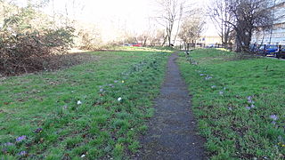
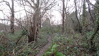
Ackroyd Drive Greenlink is a 0.87 hectare Local Nature Reserve in Mile End in the London Borough of Tower Hamlets. It forms a green corridor between Tower Hamlets Cemetery Park and Mile End Park.

Gomm Valley is a 4.1-hectare (10-acre) biological Site of Special Scientific Interest in Micklefield, a district of High Wycombe in Buckinghamshire. It is managed by the Berkshire, Buckinghamshire and Oxfordshire Wildlife Trust and is part of the Chilterns Area of Outstanding Natural Beauty. The local planning authority is Wycombe District Council.
Waterford Heath is a 35.2 hectare Local Nature Reserve in Waterford in Hertfordshire, England. It is owned by Lafarge Tarmac and managed by the Herts and Middlesex Wildlife Trust together with East Hertfordshire District Council and Lafarge.
Ivel Springs is a 15.4 hectare Local Nature Reserve in Baldock in Hertfordshire. It is owned and managed by North Hertfordshire District Council, assisted by the Friends of Baldock Green Spaces.

Purwell Meadows is an 8.6-hectare (21-acre) nature reserve in Hitchin, Hertfordshire, England. It was declared a Local Nature Reserve in 1994. It is owned and managed by North Hertfordshire District Council.
Sands Bank is an 11.1 hectares Local Nature Reserve in High Wycombe in Buckinghamshire. It is owned by West Wycombe Estates and managed by Wycombe District Council.

Prestwood Local Nature Reserve or Prestwood (Picnic Site) is a 2.1 hectares (5.2 acres) Local Nature Reserve in Prestwood in Buckinghamshire. It is in the Chilterns Area of Outstanding Natural Beauty. The site is owned by Wycombe District Council and leased to the Chiltern Society.

Warren Nature Reserve is a 2.3 hectares Local Nature Reserve in Wooburn in Buckinghamshire. It is owned by Wycombe District Council and managed by the council together with Wooburn and Bourne End parish council.
Gomm's Wood is an 18.1 hectares Local Nature Reserve in High Wycombe in Buckinghamshire. It is owned and managed by Wycombe District Council.

Fox Corner Wildlife Area is a 6.2-hectare (15-acre) Local Nature Reserve south-west of Woking in Surrey. It is owned and managed by Guildford Borough Council.
