Soper Lake

Last updated
Soper Lake
Soper Lake near Kimmirut.jpg
Soper Lake near Kimmirut
Location Baffin Island, Nunavut
Coordinates 62°55′N69°53′W / 62.917°N 69.883°W / 62.917; -69.883 (Soper Lake) Coordinates: 62°55′N69°53′W / 62.917°N 69.883°W / 62.917; -69.883 (Soper Lake)
Primary inflows Soper River
Primary outflows Pleasant Inlet
Basin  countries Canada
Settlements Kimmirut

Soper Lake (Inuktitut: Tasiujajuaq}, meaning "big lake-like lake") is a large, irregularly shaped lake in Qikiqtaaluk Region, Nunavut, Canada. It is located on Baffin Island's Meta Incognita Peninsula. The Inuit name references the lake's meromictic attribute, a mixture of fresh and salt water caused by a set of reversing falls and 9–10 m (30–33 ft) tides in Pleasant Inlet. The fresh water of Soper River drains into the lake which drains into the salt water Pleasant Inlet before reaching the Arctic Ocean.

Inuktitut name of some Inuit languages spoken in Canada

Inuktitut, also Eastern Canadian Inuktitut, is one of the principal Inuit languages of Canada. It is spoken in all areas north of the tree line, including parts of the provinces of Newfoundland and Labrador, Quebec, to some extent in northeastern Manitoba as well as the Northwest Territories and Nunavut. It is one of the aboriginal languages written with Canadian Aboriginal syllabics.

Lake A body of relatively still water, in a basin surrounded by land

A lake is an area filled with water, localized in a basin, surrounded by land, apart from any river or other outlet that serves to feed or drain the lake. Lakes lie on land and are not part of the ocean, and therefore are distinct from lagoons, and are also larger and deeper than ponds, though there are no official or scientific definitions. Lakes can be contrasted with rivers or streams, which are usually flowing. Most lakes are fed and drained by rivers and streams.

Qikiqtaaluk Region Region of Nunavut, Canada

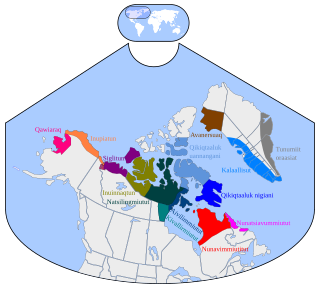
The Qikiqtaaluk Region, Qikiqtani Region or Baffin Region is the easternmost administrative region of Nunavut, Canada. Qikiqtaaluk is the traditional Inuktitut name for Baffin Island. Although the Qikiqtaaluk Region is the most commonly used name in official contexts, several notable public organizations, including Statistics Canada prefer the older term Baffin Region.

Contents

The hamlet of Kimmirut (previously, Lake Harbour) is situated at Glasgow Bay. In 1911, Hudson's Bay Company established its first south Baffin trading post at Lake Harbour. [1]

Hudsons Bay Company Canadian retail business group

The Hudson's Bay Company is a Canadian retail business group. A fur trading business for much of its existence, HBC now owns and operates retail stores in Canada and the United States. The company had sold most of its European operations by August 2019 and its remaining stores, in the Netherlands, were to be closed by the end of the year. HBC owns the Saks stores in the US; most other US operations had been sold by mid-2019 and the last remaining stores were to be sold prior to the end of 2019.

Trading post place or establishment where the trading of goods took place

A trading post, trading station, or trading house was a place or establishment where the trading of goods took place; the term is generally used, in modern parlance, in reference to such establishments in historic Northern America, although the practice long predates that continent's colonization by Europeans. The preferred travel route to a trading post or between trading posts, was known as a trade route.

The river and lake were named by Canadian biologist and Arctic explorer, J. Dewey Soper who travelled in the area in 1931. [2]

Arctic polar region on the Earths northern hemisphere

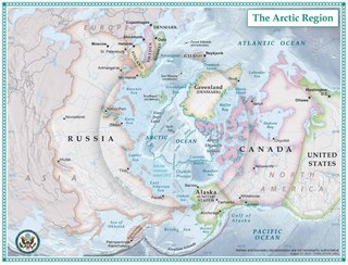
The Arctic is a polar region located at the northernmost part of Earth. The Arctic consists of the Arctic Ocean, adjacent seas, and parts of Alaska, Finland, Greenland (Denmark), Iceland, Northern Canada, Norway, Russia and Sweden. Land within the Arctic region has seasonally varying snow and ice cover, with predominantly treeless permafrost -containing tundra. Arctic seas contain seasonal sea ice in many places.

J. Dewey Soper Canadian ornithologist

Joseph Dewey Soper was a widely traveled Canadian Arctic ornithologist, explorer, zoologist, and prolific author.

Fauna

The lake is home to Greenland cod.

Related Research Articles

Iqaluit Territorial capital city in Nunavut, Canada

Iqaluit, meaning "place of fish", is the capital of the Canadian territory of Nunavut, its largest community, and its only city. It was known as Frobisher Bay from 1942 to 1987, after the large bay on the coast of which the city is situated, when the traditional Inuktitut name was restored.

Fjord A long, narrow inlet with steep sides or cliffs, created by glacial activity

Geologically, a fjord or fiord is a long, narrow inlet with steep sides or cliffs, created by a glacier. There are many fjords on the coasts of Alaska, Antarctica, British Columbia, Chile, Greenland, the Faroe Islands, Iceland, Kamchatka, the Kerguelen Islands, New Zealand, Norway, Novaya Zemlya, Labrador, Nunavut, Newfoundland, Quebec, Scotland, South Georgia Island, and Washington state. Norway's coastline is estimated at 29,000 kilometres (18,000 mi) with nearly 1,200 fjords, but only 2,500 kilometres (1,600 mi) when fjords are excluded.

Baffin Island mostly Arctic island in Nunavut, Canada

Baffin Island, in the Canadian territory of Nunavut, is the largest island in Canada and the fifth-largest island in the world. Its area is 507,451 km2 (195,928 sq mi) and its population is about 13,148. It is located in the region of 70° N and 75° W.

Baffin Bay A marginal sea between Greenland and Baffin Island, Canada

Baffin Bay, located between Baffin Island and the west coast of Greenland, is a marginal sea of the North Atlantic Ocean. It is connected to the Atlantic via Davis Strait and the Labrador Sea. The narrower Nares Strait connects Baffin Bay with the Arctic Ocean. The bay is not navigable most of the year because of the ice cover and high density of floating ice and icebergs in the open areas. However, a polynya of about 80,000 km2 (31,000 sq mi), known as the North Water, opens in summer on the north near Smith Sound. Most of the aquatic life of the bay is concentrated near that region.

Sirmilik National Park

Sirmilik National Park is a national park located in Qikiqtaaluk, Nunavut, Canada, established in 1999. Situated within the Arctic Cordillera, the park is composed of three areas: most of Bylot Island with the exception for a few areas that are Inuit-owned lands, Oliver Sound, and Baffin Island's Borden Peninsula. Much of the park is bordered by water.

Coral Harbour Hamlet in Nunavut, Canada

Coral Harbour, is a small Inuit community that is located on Southampton Island, Kivalliq Region, in the Canadian territory of Nunavut. Its name is derived from the fossilized coral that can be found around the waters of the community which is situated at the head of South Bay. The name of the settlement in Inuktitut is Salliq, sometimes used to refer to all of Southampton Island. The plural Salliit, means large flat island(s) in front of the mainland.

Kimmirut Hamlet in Nunavut, Canada

Kimmirut is a community in the Qikiqtaaluk Region, Nunavut, Canada. It is located on the shore of Hudson Strait on Baffin Island's Meta Incognita Peninsula. Kimmirut means "heel", and refers to a rocky outcrop in the inlet.

The Soper River is a waterway on Baffin Island, Nunavut. The river flows over 100 km (62 mi) and then empties into Soper Lake and Pleasant Inlet. The Soper River was designated a Canadian Heritage River in 1992.

The Canadian territory of Nunavut covers about 1.9 million square kilometres of land and water including part of the mainland, most of the Arctic Islands, and all of the islands in Hudson Bay, James Bay, and Ungava Bay which belonged to the Northwest Territories. This makes it the fifth largest country subdivision in the world. If Nunavut were a country, it would rank 13th in area, after the Democratic Republic of the Congo. Nunavut has land borders with Manitoba, the Northwest Territories on several islands as well as the mainland, and a tiny land border with Newfoundland and Labrador on Killiniq Island. Nunavut also has small land borders with Ontario and Quebec.

Amadjuak Lake lake in Nunavut, Canada

Amadjuak Lake is a lake in the Qikiqtaaluk Region, Nunavut, Canada. Along with Nettilling Lake, it is located in south-central Baffin Island's Great Plain of the Koukdjuak. It is 154 km (96 mi) south of Burwash Bay. The closest community is Iqaluit.

Koukdjuak River river in Canada

The Koukdjuak River begins at the outlet of Nettilling Lake and empties into the Arctic Ocean. It is the namesake of the Great Plain of the Koukdjuak located in the Foxe Basin on western Baffin Island, Nunavut, northern Canada.

Adams Island (Nunavut) island in Canada

Adams Island is an uninhabited island in the Qikiqtaaluk Region of Nunavut, Canada. The island is located in Baffin Bay off the northeastern coast of Baffin Island in the Canadian Arctic Archipelago. Nearby are Dexterity Island (northeast), Dexterity Fiord and Baffin Island (east), Tromso Fiord (south), Paterson Inlet (west), Bergesen Island (northwest), and Isbjorn Strait (north).

Mary River (Nunavut) location in Baffin Island, Nunavut, Canada

Mary River is located on Baffin Island about 936 km (582 mi) northwest of Iqaluit, the capital of Nunavut, and about 176 km (109 mi) southwest of Pond Inlet. It is home to iron ore deposits discovered in 1962 by Murray Edmund Watts and Ron Sheardown and is being developed by the Baffinland Iron Mines Corporation. There is a small airstrip, Mary River Aerodrome, located near the river.

Clyde Inlet

Clyde Inlet is a body of water in eastern Baffin Island, Qikiqtaaluk Region, Nunavut. Its mouth opens into the Davis Strait from the west.

Eglinton Fiord bay in Nunavut, Canada

Eglinton Fiord is a fjord on Baffin Island's northeastern coast in the Qikiqtaaluk Region of Nunavut, Canada. The Inuit settlement of Pond Inlet is 355 km (221 mi) to the northwest and Clyde River is 55 km (34 mi) to the east.

Remote Peninsula peninsula in Nunavut, Canada

The Remote Peninsula is a peninsula located on the eastern coast of Baffin Island. It is part of the Qikiqtaaluk Region of the Canadian territory of Nunavut. The Inuit settlement of Pond Inlet is 295 km (183 mi) to the northwest and Clyde River is 90 km (56 mi) to the southeast.

References

  1. Katherine Jacob (May 2, 2006). "Baffin Island's green valley". Grand Magazine. Archived from the original on May 30, 2008. Retrieved 2008-01-19.
  2. "The Soper River - Baffin Island". tatshenshini.com. Retrieved 2008-01-19.