
Ellesmere Island is Canada's northernmost and third largest island, and the tenth largest in the world. It comprises an area of 196,235 km2 (75,767 sq mi), slightly smaller than Great Britain, and the total length of the island is 830 km (520 mi).

Baffin Island, in the Canadian territory of Nunavut, is the largest island in Canada and the fifth-largest island in the world. Its area is 507,451 km2 (195,928 sq mi) and its population was 13,148 as of the 2016 Canadian Census. It is located in the region of 70° N and 75° W.

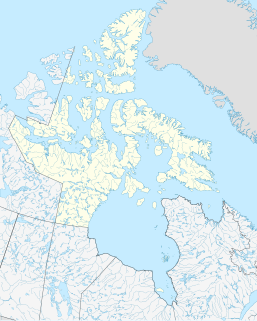
The Arctic Archipelago, also known as the Canadian Arctic Archipelago, is an archipelago lying to the north of the Canadian continental mainland, excluding Greenland.

Northern Canada, colloquially the North or the territories, is the vast northernmost region of Canada variously defined by geography and politics. Politically, the term refers to the three territories of Canada: Yukon, Northwest Territories and Nunavut. This area covers about 48 per cent of Canada's total land area, but has less than 1 per cent of Canada's population.

Pond Inlet is a small, predominantly Inuit community in the Qikiqtaaluk Region of Nunavut, Canada, located on northern Baffin Island. To the Inuit the name of the place "is and always has been Mittimatalik." The Scottish explorer Sir John Ross had named an arm of the sea that separates Bylot Island from Baffin Island as Pond's Bay, and the hamlet now shares that name. On August 29, 1921, the Hudson's Bay Company opened its trading post near the Inuit camp and named it Pond Inlet, marking the expansion of its trading empire into the High Arctic.

Devon Island is an island in Canada and the largest uninhabited island in the world. It is located in Baffin Bay, Qikiqtaaluk Region, Nunavut, Canada. It is one of the largest members of the Arctic Archipelago, the second-largest of the Queen Elizabeth Islands, Canada's sixth-largest island, and the 27th-largest island in the world. It has an area of 55,247 km2 (21,331 sq mi). The bedrock is Precambrian gneiss and Paleozoic siltstones and shales. The highest point is the Devon Ice Cap at 1,920 m (6,300 ft) which is part of the Arctic Cordillera. Devon Island contains several small mountain ranges, such as the Treuter Mountains, Haddington Range and the Cunningham Mountains. The notable similarity of its surface to that of Mars has attracted interest from scientists.

Fury and Hecla Strait is a narrow Arctic seawater channel located in the Qikiqtaaluk Region of Nunavut, Canada. Situated between Baffin Island to the north and the Melville Peninsula to the south, it connects Foxe Basin on the east with the Gulf of Boothia on the west. Water flow in the strait is sometimes westerly and sometimes easterly – there are diurnal and semidiurnal components to the flows; tidal and subtidal effects also play a role. The strait provides Arctic Ocean drainage for Hudson Bay via Foxe Basin.

Kimmirut is a community in the Qikiqtaaluk Region, Nunavut, Canada. It is located on the shore of Hudson Strait on Baffin Island's Meta Incognita Peninsula. Kimmirut means "heel", and refers to a rocky outcrop in the inlet.

The Arctic Cordillera is a terrestrial ecozone in northern Canada characterized by a vast, deeply dissected chain of mountain ranges extending along the northeastern flank of the Canadian Arctic Archipelago from Ellesmere Island to the northeasternmost part of the Labrador Peninsula in northern Labrador and northern Quebec, Canada. It spans most of the eastern coast of Nunavut with high glaciated peaks rising through ice fields and some of Canada's largest ice caps, including the Penny Ice Cap on Baffin Island. It is bounded to the east by Baffin Bay, Davis Strait and the Labrador Sea while its northern portion is bounded by the Arctic Ocean.
Katannilik Territorial Park Reserve is a territorial park in the Qikiqtaaluk Region of Nunavut, Canada. It was established in 1993 and has an area of 1,262 km2 (487 sq mi). The Soper River, part of the Canadian Heritage Rivers System, flows through the park.

Amadjuak Lake is a lake in the Qikiqtaaluk Region, Nunavut, Canada. Along with Nettilling Lake, it is located in south-central Baffin Island's Great Plain of the Koukdjuak. It is 154 km (96 mi) south of Burwash Bay. The closest community is Iqaluit.

Tasiujarjuaq formerly Soper Lake is a large, irregularly shaped lake in the Qikiqtaaluk Region, Nunavut, Canada. It is located on Baffin Island's Meta Incognita Peninsula. The Inuit name references the lake's meromictic attribute, a mixture of fresh and salt water caused by a set of reversing falls and 9–10 m (30–33 ft) tides in Pleasant Inlet. The fresh water of Soper River drains into the lake which then drains into the salt water of Pleasant Inlet before reaching the Arctic Ocean.

Joseph Dewey Soper was a widely traveled Canadian Arctic ornithologist, explorer, zoologist, and prolific author.

The Koukdjuak River begins at the outlet of Nettilling Lake and empties into the Arctic Ocean. It is the namesake of the Great Plain of the Koukdjuak located in the Foxe Basin on western Baffin Island, Nunavut, northern Canada.
Ferguson Lake is a lake in Kivalliq Region, Nunavut, Canada. It is located 150 km (93 mi) north of the tree line, midway between Yathkyed Lake and Qamanirjuaq Lake. The lake's outflow is to the east into the Ferguson River, which flows eastward through several lakes, emptying into northwestern Hudson Bay between Rankin Inlet and Whale Cove. The closest community is Baker Lake, 160 km (99 mi) to the north.
The Ferguson River originates on the eastern bank of Ferguson Lake within the northern Hearne Domain, Western Churchill province of the Churchill craton, the northwest section of the Canadian Shield in Nunavut's Kivalliq Region.
Milne Inlet is a small, shallow arm of Eclipse Sound which, along with Navy Board Inlet, separates Bylot Island from Baffin Island in Nunavut's Qikiqtaaluk Region. Milne Inlet flows in a southerly direction from Navy Board Inlet at the confluence of Eclipse Sound. Milne Inlet is shallow and has high tides and strong winds. It only has 90 days where it is ice-free—from August to October. The hamlet of Mittimatalik —Pond Inlet which is 92% Inuit, is the gateway to many tourist attractions in the region, and is 80 km from Milne Inlet. The region is part of the Arctic Cordillera, with one of Canada's most inhospitable climates—with long, dark winters and temperatures averaging −35 °C (−31 °F).

Bowman Bay is an Arctic waterway in the Qikiqtaaluk Region, Nunavut, Canada. It is located in the Foxe Basin by northeastern Foxe Peninsula off Baffin Island. The closest community is Cape Dorset, situated 204 km (127 mi) to the south, while Nuwata, a former settlement, is situated to the west.
Kangiqtualuk Uqquqti formerly Sam Ford Fiord is an isolated, elongated Arctic fjord on Baffin Island's northeastern coast in the Qikiqtaaluk Region of Nunavut, Canada. The Inuit settlement of Pond Inlet is 320 km (200 mi) to the northwest and Clyde River is 80 km (50 mi) to the east.
