Turnabout River

Last updated

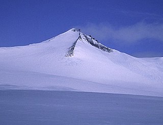
The Turnabout River is located on Ellesmere Island, Nunavut, Canada. It drains both Turnabout Lake and Turnabout Glacier into Lake Hazen.

Ellesmere Island part of the Qikiqtaaluk Region of the Canadian territory of Nunavut

Ellesmere Island is part of the Qikiqtaaluk Region in the Canadian territory of Nunavut. Lying within the Canadian Arctic Archipelago, it is considered part of the Queen Elizabeth Islands, with Cape Columbia being the most northerly point of land in Canada. It comprises an area of 196,235 km2 (75,767 sq mi) and the total length of the island is 830 kilometres (520 mi), making it the world's tenth largest island and Canada's third largest island. The Arctic Cordillera mountain system covers much of Ellesmere Island, making it the most mountainous in the Canadian Arctic Archipelago. The Arctic willow is the only woody species to grow on Ellesmere Island.

Nunavut Territory of Canada

Nunavut is the newest, largest, and most northerly territory of Canada. It was separated officially from the Northwest Territories on April 1, 1999, via the Nunavut Act and the Nunavut Land Claims Agreement Act, though the boundaries had been drawn in 1993. The creation of Nunavut resulted in the first major change to Canada's political map since the incorporation of the province of Newfoundland in 1949.

Canada Country in North America

Canada is a country in the northern part of North America. Its ten provinces and three territories extend from the Atlantic to the Pacific and northward into the Arctic Ocean, covering 9.98 million square kilometres, making it the world's second-largest country by total area. Canada's southern border with the United States is the world's longest bi-national land border. Its capital is Ottawa, and its three largest metropolitan areas are Toronto, Montreal, and Vancouver. As a whole, Canada is sparsely populated, the majority of its land area being dominated by forest and tundra. Consequently, its population is highly urbanized, with over 80 percent of its inhabitants concentrated in large and medium-sized cities, many near the southern border. Canada's climate varies widely across its vast area, ranging from arctic weather in the north, to hot summers in the southern regions, with four distinct seasons.

The river, the lake and Turnabout Glacier were named in 1957-58 during the International Geophysical Year by the Hazen Camp party directed by Geoffrey Hattersley-Smith. The river was named Turnabout due to its meandering course.

Turnabout Glacier is located on Ellesmere Island, Nunavut, Canada. It is drained by the Turnabout River.

International Geophysical Year science-cooperation year of 1957-1958

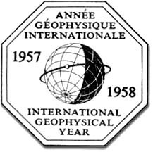
The International Geophysical Year was an international scientific project that lasted from July 1, 1957, to December 31, 1958. It marked the end of a long period during the Cold War when scientific interchange between East and West had been seriously interrupted. Sixty-seven countries participated in IGY projects, although one notable exception was the mainland People's Republic of China, which was protesting against the participation of the Republic of China (Taiwan). East and West agreed to nominate the Belgian Marcel Nicolet as secretary general of the associated international organization.

Geoffrey Francis Hattersley-Smith D.Phil, FRSC, FRGS, FAINA was an English-born geologist and glaciologist, recognized as a pioneering researcher of Northern Canada.

See also

Related Research Articles

Barbeau Peak mountain in Qikiqtaaluk, Nunavut, Canada

Barbeau Peak is a mountain in Qikiqtaaluk, Nunavut, Canada. Located on Ellesmere Island within Quttinirpaaq National Park, it is the highest mountain in Nunavut and the Canadian Arctic. The mountain was named in 1969 after Dr. Marius Barbeau (1883-1969), a Canadian anthropologist whose research into First Nations and Inuit cultures gained him international acclaim.

British Empire Range mountain range on Ellesmere Island in Nunavut, Canada

The British Empire Range is a mountain range on Ellesmere Island in Nunavut, Canada. The range is one of the most northern ranges in the world and the Arctic Cordillera, surpassed only by the Challenger Mountains which lies immediately to the northwest and the United States Range slightly further east. The highest mountain in the range is Barbeau Peak.

Lake Hazen lake

Lake Hazen is often called the northernmost lake of Canada, in the northern part of Ellesmere Island, Nunavut, but detailed maps show several smaller lakes up to more than 100 km (62 mi) farther north on Canada's northernmost island. Turnabout Lake is immediately northeast of the northern end of Hazen lake. Still further north are the Upper and Lower Dumbell Lakes, with Upper Dumbell Lake 5.2 km (3 mi) southwest of Alert, Canada's northernmost settlement on the coast of Lincoln Sea, Arctic Ocean.

Mount Oxford (Nunavut) mountain in Canada

Mount Oxford is located on Ellesmere Island, Nunavut, Canada and was named for the University of Oxford. The first known ascent was in 1935 by A. W. Moore and Nukapinguaq, a Greenland Inuit, during the Oxford University Ellesmere Land Expedition, when Moore estimated the height as 9,000 ft (2,743 m).

Gordon Noel Humphreys (1883–1966) was a British born surveyor, pilot, botanist, explorer and doctor. Originally trained as a surveyor, Humphreys worked in both Mexico and Uganda. During World War I he served as a pilot with the Royal Flying Corps, was shot down and spent his internment training himself in botany.

Turnabout Lake is a lake in Qikiqtaaluk Region, Nunavut, Canada. It is located northeast of Lake Hazen on Ellesmere Island, It is drained by the Turnabout River which flows into Lake Hazen.

Arrowhead Mountain mountain in Nunavut, Canada

Arrowhead Mountain is a mountain located on Ellesmere Island, Nunavut, Canada and is located east northeast of Mount Oxford. The mountain was named due to the four ridges that rise to a peak.

Mount Arthur (Nunavut) mountain in Canada

Mount Arthur is a mountain located on Ellesmere Island, Nunavut, Canada in the Quttinirpaaq National Park. First mapped by the Lady Franklin Bay Expedition, it was named for Chester A. Arthur the 21st President of the United States.

Mount Ayles mountain in Canada

Mount Ayles is a mountain located on Ellesmere Island, Nunavut, Canada. It forms part of the border of the Quttinirpaaq National Park. Like the nearby Ayles Ice Shelf, the mountain was named by the Geological Survey of Canada in 1965 for Petty Officer Adam Ayles of HMS Alert, who was serving in the British Arctic Expedition under George Nares.

Mount Beaufort mountain in Canada

Mount Beaufort is a mountain located on Ellesmere Island, Nunavut, Canada and was named after Francis Beaufort. The mountain was first sighted by Elisha Kane in 1845 and named Mount Francis Beaufort.

Glacier Pass is a mountain pass on northern Ellesmere Island, Nunavut, Canada. It is located in Quttinirpaaq National Park on the northeastern corner of Ellesmere Island.

The uninhabited Marvin Islands are located in the Arctic Ocean across the mouth of Disraeli Fiord, in northern Ellesmere Island within the Quttinirpaaq National Park. Ward Hunt Island lies to the northwest. The island group is a part of the Qikiqtaaluk Region Nunavut, Canada.

The Ruggles River is a waterway in Qikiqtaaluk Region, Nunavut, Canada. It is located within Ellesmere Island's Quttinirpaaq National Park. The river is the only outflow for Lake Hazen. It flows southeast to Chandler Fiord and out to Lady Franklin Bay.

Tanquary Fiord Ellesmere Island, Canada

Tanquary Fiord or Greely Fiord is a fjord on the north coast of the Canadian Arctic Archipelago's Ellesmere Island, Nunavut, Canada. It is located in the Quttinirpaaq National Park and extends 30 mi (48 km) in a north-westerly direction.

References

Quttinirpaaq National Park northernmost national park in Canada

Quttinirpaaq National Park is a Canadian national park. Located on the northeastern corner of Ellesmere Island in the Qikiqtaaluk Region of Nunavut, the most northerly extent of Canada, it is the second most northerly park on Earth after Northeast Greenland National Park. In Inuktitut, Quttinirpaaq means "top of the world". It was established as Ellesmere Island National Park Reserve in 1988, and the name was changed to Quttinirpaaq in 1999, when Nunavut was created, and became a national park in 2000. The reserve covers 37,775 square kilometres (14,585 sq mi), making it the second largest park in Canada, after Wood Buffalo National Park.

Parks Canada agency of the Government of Canada

Parks Canada, officially called the Parks Canada Agency, is an agency of the Government of Canada run by a chief executive who answers to the Minister of the Environment. Parks Canada is mandated to "protect and present nationally significant examples of Canada's natural and cultural heritage, and foster public understanding, appreciation, and enjoyment in ways that ensure their ecological and commemorative integrity for present and future generations". Parks Canada manages 38 National Parks, three National Marine Conservation Areas, 171 National Historic Sites, one National Urban Park, and one National Landmark. The agency also administers lands and waters set aside as potential national parklands, including eight National Park Reserves and one National Marine Conservation Area Reserve. More than 450,000 km2 (170,000 sq mi) of lands and waters in national parks and national marine conservation areas has been set aside for such purposes. The Canadian Register of Historic Places is supported and managed by Parks Canada, in collaboration with provincial and territorial governments and other federal bodies. The agency is also the working arm of the national Historic Sites and Monuments Board, which recommends National Historic Sites, Events, and Persons.

International Standard Book Number Unique numeric book identifier

The International Standard Book Number (ISBN) is a numeric commercial book identifier which is intended to be unique. Publishers purchase ISBNs from an affiliate of the International ISBN Agency.

Coordinates: 81°56′00″N68°52′00″W / 81.93333°N 68.86667°W / 81.93333; -68.86667 (Turnabout River)

Geographic coordinate system Coordinate system

A geographic coordinate system is a coordinate system that enables every location on Earth to be specified by a set of numbers, letters or symbols. The coordinates are often chosen such that one of the numbers represents a vertical position and two or three of the numbers represent a horizontal position; alternatively, a geographic position may be expressed in a combined three-dimensional Cartesian vector. A common choice of coordinates is latitude, longitude and elevation. To specify a location on a plane requires a map projection.