South Branch Township, Crawford County, Michigan

Last updated

South Branch Township, Michigan
South Branch Township Hall (Roscommon, MI).jpg
South Branch Township Hall
South Branch Township (Crawford), MI location2.png
Location within Crawford County
USA Michigan location map.svg
Red pog.svg
South Branch Township
Location within the state of Michigan
Usa edcp location map.svg
Red pog.svg
South Branch Township
Location within the United States
Coordinates: 44°34′39″N84°30′23″W / 44.57750°N 84.50639°W / 44.57750; -84.50639
CountryUnited States
State Michigan
County Crawford
Established1876
Government
  SupervisorLaurie Luck
   Clerk Brenda Nelson
Area
  Total105.56 sq mi (273.4 km2)
  Land104.83 sq mi (271.5 km2)
  Water0.73 sq mi (1.9 km2)
Elevation
1,135 ft (346 m)
Population
 (2010)
  Total2,007
  Density19.1/sq mi (7.4/km2)
Time zone UTC-5 (Eastern (EST))
  Summer (DST) UTC-4 (EDT)
Zip code(s)
48636 (Luzerne)
48653 (Roscommon)
49738 (Greenbush)
Area code 989
FIPS code 26-74760 [1]
GNIS feature ID1627093 [2]
Website Official website

South Branch Township is a civil township of Crawford County in the U.S. state of Michigan. The population was 2,007 at the 2010 census. [3]

Contents

Communities

Geography

According to the United States Census Bureau, the village has a total area of 105.56 square miles (273.40 km2), of which 104.83 square miles (271.51 km2) is land and 0.73 square miles (1.89 km2) (0.69%) is water. [7]

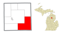
South Branch Township occupies the southeast corner of Crawford County and is bordered by Oscoda County to the east and Roscommon County to the south. The township takes its name from the South Branch of the Au Sable River, which flows nearly the length of the township, from the southwestern corner north and east to its mouth at the Au Sable River in the northern part of the township.

The Roscommon Zoo is located within the township along M-18.

Major highways

Demographics

As of the census [1] of 2000, there were 1,842 people, 735 households, and 557 families residing in the township. The population density was 17.5 per square mile (6.7/km2). There were 1,615 housing units at an average density of 15.3 per square mile (5.9/km2). The racial makeup of the township was 99.35% White, 0.05% African American, 0.11% Native American, 0.11% Asian, and 0.38% from two or more races. Hispanic or Latino of any race were 0.49% of the population.

There were 735 households, out of which 28.4% had children under the age of 18 living with them, 65.4% were married couples living together, 6.5% had a female householder with no husband present, and 24.2% were non-families. 20.4% of all households were made up of individuals, and 7.6% had someone living alone who was 65 years of age or older. The average household size was 2.51 and the average family size was 2.88.

In the township the population was spread out, with 24.0% under the age of 18, 5.5% from 18 to 24, 24.3% from 25 to 44, 28.8% from 45 to 64, and 17.3% who were 65 years of age or older. The median age was 43 years. For every 100 females, there were 107.4 males. For every 100 females age 18 and over, there were 105.6 males.

The median income for a household in the township was $34,537, and the median income for a family was $38,690. Males had a median income of $32,386 versus $19,868 for females. The per capita income for the township was $16,763. About 9.2% of families and 12.5% of the population were below the poverty line, including 20.4% of those under age 18 and 8.9% of those age 65 or over.

Related Research Articles

<span class="mw-page-title-main">Oscoda County, Michigan</span> County in Michigan, United States

Oscoda County is a county in the U.S. state of Michigan. As of the 2020 census, the population was 8,219, making it the least populous county in the Lower Peninsula, and the sixth-least populous county in the entire state. The county seat is Mio, an unincorporated community near the center of the county.

<span class="mw-page-title-main">Iosco County, Michigan</span> County in Michigan, United States

Iosco County is a county in the U.S. state of Michigan; its eastern border is formed by Lake Huron. As of the 2020 census, the population was 25,237. The county seat is Tawas City.

<span class="mw-page-title-main">Crawford County, Michigan</span> County in Michigan, United States

Crawford County is a county in the U.S. state of Michigan. Its population was 12,988 as of the 2020 census. The county seat of Crawford County is Grayling, the county's only incorporated community.

<span class="mw-page-title-main">Butler Township, Michigan</span> Civil township in Michigan, United States

Butler Township is a civil township in northeastern Branch County in the U.S. state of Michigan. As of the 2010 census, the township population was 1,467.

Albion Township is a civil township of Calhoun County in the U.S. state of Michigan. It is part of the Battle Creek, Michigan Metropolitan Statistical Area. As of the 2020 census, the township population was 1,094.

<span class="mw-page-title-main">Grant Township, Clare County, Michigan</span> Civil township in Michigan, United States

Grant Township is a civil township of Clare County in the U.S. state of Michigan. The population was 3,360 at the 2020 census.

<span class="mw-page-title-main">Surrey Township, Michigan</span> Civil township in Michigan, United States

Surrey Township is a civil township of Clare County in the U.S. state of Michigan. The population was 3,635 at the 2020 census.

<span class="mw-page-title-main">Beaver Creek Township, Michigan</span> Civil township in Michigan, United States

Beaver Creek Township is a civil township of Crawford County in the U.S. state of Michigan. As of the 2010 census, the township population was 1,736.

<span class="mw-page-title-main">Frederic Township, Michigan</span> Civil township in Michigan, United States

Frederic Township is a civil township of Crawford County in the U.S. state of Michigan. The population was 1,341 at the 2010 census.

<span class="mw-page-title-main">Grayling Charter Township, Michigan</span> Charter township in Michigan, United States

Grayling Charter Township is a charter township of Crawford County in the U.S. state of Michigan. The population was 5,827 as of the 2010 census, down from 6,516 at the 2000 census. The city of Grayling is surrounded by Grayling Charter Township, but both are administered autonomously.

<span class="mw-page-title-main">Lovells Township, Michigan</span> Civil township in Michigan, United States

Lovells Township is a civil township of Crawford County in the U.S. state of Michigan. The population was 626 at the 2010 census.

<span class="mw-page-title-main">Maple Forest Township, Michigan</span> Civil township in Michigan, United States

Maple Forest Township is a civil township of Crawford County in the U.S. state of Michigan. The population was 653 at the 2010 census.

<span class="mw-page-title-main">Oscoda Township, Michigan</span> Charter township in Michigan, United States

Oscoda Township is a charter township of Iosco County in the U.S. state of Michigan. The population was 6,788 at the 2020 census. The Wurtsmith Air Force Base is located within the township.

<span class="mw-page-title-main">Hamlin Township, Mason County, Michigan</span> Civil township in Michigan, United States

Hamlin Township is a civil township of Mason County in the U.S. state of Michigan. The population was 3,711 at the 2020 census, up from 3,408 in 2010.

<span class="mw-page-title-main">Comins Township, Michigan</span> Civil township in Michigan, United States

Comins Township is a civil township of Oscoda County in the U.S. state of Michigan. The population was 1,839 at the 2020 census.

<span class="mw-page-title-main">Greenwood Township, Oscoda County, Michigan</span> Civil township in Michigan, United States

Greenwood Township is a civil township of Oscoda County in the U.S. state of Michigan. The population was 1,158 at the 2020 census.

<span class="mw-page-title-main">Au Sable Township, Roscommon County, Michigan</span> Civil township in Michigan, United States

Au Sable Township is a civil township of Roscommon County in the U.S. state of Michigan. The population was 236 at the 2020 census, which makes it the county's least-populated municipality.

<span class="mw-page-title-main">Richfield Township, Roscommon County, Michigan</span> Civil township in Michigan, United States

Richfield Township is a civil township of Roscommon County in the U.S. state of Michigan. The population was 3,545 at the 2020 census.

<span class="mw-page-title-main">Roscommon, Michigan</span> Village in Michigan, United States

Roscommon is a village in Roscommon County the U.S. state of Michigan. The population was 981 at the 2020 census. Roscommon is the county seat of Roscommon County.

<span class="mw-page-title-main">Eldorado, Ohio</span> Village in Ohio, United States

Eldorado is a village in Preble County, Ohio, United States. The population was 458 at the 2020 census. It is part of the Dayton Metropolitan Statistical Area.

References

  1. 1 2 "U.S. Census website". United States Census Bureau . Retrieved January 31, 2008.
  2. U.S. Geological Survey Geographic Names Information System: South Branch Township, Crawford County, Michigan
  3. "Geographic Identifiers: 2010 Demographic Profile Data (G001): South Branch township, Crawford County, Michigan". U.S. Census Bureau, American Factfinder. Archived from the original on February 12, 2020. Retrieved October 1, 2014.
  4. U.S. Geological Survey Geographic Names Information System: Deerheart Valley, Michigan
  5. U.S. Geological Survey Geographic Names Information System: Eldorado, Michigan
  6. Romig, Walter (October 1, 1986) [1973]. Michigan Place Names: The History of the Founding and the Naming of More Than Five Thousand Past and Present Michigan Communities (Paperback). Great Lakes Books Series. Detroit, Michigan: Wayne State University Press. p. 179. ISBN   978-0-8143-1838-6.
  7. "Michigan: 2010 Population and Housing Unit Counts 2010 Census of Population and Housing" (PDF). 2010 United States Census . United States Census Bureau. September 2012. p. 20 Michigan. Archived (PDF) from the original on October 19, 2012. Retrieved May 1, 2020.