This article is about the many neighborhoods and districts in the Greater Richmond, Virginia area. Note that this article is an attempt to be inclusive of the broader definitions of the areas which are often considered part of the Greater Richmond Region, based on their urban or suburban character and nature, rather than by strictly political boundaries.

Carilion Clinic, formerly known as Carilion Health System, is a Roanoke, Virginia-based tax-exempt integrated health care organization that provides care for nearly one million Virginians and West Virginians. Carilion owns and operates seven hospitals in the western part of Virginia as well as Jefferson College of Health Sciences and a joint venture medical school and research institute with Virginia Tech. The system consists of hospitals, primary and specialty physician practices, pharmacies, health clubs and other complementary services. Carilion Clinic is also home to the region's only Level 1 Trauma Center at Carilion Roanoke Memorial Hospital. Carilion has more than 13,200 employees with 737 physicians covering more than 70 specialties at 225 practice sites, making it the largest employer in the Roanoke Valley Clinical expertise include cancer, cardiology, heart surgery and vascular care, gastroenterology, neurology, neurosurgery, orthopaedics, primary and preventive care, pediatrics, trauma, and women's health.

U.S. Route 221 (US 221) is a part of the U.S. Highway System that runs from Perry, Florida to Lynchburg, Virginia. In Virginia, the U.S. Highway runs 149.61 miles (240.77 km) from the North Carolina state line near Independence north to its northern terminus at US 29 Business, US 460 Business, and US 501 Business in Lynchburg. US 221 connects Independence, Galax, and Hillsville in Southwest Virginia while running concurrently with US 58. The U.S. Highway connects those communities with Roanoke via Floyd County, within which US 221 is the main east–west highway. The U.S. Highway also runs concurrently with US 460 from Roanoke to Bedford and parallels that U.S. Highway from Bedford to Lynchburg.

State Route 116 is a primary state highway in the U.S. state of Virginia. The state highway runs 20.66 miles (33.25 km) from SR 122 at Burnt Chimney north to SR 101 in Roanoke. SR 116 connects northwestern Franklin County with the southeastern part of Roanoke. The state highway forms a major street through Downtown Roanoke and the city's north side.

Carilion Roanoke Memorial Hospital (CRMH) is a private teaching hospital in Roanoke, Virginia, USA. With 703 beds, Carilion Roanoke Memorial Hospital is one of the largest hospitals in the state. It is part of Carilion Clinic.

The Virginian Railway Passenger Station, also known as the Virginian Station is a former rail station listed on the National Register of Historic Places in the South Jefferson neighborhood of the independent city of Roanoke, Virginia, U.S.A. Located at the intersection of Jefferson Street SE and Williamson Road, the Virginian Station served as a passenger station for the Virginian Railway between 1910 and 1956. The station was the only station constructed with brick along the entire length of the Virginian's 608 miles (978 km) network. It was severely damaged by fire on January 29, 2001.

Gainsboro is a Roanoke, Virginia neighborhood located in central Roanoke immediately north of Downtown, across the Norfolk Southern Railway right of way, between Interstate 581 and Orange Avenue. It borders the neighborhoods of Harrison and Gilmer on the west, Washington Park on the north, Williamson Road on the east and Downtown Roanoke on the south. As of the 2000 U.S. Census, Gainsboro has a population of 967 residents.
Franklin-Colonial is a Roanoke, Virginia neighborhood located in southwest Roanoke that is bisected by the three primary arterials of Franklin Road, the Roy L. Webber Expressway and Colonial Avenue. It borders the neighborhoods of Wasena and South Jefferson to the north, Grandin Court and Raleigh Court to the west and South Roanoke to the east. The southern border is shared with Roanoke County. As of the 2000 U.S. Census, Franklin-Colonial had a total population of 2,860.
Washington Park is a Roanoke, Virginia neighborhood located in central Roanoke, that initially developed in the 1920s as an early Roanoke suburb. It borders the neighborhoods of Roundhill on the north and Williamson Road on the north and east, Gainsboro and Harrison on the south and Melrose-Rugby on the west. Its northern and eastern boundary is concurrent with Interstate 581 and its southern boundary is concurrent with U.S. Route 460. As of the 2000 Census Harrison has a population of 1,254 residents with 531 households.
Shenandoah West is a Roanoke, Virginia neighborhood located in west Roanoke south of U.S. 460. It borders the neighborhoods of South Washington Heights, Wilmont and Cherry Hill on the west, Loudon-Melrose on the east, Villa Heights on the north and Hurt Park on the south opposite the Norfolk Southern rail yard.
Riverland/Walnut Hills is a Roanoke, Virginia neighborhood located in southeast Roanoke south of the Roanoke River. It borders the neighborhoods of South Jefferson and South Roanoke on the west, Morningside on the east and Mill Mountain on the south. The neighborhood is divided into the Walnut Hill area at the base of Mill Mountain, and the Riverland area along the Roanoke River, with Virginia State Route 116 running through the entire area. As of the 2000 U.S. Census, Riverland/Walnut Hills has a population of 1,033.
Morningside is a Roanoke, Virginia neighborhood located in east, central Roanoke, along the north bank of the Roanoke River. It borders the neighborhoods of South Jefferson and Riverland/Walnut Hills on the west, Kenwood and Riverdale on the east, Belmont on the north and both Garden City and Mill Mountain on the south. In being the location of the former American Viscose plant, the Morningside neighborhood exhibits both industrial characteristics as well as development patterns typical of those experienced for an American city during the early 20th century.
Miller Court/Arrowood is a Roanoke, Virginia neighborhood located in northwest Roanoke, bound to the east by Interstate 581. It borders the neighborhoods of Westview Terrace on the west, Fairland on the south, Airport on the east and Roanoke County on the north. The neighborhood sees both a mix of residential and commercial development throughout its area. Its development patterns typical of those experienced for an American city during the mid-20th century with low-density housing and commercial developments along its Virginia State Route 117 frontage.
Westview Terrace is a Roanoke, Virginia neighborhood located in northwest Roanoke. It borders the neighborhoods of Peachtree/Norwood on the west, Villa Heights and Washington Heights on the south and Miller Court/Arrowood on the north and east. The neighborhood is predominantly residential in character throughout its area with limited commercial development along its Virginia State Route 117 frontage. Its development patterns typical of those experienced for an American city during the mid-20th century with low-density housing.
Peachtree/Norwood is a Roanoke, Virginia neighborhood located in far northwest Roanoke. It borders the neighborhoods of Edgewood-Summit Hills on the south, Washington Heights and Westview Terrace on the east, Roanoke County on the north and the City of Salem on the west. The neighborhood is predominantly residential in character throughout its central area with commercial development along both its U.S. 460 and Virginia State Route 117 frontages. Its development patterns typical of those experienced for an American city during the mid-20th century with low-density housing.

Downtown is the central business district of Roanoke, Virginia, United States. Located geographically at the center of the city, Downtown began its development with the completion of the Shenandoah Valley Railroad in 1882. Today the Downtown core is noted as the center of business for the Roanoke Valley and Southwest Virginia, the Roanoke City Market, the Roanoke Downtown Historic District and many other attractions and amenities.

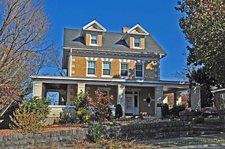
Old Southwest is a neighborhood of the independent city of Roanoke, Virginia, United States. Located geographically near the center of the city, Old Southwest was annexed from Roanoke County in 1890 and developed as one of Roanoke's more affluent residential areas. Today the majority of the neighborhood falls within the Southwest Historic District listed on both the Virginia Landmarks Register and the National Register of Historic Places.
Washington Heights is a Roanoke, Virginia neighborhood located in northwest Roanoke, bound to the west by Virginia State Route 117. It borders the neighborhoods of Peachtree/Norwood on the west, South Washington Heights on the south, Villa Heights on the east and Westview Terrace on the north. The neighborhood sees both a mix of residential development throughout its area spanning a more traditional grid street network in addition to more typical suburban ranch style construction.
The Riverland Historic District encompasses an early 20th century neighborhood on the south side of the Roanoke River in Roanoke, Virginia. The area consists of a portion of the residential area bounded on the south by Walnut Avenue SE, on the east by Arbutus Avenue SE, and on other sides by the river. Most of the included properties are either on Arbutus Avenue or Riverland Street, with some also on Piedmont Street and Walnut Avenue. The neighborhood is one of closely spaced residential properties built to provide housing for workers in nearby businesses. It was developed by the Highland Land Company, and was mostly built out between 1900 and 1930.