Related Research Articles

Vinton is a town in eastern Roanoke County, Virginia, United States. The population was 8,059 at the 2020 census. Vinton is part of the Roanoke Metropolitan Statistical Area and the Roanoke Region of Virginia.
The Roanoke Valley in southwest Virginia is an area adjacent to and including the Roanoke River between the Blue Ridge Mountains to the east and the Appalachian Plateau to the west. The valley includes much of Roanoke County, as well as the two independent cities of Roanoke and Salem.
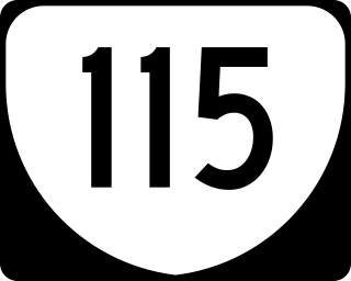
State Route 115 is a primary state highway in the U.S. state of Virginia. Known for most of its length as Plantation Road, the state highway runs 6.00 miles (9.66 km) from U.S. Route 221, US 460, and US 220 Alternate in Roanoke north to Interstate 81 (I-81) and US 220 near Hollins.
Mecca Gardens is a Roanoke, Virginia neighborhood and is the most eastern neighborhood within the city limits It borders the neighborhoods of Wildwood on the west, Eastgate on the north across Orange Avenue, the town of Vinton on the south and Roanoke County on the east.
Garden City is a Roanoke, Virginia neighborhood located far southeast Roanoke, abutting Mill Mountain. It borders the neighborhoods of Morningside and Riverdale on the north, and Mill Mountain and Southern Hills to the west. The eastern border is shared with Roanoke County. As of the 2000 U.S. Census, Garden City has a population of 2,981 residents.
Franklin-Colonial is a Roanoke, Virginia neighborhood located in southwest Roanoke that is bisected by the three primary arterials of Franklin Road, the Roy L. Webber Expressway and Colonial Avenue. It borders the neighborhoods of Wasena and South Jefferson to the north, Grandin Court and Raleigh Court to the west and South Roanoke to the east. The southern border is shared with Roanoke County. As of the 2000 U.S. Census, Franklin-Colonial had a total population of 2,860.
Fallon is a Roanoke, Virginia neighborhood located in southeast Roanoke. It borders the neighborhoods of Hollins on the north, Kenwood to the south and Belmont on the west. The eastern and part of the northern border is shared with the town of Vinton. Today the neighborhood is bisected by Virginia State Route 24 and is bordered by Tinker Creek to the east.
Belmont is a Roanoke, Virginia neighborhood located in southeast Roanoke. It borders the neighborhoods of Hollins and Williamson Road on the north, Morningside and South Jefferson to the south, Downtown on the west and Fallon on the east. Today the neighborhood is bisected by Virginia State Route 24 and is bordered by Interstate 581 to the west.
Wilmont is a Roanoke, Virginia neighborhood located in far western Roanoke. It borders the neighborhoods of South Washington Heights on the north, Cherry Hill on the south, Shenandoah West on the east and Ridgewood Park on the west.
South Washington Heights is a neighborhood in Roanoke, Virginia, located in far western Roanoke. It borders the neighborhoods of Washington Heights and Villa Heights on the north, Wilmont on the south, Shenandoah West on the east and Edgewood-Summit Hills on the west. The neighborhood fronts U.S. Highway 460 along its entire northern boundary.
Washington Park is a neighborhood located in central Roanoke, Virginia, that initially developed in the 1920s as an early Roanoke suburb. It borders the neighborhoods of Roundhill on the north and Williamson Road on the north and east, Gainsboro and Harrison on the south, and Melrose-Rugby on the west. Its northern and eastern boundary is concurrent with Interstate 581, and its southern boundary is concurrent with U.S. Route 460. As of the 2000 census, Harrison had a population of 1,254 residents, with 531 households.
Preston Park is a Roanoke, Virginia neighborhood located in northeast Roanoke. It borders the neighborhoods of Williamson Road on the south, Monterey and Hollins on the east, and Roundhill and the Airport on the west. The northern border is shared with Roanoke County. The name of the neighborhood reflects the fact that the large park of the same name is located within the neighborhood.
Williamson Road is a Roanoke, Virginia neighborhood in north-central Roanoke. It borders the neighborhoods of Roundhill and Preston Park to the north, Belmont to the south, Hollins to the east, and Gainsboro and Washington Park to the west opposite Interstate 581. It is bisected by Williamson Road.
Fairland is a Roanoke, Virginia neighborhood located in north, central Roanoke across Interstate 581, opposite Valley View Mall. It borders the neighborhoods of Miller Court/Arrowood and Villa Heights on the west and Roundhill and Melrose-Rugby on the east. As of the 2000 U.S. Census, Fairland has a population of 1,492 residents.
West End is a Roanoke, Virginia neighborhood located in central Roanoke south of the Norfolk Southern railyard. It borders the neighborhoods of Hurt Park and Mountain View on the west, Downtown on the east, Gilmer on the north across the Norfolk Southern railyard and Old Southwest on the south.
Wildwood is a neighborhood in eastern Roanoke, Virginia, in the United States. It lies along U.S. 460 and is bordered by the neighborhoods of Hollins on the west, Mecca Gardens on the east, Eastgate on the north, and the town of Vinton to the south. Originally included as part of Roanoke County, Wildwood was annexed by the city in 1976. Predominantly rural prior to its annexation, growth within the neighborhood has been suburban in nature since the 1970s with significant commercial development located along its Orange Avenue frontage.
Eastgate is a neighborhood of Roanoke, Virginia, in the United States. Eastgate is located in eastern Roanoke, along the eastern bank of Tinker Creek. It is bordered by the neighborhoods of Hollins on the west, Monterey on the north, Mecca Gardens and Wildwood on the southeast, and by Roanoke County to the northeast. Originally included as part of Roanoke County, Wildwood was annexed by the city in 1976. Predominantly rural prior to its annexation, growth within the neighborhood has been suburban in nature since the 1970s.
Monterey is a neighborhood located in northeastern Roanoke, Virginia, in the United States. It is the most northeastern neighborhood within the city. It is bordered by the neighborhoods of Preston Park on the west, Eastgate on the east, Hollins on the south, and by Roanoke County to the north. Originally included as part of Roanoke County, Wildwood was annexed by the city in 1976. Predominantly rural prior to its annexation, growth within the neighborhood has been suburban in nature since the 1970s.
Westview Terrace is a Roanoke, Virginia neighborhood located in northwest Roanoke. It borders the neighborhoods of Peachtree/Norwood on the west, Villa Heights and Washington Heights on the south and Miller Court/Arrowood on the north and east. The neighborhood is predominantly residential in character throughout its area with limited commercial development along its Virginia State Route 117 frontage. Its development patterns typical of those experienced for an American city during the mid-20th century with low-density housing.
References
- 1 2 3 4 "Hollins/Wildwood Area Plan". City of Roanoke Planning Division. Archived from the original on 2007-09-19. Retrieved 2008-04-29.