
Roanoke is an independent city in Virginia, United States. It is located in Southwest Virginia along the Roanoke River, in the Blue Ridge range of the greater Appalachian Mountains. Roanoke is approximately 50 miles (80 km) north of the Virginia–North Carolina border and 250 miles (400 km) southwest of Washington, D.C., along Interstate 81. At the 2020 census, Roanoke's population was 100,011, making it the most-populous city in Virginia west of the state capital Richmond. It is the primary population center of the Roanoke metropolitan area, which had a population of 315,251 in 2020.
River Oaks is a residential community located in the center of Houston, Texas, United States. Located within the 610 Loop and between Downtown and Uptown, the community spans 1,100 acres (450 ha). Established in the 1920s by brothers Will Hogg and Michael Hogg, the community became a well-publicized national model for community planning. Real estate values in the community range from $1 million to over $20 million. River Oaks was also named the most expensive neighborhood in Houston in 2013. The community is home to River Oaks Country Club, which includes a golf course designed by architect Donald Ross and redesigned in 2015 by Tom Fazio.

Locust Point is a peninsular neighborhood in Baltimore, Maryland. Located in South Baltimore, the neighborhood is entirely surrounded by the Locust Point Industrial Area; the traditional boundaries are Lawrence street to the west and the Patapsco River to the north, south, and east. It once served as a center of Baltimore's Polish-American, Irish-American and Italian-American communities; in more recent years Locust Point has seen gradual gentrification with the rehabilitation of Tide Point and Silo Point. The neighborhood is also noted as being the home of Fort McHenry and the western end of its namesake tunnel that carries eight lanes of Interstate 95 under the river.

Upper Kirby is a commercial district in Houston, Texas, United States. It is named after Kirby Drive, so indirectly takes its name from John Henry Kirby.

Boulevard Oaks is a neighborhood in Houston, Texas, United States, containing 21 subdivisions north of Rice University and south of U.S. Highway 59. Developed primarily during the 1920s and 1930s, Boulevard Oaks contains two National Register historic districts, Broadacres and Boulevard Oaks. The Boulevard Oaks Civic Association (BOCA) is the common civic association for all 21 subdivisions.
The Near East Side is a neighborhood located near downtown Columbus, Ohio, made up of several neighborhoods: Mount Vernon, King-Lincoln Bronzeville, Eastgate, Franklin Park, Nelson Park, Olde Towne East, and Woodland Park.

Norwich is a Roanoke, Virginia neighborhood located in west central Roanoke, immediately south of the Roanoke River. It borders the neighborhoods of Mountain View on the east, and Raleigh Court on the south. The northern and western reaches of the neighborhood are bound by the Roanoke River without crossings into both Hurt Park and Cherry Hill across the river. As of the 2000 U.S. Census, Norwich has a population of 652 residents.

Gainsboro is a Roanoke, Virginia neighborhood located in central Roanoke immediately north of Downtown, across the Norfolk Southern Railway right of way, between Interstate 581 and Orange Avenue. It borders the neighborhoods of Harrison and Gilmer on the west, Washington Park on the north, Williamson Road on the east and Downtown Roanoke on the south. As of the 2000 U.S. Census, Gainsboro has a population of 967 residents.
Franklin-Colonial is a Roanoke, Virginia neighborhood located in southwest Roanoke that is bisected by the three primary arterials of Franklin Road, the Roy L. Webber Expressway and Colonial Avenue. It borders the neighborhoods of Wasena and South Jefferson to the north, Grandin Court and Raleigh Court to the west and South Roanoke to the east. The southern border is shared with Roanoke County. As of the 2000 U.S. Census, Franklin-Colonial had a total population of 2,860.
Fallon is a Roanoke, Virginia neighborhood located in southeast Roanoke. It borders the neighborhoods of Hollins on the north, Kenwood to the south, and Belmont on the west. The eastern and part of the northern border is shared with the town of Vinton. Today the neighborhood is bisected by Virginia State Route 24 and is bordered by Tinker Creek to the east.
Belmont is a Roanoke, Virginia neighborhood located in southeast Roanoke. It borders the neighborhoods of Hollins and Williamson Road on the north, Morningside and South Jefferson to the south, Downtown on the west and Fallon on the east. Today the neighborhood is bisected by Virginia State Route 24 and is bordered by Interstate 581 to the west.
Melrose–Rugby is a Roanoke, Virginia neighborhood located in central Roanoke, that initially developed in the 1890s as an early Roanoke suburb. It borders the neighborhoods of Roundhill on the north, Washington Park on the east, Loudon-Melrose and Harrison on the south and Fairland and Villa Heights on the west. Its northern and eastern boundary is concurrent with Interstate 581 and its southern boundary is concurrent with U.S. Route 460.
Roundhill is a Roanoke, Virginia neighborhood located in northwest Roanoke. It borders the neighborhoods of Airport on the north, Williamson Road on the south, Preston Park on the east, and Fairland, Melrose-Rugby and Washington Park on the west opposite Interstate 581.

Raleigh Court is a Roanoke, Virginia neighborhood located in southwest Roanoke along U.S. 11. It borders the neighborhoods of Greater Deyerle on the west, Wasena on the east, Cherry Hill, Mountain View and Norwich on the north and Franklin-Colonial and Grandin Court on the south. Today the neighborhood is accessed from the downtown areas via the Memorial Bridge across the Roanoke River. As of the 2000 U.S. Census, Raleigh Court has a population of 11,200 residents.
Hurt Park is a Roanoke, Virginia neighborhood located in central Roanoke between the Norfolk Southern railyard and the Roanoke River. It borders the neighborhoods of Cherry Hill on the west, West End on the east, Gilmer, Loudon-Melrose and Shenandoah West on the north across the Norfolk Southern railyard and Norwich across the Roanoke River and Mountain View on the south.

Mountain View is a Roanoke, Virginia neighborhood located in central Roanoke north of the Roanoke River. It borders the neighborhoods of Norwich on the west, West End on the east, Hurt Park on the north and Raleigh Court and Wasena on the south.
Riverland/Walnut Hills is a Roanoke, Virginia neighborhood located in southeast Roanoke south of the Roanoke River. It borders the neighborhoods of South Jefferson and South Roanoke on the west, Morningside on the east and Mill Mountain on the south. The neighborhood is divided into the Walnut Hill area at the base of Mill Mountain, and the Riverland area along the Roanoke River, with Virginia State Route 116 running through the entire area. As of the 2000 U.S. Census, Riverland/Walnut Hills has a population of 1,033.

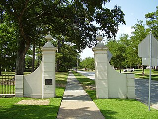
Old Southwest is a neighborhood of the independent city of Roanoke, Virginia, United States. Located geographically near the center of the city, Old Southwest was annexed from Roanoke County in 1890 and developed as one of Roanoke's more affluent residential areas. Today the majority of the neighborhood falls within the Southwest Historic District listed on both the Virginia Landmarks Register and the National Register of Historic Places.

Wasena Historic District is a national historic district located in the Wasena neighborhood of Roanoke, Virginia. It encompasses 574 contributing buildings, 1 contributing site, 3 contributing structures, and 3 contributing objects. It is a primarily residential district with single-family dwellings. Also in the district are a few commercial buildings, several industrial buildings, a park along the river and the Wasena Bridge.

