
Crosshaven is a village in County Cork, Ireland. It is located in lower Cork Harbour at the mouth of the River Owenabue, across from Currabinny Wood. Originally a fishing village, from the 19th century, the economy of the area became more reliant on a growing tourism industry.

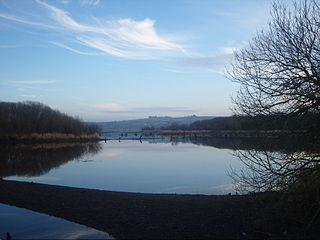
Cork Harbour is a natural harbour and river estuary at the mouth of the River Lee in County Cork, Ireland. It is one of several which lay claim to the title of "second largest natural harbour in the world by navigational area". Other contenders include Halifax Harbour in Canada, Trincomalee Harbour in Sri Lanka and Poole Harbour in England.
The River Lee is a river in Ireland. It rises in the Shehy Mountains on the western border of County Cork and flows eastwards through Cork, where it splits in two for a short distance, creating an island on which Cork's city centre is built, then passing through Cork Harbour on the south coast, one of the largest natural harbours in the world, to empty into the Celtic Sea. The catchment area of the River Lee is 1,253 km2. The long-term average flow rate of the River Lee is 40.4 cubic metres per second (m3/s)

Southport is a coastal suburb in the City of Gold Coast in Queensland, Australia. In the 2016 census, Southport had a population of 31,908 people. It contains the Gold Coast central business district.

Douglas is a suburb, with a village core, in Cork city, Ireland. Douglas is also the name of the townland, Roman Catholic parish, Church of Ireland parish and civil parish in which it is contained.

Dublin Docklands is an area of the city of Dublin, Ireland, on both sides of the River Liffey, roughly from Talbot Memorial Bridge eastwards to the 3Arena. It mainly falls within the city's D01 and D02 postal districts but includes some of the urban fringes of the D04 district on its southernmost side.

St Patrick's Street is the main shopping street of the city of Cork in the south of Ireland. The street was subject to redevelopment in 2004, and has since won two awards as Ireland's best shopping street. St Patrick's Street is colloquially known to some locals as "Pana".

Little Island, County Cork, is a civil parish and mainly industrial area to the east of Cork city in Ireland. It is no longer an island, since the northern channel separating it from the mainland has filled over. To the west and south is Lough Mahon, part of Cork Harbour; across a channel to the east is Fota Island. Little Island is within the Dáil constituency of Cork North-Central.

Cork is the second largest city in Ireland and third largest city by population on the island of Ireland. It is located in the south-west of Ireland, in the province of Munster. Following an extension to the city's boundary in 2019, its population is over 222,000.
The Mardyke is an area in Cork city, on the northern half of the long western part of the island formed by the two channels of the River Lee near the city centre. It was historically left as open space because the land along the north channel of the river is prone to flooding. From east to west these open spaces are: Presentation Brothers College, a boy's secondary school; the Mardyke ground of Cork County Cricket Club; Fitzgerald Park, which includes Cork Public Museum; Sunday's Well Lawn Tennis Club; and the athletic grounds of University College Cork.

The North Infirmary was the first general hospital to be opened in Cork. Originally holding only 24 beds, it eventually expanded to 115 beds. It was used as a fever hospital during the famine, housed Irish soldiers wounded in the First World War and covertly treated wounded Republicans during the War of Independence. The infirmary closed its doors on 26 November 1987, and is now a hotel.
The English Market is a municipal food market in the center of Cork city, Ireland. It stretches from Princes Street to the Grand Parade, and combines Princes Street Market and Grand Parade Market. The market is regarded for both its mid-19th century architecture and locally produced artisan food.
The second largest city in Ireland, Cork, has an economy focused on the city centre, which as of 2011, supported employment for 24,092 people. According to 2006 figures, the top five employers in the area were public sector organisations, and included Cork University Hospital, University College Cork, Collins Barracks, Cork City Council and Cork Institute of Technology. Apple Inc. was the sixth largest employer, followed by Supervalu / Centra Distribution Ltd, Mercy University Hospital, Bon Secours Hospital and Boston Scientific.
Occupy Cork was a peaceful protest and demonstration against alleged economic inequality, social injustice and corporate greed taking place on the junction of the Grand Parade and South Mall and at the NAMA-listed Stapleton House on Oliver Plunkett Street in the Irish city of Cork. The group occupied Stapleton House after receiving the keys to the building on 25 December 2011. The camp was dismantled on 13 March 2012.

Oliver Plunkett Street is a shopping street in Cork, Ireland. It was originally laid-out in the early 18th century as the city expanded eastwards beyond the original city walls.

Bishop Lucey Park is a public park located between Grand Parade and South Main Street in the centre of Cork in Ireland. It is one of few green spaces in the city centre and among the largest. It is often erroneously known as "The Peace Park" by locals, although this name actually refers to the area next to the River Lee at the junction of Grand Parade and South Mall where the National Monument, and the memorials to World War I and the Hiroshima and Nagasaki bombings are located.

Grand Parade is one of the main streets of Cork city, Ireland. It runs from South Mall in the south to St. Patrick's Street/Daunt Square in the north, with intersections with Oliver Plunkett Street, Tuckey Street, Washington Street, Augustine Street and a number of pedestrian-only lanes in between. The Irish name of the street, Sráid an Chapaill Bhuí, comes from a time when there was a statue of King George II on horse-back at the junction with South Mall. The location of this statue is now occupied by the national monument.
Parnell Place is a street in Cork, Ireland. It is a major south-to-north route across the city centre, and the location of Parnell Place Bus Station.

North Main Street is a street and retail area in Cork City, Ireland.
Dalata Hotel Group PLC is a hotel company which owns and operates hotels across Ireland and the UK. It is the largest hotel operator in Ireland with 7,101 rooms available across owned, leased and managed hotels. As of February 2020, the company operates 32 hotels across Ireland as well as managing 3 on behalf of external parties. Additionally, it operates 9 hotels across the UK.


