Related Research Articles

County Cork is the largest and the southernmost county of Ireland, named after the city of Cork, the state's second-largest city. It is in the province of Munster and the Southern Region. Its largest market towns are Mallow, Macroom, Midleton, and Skibbereen. As of 2022, the county had a population of 581,231, making it the third-most populous county in Ireland. Cork County Council is the local authority for the county, while Cork City Council governs the city of Cork and its environs. Notable Corkonians include Michael Collins, Jack Lynch, Roy Keane, Sonia O'Sullivan, Cillian Murphy, and Graham Norton.

Mallow is a town in County Cork, Ireland, approximately thirty-five kilometres north of Cork. Mallow is in the barony of Fermoy.
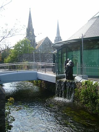
Clonakilty, sometimes shortened to Clon, is a town in County Cork, Ireland. The town is at the head of the tidal Clonakilty Bay. The rural hinterland is used mainly for dairy farming. The town's population was 4,592 at the 2016 census. The town is a tourism hub in West Cork, and was recognised as the "Best Town in Europe" in 2017, and "Best Place of the Year" in 2017 by the Royal Institute of the Architects of Ireland. Clonakilty is in the Dáil constituency of Cork South-West, which has three seats.

Carrigaline is a town and civil parish in County Cork, Ireland, situated on the River Owenabue. Located about 14 kilometres (8.7 mi) south of Cork city, and with a population of 18,239 people, it is one of the largest commuter towns of the city. The R611 regional road passes through the town, and it is just off the N28 national primary route to Ringaskiddy. Carrigaline grew rapidly in the late 20th century, from a village of a few hundred people into a thriving commuter town although some locals still refer to it as "the village". The town is one of the key gateways to west Cork, especially for those who arrive by ferry from France. Carrigaline is within the Cork South-Central Dáil constituency.
University College Cork – National University of Ireland, Cork (UCC) is a constituent university of the National University of Ireland, and located in Cork.

West Cork is a tourist region and municipal district in County Cork, Ireland. As a municipal district, West Cork falls within the administrative area of Cork County Council, and includes the towns of Bantry, Castletownbere, Clonakilty, Dunmanway, Schull and Skibbereen, and the 'key villages' of Baltimore, Ballydehob, Courtmacsherry, Drimoleague, Durrus, Glengarriff, Leap, Rosscarbery, Timoleague and Union Hall.

Castlemartyr is a large village in County Cork, Ireland. It is around 30 kilometres (19 mi) east of Cork city, 10 km (6 mi) east of Midleton, 16 km (10 mi) west of Youghal and 6 km (4 mi) from the coast. Approximately 1,600 people live in the village and its hinterland. It is situated on the N25 national primary road and the R632 regional road.

Kanturk is a town in the north west of County Cork, Ireland. It is situated at the confluence of the Allua (Allow) and Dallow (Dalua) rivers, which stream further on as tributaries to the River Blackwater. It is about 50 kilometres from Cork and Limerick, and lies just north of the main N72 road, 15 km from Mallow and about 40 km from Killarney. Kanturk is within the Cork North-West Dáil constituency.
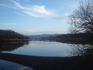
The River Lee is a river in Ireland. It rises in the Shehy Mountains on the western border of County Cork and flows eastwards through Cork, where it splits in two for a short distance, creating an island on which Cork's city centre is built, then passing through Cork Harbour on the south coast, one of the largest natural harbours in the world, to empty into the Celtic Sea. The catchment area of the River Lee is 1,253 km2. The long-term average flow rate of the River Lee is 40.4 cubic metres per second (m3/s)
Mahon is an area to the south-eastern side of Cork, Ireland. Mahon gets its name from Lough Mahon, a wide stretch of the upper section of Cork Harbour. It was once a semi-rural peninsula, but from the late 20th century was subject to residential development, and has a number of housing estates and developments. The area was generally known as the Ring of Mahon, and is the site of Ringmahon House. Mahon is within the Cork South-Central Dáil constituency.

Haulbowline is an island in Cork Harbour off the coast of Ireland. The world's first yacht club was founded on Haulbowline in 1720. The western side of the island is the main naval base and headquarters for the Irish Naval Service, with the eastern side previously used for heavy industry and later redeveloped as a park. Since 1966 the island has been connected to the mainland by a roadbridge.
Metropolitan Cork is a semi-official term which refers to the city of Cork, Ireland, its suburbs, the rural hinterland that surrounds it, and a number of the towns and villages in that hinterland. Some of the latter towns and villages are within the administrative area of County Cork.

Limerick railway station also known as Colbert Station or Limerick Colbert serves the city of Limerick in County Limerick. It is on Parnell Street and is the main station on the Limerick Suburban Rail network. It has approximately 2,500 rail passengers a day travelling on four rail routes. The Bus Éireann bus station on site services approximately one million passengers a year, with 125 buses departing each day.

Cork is the second largest city in the Republic of Ireland and third largest city on the island of Ireland. It is the largest urban centre of the Southern Region and the province of Munster. In the 2022 census, the first following an extension to the city's boundary in 2019, the city had a population of 222,333.
The Mardyke is an area in Cork city, on the northern half of the long western part of the island formed by the two channels of the River Lee near the city centre. It was historically left as open space because the land along the north channel of the river is prone to flooding. From east to west these open spaces are: Presentation Brothers College, a boy's secondary school; the Mardyke ground of Cork County Cricket Club; Fitzgerald Park, which includes Cork Public Museum; Sunday's Well Lawn Tennis Club; and the athletic grounds of University College Cork.
Live at the Marquee is a season of music concerts and other live performance events organised by Aiken Promotions in a large marquee in Cork, Ireland, every summer since 2005. For about a month in June and July, a concert is held most evenings; tickets for each night are sold separately, with varying lineups and pricing. Acts have represented many genres of popular music, including rock, folk, electronic, hip hop, rhythm and blues, and country; as well as stand-up comedy acts.
Montenotte is an area in the northeast of Cork City, Ireland, which was home to merchants and a prosperous middle class from the early to mid-19th century. It was named after the late 18th century Napoleonic battle, the Battle of Montenotte, which took place in Northern Italy. The suburb comprises two electoral districts within the Dáil constituency of Cork North-Central. As of 2002, the populations of these electoral districts were 1,853 and 2,723 respectively.
Lindsay Peat is an Ireland women's rugby union international. Peat represented Ireland at the 2017 Women's Rugby World Cup. Peat is an all-round sportswoman. In addition to representing Ireland at women's rugby union, she has also played for the Republic of Ireland women's national association football team at U-18 level, captained the Ireland women's national basketball team and played senior Ladies' Gaelic football for Dublin. Between 2009 and 2014 she played in three All-Ireland finals. She was a member of the Dublin team that won the All-Ireland title in 2010 and she scored two goals in the 2014 final.
References
- 1 2 "Montenotte Hotel, Glanmire Road Middle, Cork, Cork City". buildingsofireland.ie. National Inventory of Architectural Heritage. Retrieved 16 November 2018.
- 1 2 "Montenotte Hotel - Spa - Brochure - 2018" (PDF). themontenottehotel.com. The Montenotte Hotel. Retrieved 16 November 2018.
- ↑ "Frankie Whelehan's €5m Montenotte hotel spend". irishexaminer.com. Irish Examiner. 21 April 2016.
- ↑ "Cainwhite job sheet". cainwhite.ie. Cainwhite Piling & Foundations. Archived from the original on 18 November 2007.
- ↑ "The Montenotte news and events". themontenottehotel.com. Montenotte Hotel. Archived from the original on 26 January 2009.
- ↑ "U2 by David Corio". rockarchive.com. Rockarchive Ltd. Archived from the original on 20 November 2008.