
South Parish is the name given to both a Roman Catholic parish of Cork City and to the residential area contained within it.

South Parish is the name given to both a Roman Catholic parish of Cork City and to the residential area contained within it.
The parish stretches from Oliver Plunkett Street in the north to St Patrick's Road in the south and from Sharman Crawford Street in the west to Albert Road in the east. [1]
When used to refer to the residential area, the parts north of the south channel of the River Lee are usually excluded as being part of the city centre. For example, the scope of Cork City Council's 'South Parish Area Action Plan' excludes the parish's city centre areas. [2]

The South Parish is one of the oldest inhabited areas of Cork City. Along with Shandon, it was the first area developed outside the city walls. In the oldest known maps of Cork City, including examples dated to 1545 and 1601, there are structures shown in the area. [3] [4]
There was a Danish settlement in the area that is now Frenches Quay, Barrack Street and George's Quay as early as the 10th century AD. In this area, Keysers Hill still bears a name of Danish origin. [5]
The Red Abbey, Cork's oldest surviving medieval structure, [6] was built in the late 13th or early 14th century. [7] Also in the area is Elizabeth Fort, the current structure of which was built in 1624, to replace an earlier fort dating from 1601. [8]
By 1690, there had been additional development in the area, with the streets that are now Barrack St, Evergreen St, Douglas St, Cove St and Sober Lane distinguishable in maps and lined with buildings. [9] It was in this year that the Siege of Cork took place. Cork was occupied by Jacobite forces who held Elizabeth Fort. They were attacked by Williamite forces from the Red Abbey and Saint Fin Barre's Cathedral. [10] Both located in South Parish, these were the only high vantage points in the area. This siege led to significant damage to buildings in the area, such as the Red Abbey, which was never used for religious purposes again and St Nicholas Church, which was not rebuilt until 1720. [5]
By 1726 all but a small area of the South Parish, designated as 'Gardens', had been built up [11] and by 1750, the development of the area was complete, [12] with any new buildings replacing existing buildings.
The present South Chapel (St. Finbarr's South), the Roman Catholic parish church, was built in 1766. [5] The Church of Ireland church, St Nicholas, was rebuilt again in 1850, although this is now deconsecrated with parish duties merged with the parish of St Fin Barre's cathedral [13]
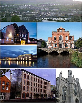
Newry is a city in Northern Ireland, standing on the Clanrye river in counties Down and Armagh. It is near the border with the Republic of Ireland, on the main route between Belfast and Dublin. The population was 27,913 in 2021.

The Metropolitan Borough of St Marylebone was a metropolitan borough of the County of London from 1900 to 1965. It was based directly on the previously existing civil parish of St Marylebone, Middlesex, which was incorporated into the Metropolitan Board of Works area in 1855, retaining a parish vestry, and then became part of the County of London in 1889.
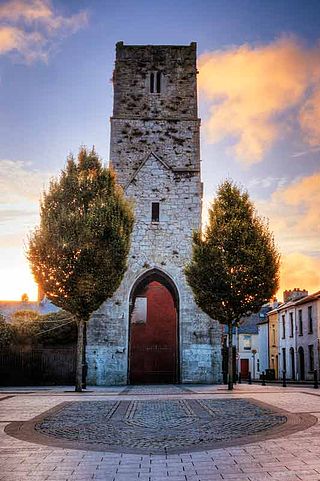
The Red Abbey in Cork, Ireland was a 14th-century Augustinian abbey which took its name from the reddish sandstone used in construction. Today all that remains of the structure is the central bell tower of the abbey church, which is one of the last remaining visible structures dating to the medieval walled town of Cork.

Kinsale is a historic port and fishing town in County Cork, Ireland. Located approximately 25 km (16 mi) south of Cork City on the southeast coast near the Old Head of Kinsale, it sits at the mouth of the River Bandon, and has a population of 5,281 which increases in the summer when tourism peaks.

Saint Finbar, Finbarr, Finnbar, or Finnbarr, in Irish Fionnbharra, very often abbreviated to Barra, was Bishop of Cork and abbot of a monastery in what is now the city of Cork, Ireland. He is patron saint of the city and of the Diocese of Cork. His feast day is 25 September.

Bathampton is a village and civil parish 2 miles (3 km) east of Bath, England on the south bank of the River Avon. The parish has a population of 1,603.
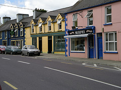
The twin villages of Ballineen and Enniskeane, or Enniskean, in County Cork in Ireland are 43 km (26.72 mi) southwest of Cork City, on the R586 road. The linear settlement lies on the River Bandon between Bandon and Dunmanway. The combined settlement is designated as a 'key village' by Cork County Council for planning purposes and, as of the 2016 census, had a population of 692 people.

Douglas is a suburb, with a village core, in Cork city, Ireland. Douglas is also the name of the townland, Roman Catholic parish, Church of Ireland parish and civil parish in which it is contained.
Ballinlough is a mainly residential townland and suburb on the southside of Cork city, in Ireland. It is located between Ballintemple and the larger suburbs of Douglas and Blackrock.

St Patrick's Street is the main shopping street of the city of Cork in the south of Ireland. The street was subject to redevelopment in 2004, and has since won two awards as Ireland's best shopping street. St Patrick's Street is colloquially known to most locals as simply 'Patrick's Street', with the 'St' honorific dropped, in accordance with the pattern applied to many locations named after saints. It is also referred to colloquially by some locals as "Pana", with the first 'a' being elongated.

Cork is the second largest city in the Republic of Ireland, third largest on the island of Ireland, and largest in the province of Munster. At the 2022 census, it had a population of 222,526.

Washington Street is a street in central Cork city, Ireland. Built in 1824, it runs from the old medieval town centre onto the site of the western marshes, and today links the Western Road and Lancaster Quay with the Grand Parade.

Shandon is a district on the north-side of Cork city. Shandon lies north of the River Lee and North Gate Bridge, the northernmost point of the medieval city. Several landmarks of Cork's north-side are located in the area, including the bell tower of the Church of St Anne, the Cathedral of St Mary and St Anne, Saint Mary’s Dominican Church & Priory, and Firkin Crane Arts Centre.

Elizabeth Fort is a 17th-century star fort off Barrack Street in Cork, Ireland. Originally built as a defensive fortification on high-ground outside the city walls, the city eventually grew around the fort, and it took on various other roles – including use as a military barracks, prison, and police station. Since 2014, the fort has seen some development as a tourism heritage site, reportedly attracting 36,000 visitors during 2015. The walls of the fort have been accessible to the public on a regular basis since September 2014.
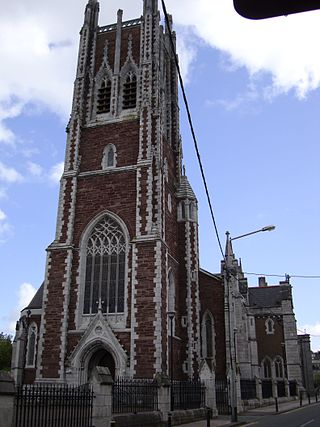
The Cathedral of Saint Mary and Saint Anne, also known as Saint Mary's Cathedral, The North Cathedral or The North Chapel, is a Roman Catholic cathedral located at the top of Shandon Street in Cork, Ireland. It is the seat of the Bishop of Cork and Ross, and the mother church of the Roman Catholic Diocese of Cork and Ross. Its name derived from the fact that it encompassed the ecclesiastical parish of St. Mary and the civil parish of St. Anne.

Grand Parade is one of the main streets of Cork city, Ireland. It runs from South Mall in the south to St. Patrick's Street/Daunt Square in the north, with intersections with Oliver Plunkett Street, Tuckey Street, Washington Street, Augustine Street and a number of pedestrian-only lanes in between. The Irish name of the street, Sráid an Chapaill Bhuí, comes from a time when there was a statue of King George II on horse-back at the junction with South Mall. The location of this statue is now occupied by the national monument.

Holy Trinity Church, also known as Father Mathew Memorial Church, is a Roman Catholic Gothic Revival church and friary on Fr. Mathew Quay, on the bank of the River Lee in Cork. It belongs to the Order of Friars Minor Capuchin and is the only church dedicated to Father Theobald Mathew.

Shandon Street, formerly known as Mallow Lane, is a street in the Shandon area of Cork City, Ireland and is a retail area on the North-Side of Cork city.
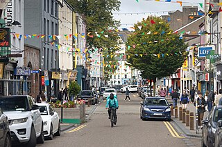
North Main Street is a street and retail area in Cork City, Ireland. Joined by bridge with South Main Street in the 12th century, it formed the main thoroughfare within the original city walls of medieval Cork. As of the 21st century, it is predominantly occupied by commercial and retail premises, some of which are built upon earlier structures.

Shandon Castle, originally known as Lord Barry's Castle, was an early medieval castle in the Shandon area of Cork city in Ireland. It was built in the late 12th century by Philip de Barry, close to an earlier ringfort. Located outside the city's gates and defensive walls, the castle was a seat of the Cambro-Norman de Barry family for several centuries.