
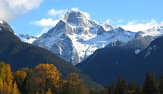
Mount Waddington, once known as Mystery Mountain, is the highest peak in the Coast Mountains of British Columbia, Canada. Although it is lower than Mount Fairweather and Mount Quincy Adams, which straddle the United States border between Alaska and British Columbia, Mount Waddington is the highest peak that lies entirely within British Columbia. It and the subrange which surround it, known as the Waddington Range, stand at the heart of the Pacific Ranges, a remote and extremely rugged set of mountains and river valleys.

The Pacific Ranges are the southernmost subdivision of the Coast Mountains portion of the Pacific Cordillera. Located entirely within British Columbia, Canada, they run northwest from the lower stretches of the Fraser River to Bella Coola and Burke Channel, north of which are the Kitimat Ranges. The Coast Mountains lie between the Interior Plateau and the Coast of British Columbia.

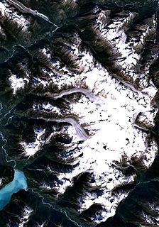
The Waddington Range is a subrange of the Pacific Ranges of the Coast Mountains in southwestern British Columbia, Canada. It is only about 4,000 km² in area, relatively small in area within the expanse of the range, but it is the highest area of the Pacific Ranges and of the Coast Mountains, being crowned by its namesake Mount Waddington 4,019 m (13,186 ft). The Waddington Range is also extremely rugged and more a complex of peaks than a single icefield, in contrast to the other huge icefield-massifs of the southern Coast Mountains, which are not so peak-studded and tend to have more contiguous icemasses.

The Niut Range is 3600 km2 in area. It is a subrange of the Pacific Ranges of the Coast Mountains of British Columbia, although in some classifications it is considered part of the Chilcotin Ranges. The Niut is located in the angle of the Homathko River and its main west fork, Mosley Creek. It is isolated, island-like, by those rivers from its neighbour ranges, as both streams have their source on the Chilcotin Plateau in behind the range. Razorback Mountain is its highest peak.
Officially Good Hope Mountain but commonly known as Mount Good Hope is one of the principal summits of the Pacific Ranges of the southern Coast Mountains in British Columbia, Canada. It stands immediately west of Chilko Lake, with the highest peak on the massif rising between the lake's southern arms.
Mount Tiedemann 3838m, prominence 848m, is one of the principal summits of the Pacific Ranges subdivision of the Coast Mountains of British Columbia. It is located 3 km (1.9 mi) northeast of Mount Waddington in the Waddington Range massif between the Homathko and Klinaklini Rivers.

The Homathko River is one of the major rivers of the southern Coast Mountains of the Canadian province of British Columbia. It is one of the few rivers that penetrates the range from the interior Chilcotin Country to the coastal inlets of the Pacific Ocean. The Homathko River reaches the sea at the head of Bute Inlet, just west of the mouth of the Southgate River.

Bute Inlet is one of the principal inlets of the British Columbia Coast. It is 80 km (50 mi) long from the estuaries of the Homathko and Southgate Rivers at the head of the inlet, to the mouth, where it is nearly blocked by Stuart Island, and it averages about 4 km (2.5 mi) in width. Bute Inlet is in a spectacular wilderness setting and is one of the most scenic waterways in the world. In the upper reaches of the inlet mountains rise 2,700 m (9,000 ft) feet above sea level. Bute Inlet is a spectacular wilderness that is visited by very few people. In more recent years tourists are travelling from around the world to view grizzly bears in a natural setting and explore the wilderness of Bute Inlet.
Kingcome Inlet is one of the lesser principal fjords of the British Columbia Coast, north and east of Broughton Island. It is sixth in sequence of the major saltwater fjords north from the 49th parallel near Vancouver and similar in width, on average 2.5 km (1.6 mi), to longer inlets such as Knight Inlet and Bute Inlet, but it is only 35 km (22 mi) in length from the mouth of the Kingcome River to Sutlej Channel, which ultimately connects around Broughton Island to the main regional waterway of the Queen Charlotte Strait. Kingcome Inlet has a short side inlet, Wakeman Sound, fed by the Wakeman River.
The Klinaklini River is one of the major rivers of the Pacific Ranges section of the Coast Mountains in the Canadian province of British Columbia. It originates in the Pantheon Range and empties into the head of Knight Inlet.
Bishop River Provincial Park is a provincial park in the Pacific Ranges of the Coast Mountains on the Mainland of British Columbia, Canada, located southwest of and adjoining Ts'yl-os Provincial Park."Bishop River Park". BC Geographical Names. It lies along the upper course of the Bishop River, the main tributary of the Southgate River, from the Bishop's source at the western side of the Lillooet Icecap to midway along its course above its confluence with the Southgate. The park is 19,947 ha. in size. There are no roads or trails in the park although a forest service road from Waddington Harbour at the head of Bute Inlet leads up the Southgate to within a few miles of the park boundary.
Homathko Estuary Provincial Park is a provincial park in British Columbia, Canada, located at the head of Bute Inlet surrounding the mouth of the Homathko River in the Pacific Ranges of the Coast Mountains.
The Lillooet Icecap, also called the Lillooet Icefield or the Lillooet Crown, is a large icefield in the Pacific Ranges of the Coast Mountains in southwestern British Columbia, Canada. It is about 90 km (56 mi) northwest of the towns of Pemberton and Whistler, and about 175 km (109 mi) north of Vancouver, British Columbia. The Lillooet Icecap is one of the largest of several large icefields in the Pacific Ranges which are the largest temperate-latitude glacial fields in the world. At its maximum extent including its glacial tongues it measures 30 km (19 mi) east to west and 20 km (12 mi) north to south; its central icefield area is approximately 15 km (9 mi) in diameter.
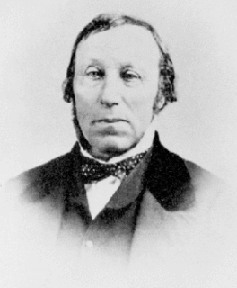
Alfred Penderell Waddington, during his later years, was actively involved in the Colony of Vancouver Island in what later became the province of British Columbia, Canada.
The Homathko Icefield is an icefield in British Columbia, Canada. Officially named the Homathko Snowfield from 1950 until the current name was adopted in 1976, it is one of the largest icefields in the southern half of the Coast Mountains, with an area of over 2,000 km2 (770 sq mi). It is located between Chilko Lake and the Homathko River, and lies across the Great Canyon of that river to the east of the Waddington Range. Although adjacent to Mount Queen Bess, the Homathko Icefield is largely an expanse of ice, about 30 km (19 mi) across, ringed by relatively minor peaks and distinguished, relative to the other Coast Mountains icefields, by lack of any major ones. The Lillooet Icecap and the Compton Névé, both similar in size to the Homathko Icefield but much more peak-studded, lie to the Homathko Icefield's southeast across the Southgate River which bends around the icefield-massif's southern flank to reach the head of Bute Inlet adjacent to the mouth of the Homathko River. The icefield is essentially one large ice-girt montane plateau between these two rivers.
Waddington Canyon is a canyon on the Homathko River in the heart of the Pacific Ranges of the Coast Mountains in British Columbia, Canada, located below the confluence of Mosley Creek.
Waddington Harbour is a harbour at the head of Bute Inlet in the Central Coast region of British Columbia, Canada. Also issuing into the head of Bute Inlet and Waddington Harbour, just east of the mouth of the Homathko, is the Teaquahan River. Issuing directly into the inlet a few miles south on the harbour's southeast is the Southgate River, one of the major rivers of the central Pacific Ranges, which begins on the west side of the Lillooet Icecap. Its lower valley adjacent to the inlet's shores is called Pigeon Valley.
The Teaquahan River, formerly Teaquahan Creek, is a river in the Pacific Ranges of the Coast Mountains, flowing into the head of Bute Inlet at Waddington Harbour, immediately east of the mouth of the Homathko River.
The Bishop River is a river in the Pacific Ranges of the Coast Mountains, flowing west from the western edge of the Lillooet Icecap to join the Southgate River east of the Homathko Icefield. Bishop River Provincial Park surrounds the upper course of the river, from the source at the Lillooet Icecap to midway along its course above its confluence with the Southgate.
Mount Bute, also known as Bute Mountain, is a 2,810-metre (9,220-foot) mountain located in the Coast Mountains of British Columbia, Canada. Situated at the southern extreme of the Homathko Icefield, Mount Bute has an impressive 800-metre sheer granite west face, and Bute Glacier dominates the north aspect. This imposing mountain is visible from Waddington Harbour at the head of Bute Inlet, in a remote wilderness area that few visit. Its nearest higher peak is Mount Grenville, 13.0 km (8.1 mi) to the east-northeast. Mount Grenville is the highest summit of the icefield. Mount Bute is 63.0 km (39.1 mi) southeast of Mount Waddington, the highest peak of the entire Coast Mountains range.

