Soyaux | |
|---|---|
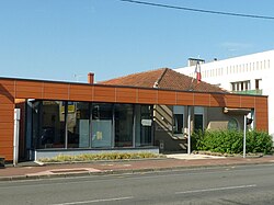 Town hall | |
 Location of Soyaux | |
 Soyaux  Soyaux | |
| Coordinates: 45°38′29″N0°11′55″E / 45.6414°N 0.1986°E | |
| Country | France |
| Region | Nouvelle-Aquitaine |
| Department | Charente |
| Arrondissement | Angoulême |
| Canton | Angoulême-3 |
| Intercommunality | Grand Angoulême |
| Government | |
| • Mayor (2020–2026) | François Nebout [1] |
Area 1 | 12.76 km2 (4.93 sq mi) |
| Population (2022) [2] | 10,057 |
| • Density | 788.2/km2 (2,041/sq mi) |
| Time zone | UTC+01:00 (CET) |
| • Summer (DST) | UTC+02:00 (CEST) |
| INSEE/Postal code | 16374 /16800 |
| Elevation | 56–166 m (184–545 ft) (avg. 161 m or 528 ft) |
| 1 French Land Register data, which excludes lakes, ponds, glaciers > 1 km2 (0.386 sq mi or 247 acres) and river estuaries. | |
Soyaux (French pronunciation: [swajo] or [sojo] ) is a commune in the Charente department in the Nouvelle-Aquitaine region in southwestern France. Situated east of Angoulême, it is one of the suburbs of the Angoulême urban area.

