Balzac, Charente

Last updated

Balzac
Balzac2.12.JPG
Old well in front of the Chateau
Blason ville fr Balzac (Charente).svg
Location of Balzac
Balzac, Charente
France location map-Regions and departements-2016.svg
Red pog.svg
Balzac
Aquitaine-Limousin-Poitou-Charentes region location map.svg
Red pog.svg
Balzac
Coordinates: 45°42′38″N0°08′14″E / 45.7106°N 0.1372°E / 45.7106; 0.1372
Country France
Region Nouvelle-Aquitaine
Department Charente
Arrondissement Angoulême
Canton Gond-Pontouvre
Intercommunality CA Grand Angoulême
Government
  Mayor (20202026) Jean-Claude Courari [1]
Area
1
9.64 km2 (3.72 sq mi)
Population
 (Jan. 2021) [2]
1,378
  Density140/km2 (370/sq mi)
Time zone UTC+01:00 (CET)
  Summer (DST) UTC+02:00 (CEST)
INSEE/Postal code
16026 /16430
Elevation30–102 m (98–335 ft)
(avg. 40 m or 130 ft)
1 French Land Register data, which excludes lakes, ponds, glaciers > 1 km2 (0.386 sq mi or 247 acres) and river estuaries.

Balzac (French pronunciation: [balzak] ) is a commune in the Charente department in the Nouvelle-Aquitaine region of south-western France.

Contents

Geography

Balzac is located some 7 km north-west of Angoulême. Access to the commune is by the D737 from Angoulême which passes through the east of the commune and the town continuing north to Montignac-Charente. The D105 branches off the D737 north of the town and goes east to Champniers. The D406 also branches off the D737 and goes west to Vindelle. Apart from the town there are the hamlets of Coursac, La Chapelle, Les Chabots, and Les Courlis in the commune. The commune is mostly farmland with a small forest in the south-west and a significant urban area for the town. [3]

Geology and terrain

Balzac occupies the interior of a wide bend of the Charente. The bedrock of the large eastern half of the commune, which is the highest in altitude, consists of limestone dating from the Upper Jurassic (Kimmeridgian) period.

The centre of the town, between Labbés, Genin, and Texier, is located on old alluvium from the Quaternary period.

The western part of the commune, between La Chapelle and Chabots, contains other alluvial deposits which form a low terrace. The river bed (floodplain) is itself made up of more recent alluvium (silt, sandy clay, and peat). [4] [5] [6] [7]

The terrain that separates the valley of the Charente from that of the Argence forms a kind of long cliff, very high and steep in its northern part, which is the concave side of the bend in the river near the villages of Coursac and Font-Saint-Martin, which gradually decreases in height to end at the foot of the Chateau of Balzac.

The highest point in the commune is at an altitude of 102 m east at Puylebin to the east of Coursac. The lowest point is 30 m on the Charente river at the confluence of the Argence. The village is about 60 m above sea level. [8]

Hydrography

The river Charente forms the entire south, west, and north-west border of the commune as it flows around the commune and continues south-east to eventually join the Atlantic Ocean at Rochefort. The Argence flows from the north-east and forms much of the eastern border where it joins the Charente in the south-eastern corner of the commune. [3]

Climate

The climate is oceanic Aquitaine and similar to the town of Cognac where the departmental weather station is located.

TownSunshine
Weather-clear.svg
(hours/yr)
Rain
Weather-overcast-rare-showers.svg
(mm/yr)
Snow
Weather-snow.svg
(days/yr)
Storm
Weather-violent-storm.svg
(days/yr)
Fog
Weather-day-more-fog.svg
(days/yr)
National average1,973770142240
Balzac [10] 2,02776332354
Paris 1,661637121810
Nice 2,7247671291
Strasbourg 1,693665292956
Brest 1,6051,21171275
Climate data for Cognac
MonthJanFebMarAprMayJunJulAugSepOctNovDecYear
Mean daily maximum °C (°F)9.4
(48.9)
11.0
(51.8)
14.4
(57.9)
16.9
(62.4)
20.8
(69.4)
24.3
(75.7)
26.8
(80.2)
26.7
(80.1)
23.5
(74.3)
19.0
(66.2)
13.0
(55.4)
9.8
(49.6)
18.0
(64.4)
Daily mean °C (°F)6.1
(43.0)
6.9
(44.4)
9.7
(49.5)
11.9
(53.4)
15.8
(60.4)
19.0
(66.2)
21.1
(70.0)
20.9
(69.6)
17.9
(64.2)
14.4
(57.9)
9.3
(48.7)
6.6
(43.9)
13.3
(55.9)
Mean daily minimum °C (°F)2.8
(37.0)
2.8
(37.0)
4.9
(40.8)
6.9
(44.4)
10.6
(51.1)
13.6
(56.5)
15.3
(59.5)
15.0
(59.0)
12.3
(54.1)
9.9
(49.8)
5.6
(42.1)
3.3
(37.9)
8.6
(47.5)
Average precipitation mm (inches)70.5
(2.78)
51.4
(2.02)
57.2
(2.25)
69.6
(2.74)
63.8
(2.51)
50.6
(1.99)
47.4
(1.87)
45.3
(1.78)
59.3
(2.33)
79.5
(3.13)
85.1
(3.35)
83.1
(3.27)
762.8
(30.03)
Average precipitation days (≥ 1 mm)11.69.210.111.210.57.46.96.58.011.211.511.6115.7
Mean monthly sunshine hours 77.3111.1160.2179.3211.4351.4254.6239.4219.3141.691.489.62,026.6
Source: Meteorological data for Cognac - 59m altitude, from 1981 to 2010 January 2015 (in French)
Confluence of the Argence with the Charente Styrieix argence.JPG
Confluence of the Argence with the Charente
View of Font-Saint-Martin in the Charente Valley Charente vindelle.jpg
View of Font-Saint-Martin in the Charente Valley

Neighbouring communes and villages

[3]

Toponymy

Old forms of the name Balzac are Balazacum and Balazaco in 1298. [11]

According to Dauzat, the origin of the name Balzac dates back to a Gallo-Roman person Ballitius, which itself is derived from Ballius, to which is added the suffix -acum which would give Ballitiacum or "Domain of Ballitius". [12] According to other sources, Balatius was the name of a Gallic man, derived from Balatos. [13] [14]

History

Aerial archaeology has revealed evidence of a Neolithic Bronze Age Promontory fort on the slopes of Coursac in a position dominating the Charente. [15]

A Chateau existed in the 12th century and Balzac was a former fief under the Bishopric of Angoulême and the barony of Tourriers which was acquired in 1398 by Guy de La Rochefoucauld. From the 12th to the 17th century the chateau passed through many hands. The present chateau was rebuilt on the same site in 1600 by Guillaume Guez and his wife who left from time to time for their house in Angoulême. It was the residence of the family Guez de Balzac and Jean-Louis Guez de Balzac, the "Restorer of the French Language", lived there.

From 4 March to 29 August 1619 Marie de' Medici was hosted there by the Guez family, "not wishing to stay elsewhere until the peace that made her son Louis XIII". The castle became the crossroads for personalities of the time during her stay - such as Cardinal Richelieu, the Duke of Épernon, the Cardinal de La Rochefoucauld, and the Count of Bethune. [16]

The road to Vars was a transport route by donkey for Salt to the port of Basseau. [17] The name la Montée des Sauniers (Ascent of Salt workers) above Coursac came from this. [8]

Formerly the Terrier de Bourguignol, then called the Plantier de Bourguignone, located near the Pont Suraud (Suraud Bridge) on the Argence was a dolmen called the Tomb of Bourguignon which was still visible in 1760. [18] [19]

At the beginning of the 20th century cherries and peas from Balzac were particularly appreciated from Angoulême to Paris. The fields provided milk feeding two major dairy factories in the commune, run by Messrs. Hortolan and Rochier. [20]

Heraldry

Arms of Balzac Blason ville fr Balzac (Charente).svg
Arms of Balzac
Coat of Arms

Blazon:
Quarterly, at 1 and 4 Vert, a bouquet in Sable; at 2 and 3 Argent a bugle-horn of Or stringed the same.


Administration

The Town Hall Balzac1.JPG
The Town Hall

List of Successive Mayors [22]

FromToName
19952026Jean-Claude Courari

Demography

The inhabitants of the commune are known as Balzatois or Balzatoises in French. [23] Balzac lost 30% of its population in the second half of the 19th century which then stabilised and experienced consistent growth in the last quarter of the 20th century.

Historical population
YearPop.±% p.a.
1793 957    
1800 1,016+0.86%
1806 905−1.91%
1821 961+0.40%
1831 1,000+0.40%
1841 968−0.32%
1846 942−0.54%
1851 928−0.30%
1856 918−0.22%
1861 838−1.81%
1866 815−0.56%
1872 785−0.62%
1876 780−0.16%
1881 768−0.31%
1886 798+0.77%
1891 727−1.85%
1896 705−0.61%
1901 688−0.49%
YearPop.±% p.a.
1906 708+0.57%
1911 644−1.88%
1921 612−0.51%
1926 605−0.23%
1931 623+0.59%
1936 613−0.32%
1946 621+0.13%
1954 644+0.46%
1962 606−0.76%
1968 687+2.11%
1975 809+2.36%
1982 934+2.07%
1990 1,185+3.02%
1999 1,237+0.48%
2007 1,246+0.09%
2012 1,326+1.25%
2017 1,337+0.17%
Source: EHESS [24] and INSEE [25]

Distribution of Age Groups

Headquarters building for the Community of communes Balzac cc.JPG
Headquarters building for the Community of communes

Percentage Distribution of Age Groups in Balzac and Charente Department in 2017

BalzacCharente
Age RangeMenWomenMenWomen
0 to 14 Years17.316.316.714.8
15 to 29 Years10.610.915.713.8
30 to 44 Years19.919.817.116.3
45 to 59 Years22.522.221.120.8
60 to 74 Years21.919.119.619.8
75 to 89 Years7.810.58.912.0
90 Years+0.01.20.92.4

Source: INSEE [25] [26]

Facilities

Education

The school is an Inter-communal Educational Grouping (RPI) with Vindelle. Balzac has a primary school (Nursery and from CP to CE2) and Vindelle has an elementary school (from CE2 to CM2). The Jean Caillard High School for Balzac is located in Genins. [27]

Sites and monuments

The Chateau of Balzac Balz ch2.JPG
The Chateau of Balzac
The Church of Saint Martin Balz eg1.JPG
The Church of Saint Martin

Balzac is also the location of the headquarters of the Community of communes of Braconne and Charente.

Notable people linked to the commune

See also

Related Research Articles

<span class="mw-page-title-main">Angoulême</span> Prefecture and commune in Nouvelle-Aquitaine, France

Angoulême is a small city in the southwestern French department of Charente, of which it is the prefecture.

<span class="mw-page-title-main">Jean-Louis Guez de Balzac</span> French writer of epistolary essays

Jean-Louis Guez de Balzac was a French author in Baroque Précieuses style, best known for his epistolary essays, which were widely circulated and read in his day. He was one of the founding members of Académie française.

<span class="mw-page-title-main">Aubeterre-sur-Dronne</span> Commune in Nouvelle-Aquitaine, France

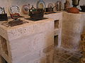
Aubeterre-sur-Dronne, commonly referred to as Aubeterre, is a commune in the Charente department in the Nouvelle-Aquitaine region of Southwestern France.

<span class="mw-page-title-main">Archiac</span> Commune in Nouvelle-Aquitaine, France

Archiac is a commune in the Charente-Maritime department in the Nouvelle-Aquitaine region of southwestern France.

<span class="mw-page-title-main">Ille-sur-Têt</span> Commune in Occitania, France

Ille-sur-Têt is a commune in the Pyrénées-Orientales département in southern France.

<span class="mw-page-title-main">Abzac, Charente</span> Commune in Nouvelle-Aquitaine, France

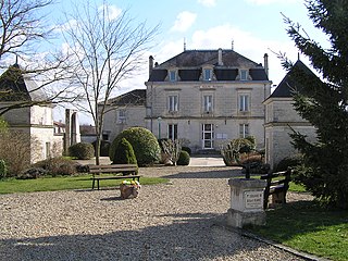
Abzac is a commune in the Charente department in the Nouvelle-Aquitaine region of southwestern France.

<span class="mw-page-title-main">Les Adjots</span> Commune in Nouvelle-Aquitaine, France

Les Adjots is a commune in the Charente department in the Nouvelle-Aquitaine region of southwestern France.

<span class="mw-page-title-main">Agris</span> Commune in Nouvelle-Aquitaine, France

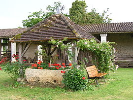
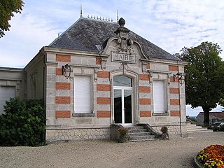
Agris is a commune in the Charente department in the Nouvelle-Aquitaine region of southwestern France.

<span class="mw-page-title-main">Aignes-et-Puypéroux</span> Part of Montmoreau in Nouvelle-Aquitaine, France

Aignes-et-Puypéroux is a former commune in the Charente department in the Nouvelle-Aquitaine region of southwestern France. On 1 January 2017, it was merged into the new commune Montmoreau.

<span class="mw-page-title-main">Aigre</span> Commune in Nouvelle-Aquitaine, France

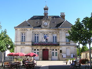
Aigre is a commune in the Charente department in the Nouvelle-Aquitaine region of southwestern France.

<span class="mw-page-title-main">Alloue</span> Commune in Nouvelle-Aquitaine, France

Alloue is a commune in the Charente department in the Nouvelle-Aquitaine region of southwestern France.

<span class="mw-page-title-main">Ambérac</span> Commune in Nouvelle-Aquitaine, France

Ambérac is a commune in the Charente département, region in the Nouvelle-Aquitaine region of southwestern France.

<span class="mw-page-title-main">Ambernac</span> Commune in Nouvelle-Aquitaine, France

Ambernac is a commune in the Charente department in the Nouvelle-Aquitaine region of south-western France.

<span class="mw-page-title-main">Ambleville, Charente</span> Part of Lignières-Ambleville in Nouvelle-Aquitaine, France

Ambleville is a former commune in the Charente department in the Nouvelle-Aquitaine region of southwestern France. On 1 January 2022, it was merged into the new commune of Lignières-Ambleville.

<span class="mw-page-title-main">Anais, Charente</span> Commune in Nouvelle-Aquitaine, France

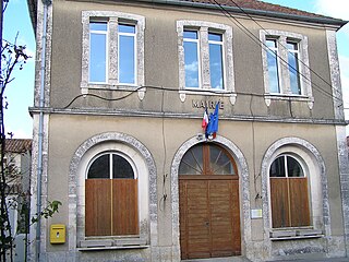
Anais is a commune in the Charente department in the Nouvelle-Aquitaine region of southwestern France.

<span class="mw-page-title-main">Angeac-Champagne</span> Commune in Nouvelle-Aquitaine, France

Angeac-Champagne is a commune in the Charente department in the Nouvelle-Aquitaine region of southwestern France.

<span class="mw-page-title-main">Baignes-Sainte-Radegonde</span> Commune in Nouvelle-Aquitaine, France

Baignes-Sainte-Radegonde is a commune in the Charente department in the Nouvelle-Aquitaine region of south-western France.

<span class="mw-page-title-main">Brie, Charente</span> Commune in Nouvelle-Aquitaine, France

Brie is a commune in the Charente department in southwestern France.

<span class="mw-page-title-main">Aulnay, Charente-Maritime</span> Commune in Nouvelle-Aquitaine, France

Aulnay, commonly referred to as Aulnay-de-Saintonge, is a commune in the Charente-Maritime department, region of Nouvelle-Aquitaine, France.

<span class="mw-page-title-main">Ballans</span> Commune in Nouvelle-Aquitaine, France

Ballans is a commune in the department of Charente-Maritime, southwestern France.

References

  1. "Répertoire national des élus: les maires" (in French). data.gouv.fr, Plateforme ouverte des données publiques françaises. 13 September 2022.
  2. "Populations légales 2021". The National Institute of Statistics and Economic Studies. 28 December 2023.
  3. 1 2 3 Google Maps
  4. Infoterre Visualiser Archived 2017-04-23 at the Wayback Machine , BRGM website (in French)
  5. BRGM Map on Géoportail (in French)
  6. Notice on the Mansle page, BRGM, 1984, Infoterre website, consulted on 13 November 2011 (in French)
  7. Notice on the Angoulême page, BRGM, 1973, Infoterre website, consulted on 17 November 2011 (in French)
  8. 1 2 IGN Map on Géoportail (in French)
  9. Paris, Nice, Strasbourg, Brest
  10. Data from the Station at Cognac from 1981 to 2010 (in French)
  11. Book of Fiefs of Guillaume de Blaye, Bishop of Angoulême (the "Liber feodorum"), Jean Nanglard, Vol. 5, Société archéologique et historique de la Charente, 1905 (1st ed. 1273), 404 p., p. 96, 228, 253, 274 (in Latin)
  12. Albert Dauzat and Charles Rostaing, Etymological Dictionary of place names in France, Paris, Librairie Guénégaud, 1989, 738 p. ( ISBN   2-85023-076-6), p. 50 (in French)
  13. Revue celtique, 1907, p.94 (in French)
  14. Jean Talbert, Origin of Place Names, 1928 (in French)
  15. Fouilles Claude Burnez and José Gomez de Soto in, Jacques Dassié, Aerial Archaeology. Archaeological and Touristic Heritage of Charente, Alan Sutton, 2001, 176 pages, p. 64 (photo), ISBN   2-84253-607-X (in French)
  16. Jean-Paul Gaillard, Châteaux, Lodgings, and old Houses of Charente, Paris, librairie Bruno Sépulchre, 1993 (reprinted 2005), 893 p., p. 91 (in French)
  17. André Debord, Lay Society in Charente country 10th-12th century, Picard, 1984, 585 p., ISBN   2-7084-0112-2, p. 356 (in French)
  18. Vigier de la Pile, History of the Angoumois, Paris, Derache (1846, Laffite reprint 2002), 1760, 160 p. ISBN   2-86276-384-5, p. 139 (in French)
  19. François Corlieu, Reports in the form of History, Paris, Derache (1846, Laffite reprint 2002), 1576, 81 p., ISBN   2-86276-384-5, p. 6 (in French)
  20. Jules Martin-Buchey, Historical and Communal Geography of Charente, published by the author, Châteauneuf, 1914-1917 (reprint Bruno Sépulchre, Paris, 1984), 422 p., p. 67 (in French)
  21. Balzac official website (in French)
  22. List of Mayors of France (in French)
  23. Le nom des habitants du 16 - Charente, habitants.fr
  24. Des villages de Cassini aux communes d'aujourd'hui: Commune data sheet Balzac, EHESS (in French).
  25. 1 2 Évolution et structure de la population en 2017: Commune de Balzac (16026)
  26. Évolution et structure de la population en 2017: Département de la Charente (16)
  27. Inspectorate of the Academy of Charente website (in French)
  28. Ministry of Culture, Mérimée PA00104236 Chateau of Balzac (in French) Camera aabb.svg
  29. Church of Saint-Martin, Balzac official website, 2012, consulted on 14 March 2014 (in French)