Special routes of U.S. Route 521 | |
|---|---|
| Highway system | |

Four special routes of U.S. Route 521 exist, and two others have existed in the past. In order from south to north they are as follows.
Special routes of U.S. Route 521 | |
|---|---|
| Highway system | |
Four special routes of U.S. Route 521 exist, and two others have existed in the past. In order from south to north they are as follows.
U.S. Highway 521 Business | |
|---|---|
| Location | Andrews, South Carolina |
| Length | 3.420 mi [1] (5.504 km) |
U.S. Route 521 Business (US 521 Bus.) is a 3.420 miles (5.504 km) business route of US 521 that travels through downtown Andrews, via Main Street. [2] It follows the old US 521 mainline route.[ citation needed ]
The entire route is in Georgetown County.
| Location | mi [1] | km | Destinations | Notes | |
|---|---|---|---|---|---|
| | 0.000 | 0.000 | Southern terminus; flyover interchange | ||
| Andrews | 2.410 | 3.879 | |||
| 3.420 | 5.504 | Northern terminus | |||
| 1.000 mi = 1.609 km; 1.000 km = 0.621 mi | |||||
This section is missing mileposts for junctions. |
U.S. Highway 521 Truck | |
|---|---|
| Location | Camden, South Carolina |
| Length | 6.9 mi [3] (11.1 km) |
U.S. Route 521 Truck (US 521 Truck) is a truck route of US 521 to direct truck traffic to avoid downtown Camden. The highway takes various roads including: Ehrenclou Drive, Chestnut Ferry Road, Jefferson Davis Highway (in concurrency with US 1/US 601/SC 34), Springdale Drive, and Boykin Road (in concurrency with US 601 Truck). Nearly the entire length of the truck route is within the city limits of Camden.
The entire route is in Camden, Kershaw County.
| mi | km | Destinations | Notes | ||
|---|---|---|---|---|---|
| 0.0 | 0.0 | Southern terminus of US 1 Truck and US 521 Truck | |||
| Southern end of US 1/US 601/SC 34 concurrency | |||||
| Senator Donald H. Don Holland Memorial Bridge | Crossing over railroad tracks of CSX | ||||
| Northern end of US 1/US 601/SC 34 concurrency; southern end of US 601 Truck concurrency; southern terminus of US 601 Truck | |||||
| Northern end of US 601 Truck concurrency; northern terminus of US 521 Truck and US 601 Truck | |||||
1.000 mi = 1.609 km; 1.000 km = 0.621 mi
| |||||
U.S. Highway 521 Truck | |
|---|---|
| Location | Camden, South Carolina |
| Length | 0.830 mi [4] [5] (1,336 m) |
U.S. Route 521 Truck (US 521 Truck) is a 0.830-mile (1.336 km) truck route of US 521 that exists entirely within the southern part of Camden. It uses York Street and Mill Street to connect US 521 (Broad Street) with US 1/SC 34 (East Dekalb Street). It is entirely concurrent with SC 34 Truck. The southbound lanes are also part of US 1 Truck, with no indication of US 1 Truck or SC 34 Truck; the northbound lanes have no indication of US 521 Truck. [6]
U.S. Highway 521 Business | |
|---|---|
| Location | Kershaw, South Carolina |
| Length | 1.500 mi [7] (2.414 km) |
U.S. Route 521 Business (US 521 Bus.) is a 1.500-mile (2.414 km) business route of US 521 that exists in Kershaw. It travels through downtown, via Hampton Street. It also has a concurrency with US 601 Bus. [8] It follows the former path of US 521.[ citation needed ]
The entire route is in Lancaster County.
| Location | mi [7] | km | Destinations | Notes | |
|---|---|---|---|---|---|
| Kershaw | 0.000 | 0.000 | Southern end of US 601 Bus. concurrency; southern terminus of US 521 Bus. and US 601 Bus. | ||
| 0.480 | 0.772 | Northern terminus of SC 341 | |||
| 0.760 | 1.223 | Hilton Street (US 521 Truck south / US 601 / SC 157 Truck / SC 341 Truck) – Jefferson, Pageland | Northern end of US 601 Bus. concurrency; northern terminus of US 521 Truck and US 601 Bus. | ||
| | 1.500 | 2.414 | Northern terminus | ||
1.000 mi = 1.609 km; 1.000 km = 0.621 mi
| |||||
U.S. Highway 521 Truck | |
|---|---|
| Location | Kershaw, South Carolina |
| Length | 0.140 mi [9] (225 m) |
U.S. Route 521 Truck (US 521 Truck) is a truck route of US 521 that exists entirely within the northern part of the town of Kershaw. It connects US 521 (North Matson Street) with US 521 Business (US 521 Bus.) and US 601 Bus. (North Hampton Street). It is completely concurrent with US 601, South Carolina Highway 157 Truck (SC 157 Truck), and SC 341 Truck. It is known as Hilton Street. There is no signs on US 521 or US 521 Bus./US 601 Bus. There is one sign just south of its northern terminus. [10]
U.S. Highway 521 Connector | |
|---|---|
| Location | Kershaw, South Carolina |
| Length | 0.060 mi [11] (97 m) |
U.S. Route 521 Connector (US 521 Conn.) is a 0.060-mile (0.097 km) connector route of US 521 that serves to connect US 521 Business (US 521 Bus.) with US 521 (North Matson Street / Kershaw–Camden Highway) north of Kershaw. [12] It is unnamed and is an unsigned highway. [13]
U.S. Highway 521 Business | |
|---|---|
| Location | Lancaster, South Carolina |
| Length | 3.870 mi [14] (6.228 km) |
| Existed | 1965[ citation needed ]–present |
U.S. Route 521 Business (US 521 Bus.) is a 3.870-mile (6.228 km) business route of US 521 that travels through downtown Lancaster, via Market Street and Main Street. [15] It follows the old US 521 mainline route.[ citation needed ] At some point, it was relocated to Market Street until the intersection with Barr Street, where it turned left and then right onto Main Street. [16]
The entire route is in Lancaster, Lancaster County.
| mi [14] | km | Destinations | Notes | ||
|---|---|---|---|---|---|
| 0.000 | 0.000 | Southern terminus | |||
| 1.440 | 2.317 | Camden–Kershaw Highway north | Southern terminus of Camden–Kershaw Highway; former US 521 Bus. north | ||
| 1.660 | 2.672 | Southern end of SC 200 concurrency | |||
| 2.270 | 3.653 | Northern terminus of SC 903 | |||
| 2.380 | 3.830 | Southern end of SC 9 Bus. concurrency | |||
| 2.650 | 4.265 | Northern end of SC 9 Bus. concurrency | |||
| 2.900 | 4.667 | West Barr Street west / North Main Street south | Former US 521 Bus. south; US 521 Bus./SC 200 turns right. | ||
| 3.680 | 5.922 | Northern end of SC 200 concurrency | |||
| 3.870 | 6.228 | Northern terminus; interchange | |||
1.000 mi = 1.609 km; 1.000 km = 0.621 mi
| |||||
This section relies largely or entirely upon a single source .(December 2020) |
U.S. Highway 521 Connector | |
|---|---|
| Location | Sumter, South Carolina |
| Length | 4.7 mi [17] (7.6 km) |
U.S. Route 521 Connector (US 521) was a 4.7 miles (7.6 km) connector route that went east around Sumter along Guignard Drive, connecting to US 15, in the southern end of Sumter. This connector became part of the main route sometime before 2009.[ citation needed ]
U.S. Highway 521 Bypass | |
|---|---|
| Location | Lancaster, South Carolina |
U.S. Route 521 Bypass (US 521 Byp.) was the bypass around downtown Lancaster, until the mainline was realigned in 1965, and the former route was converted into US 521 Business (US 521 Bus.).

U.S. Route 378 (US 378) is a spur of US 78 in the U.S. states of Georgia and South Carolina. The U.S. Highway runs 234.30 miles (377.07 km) from US 78, Georgia State Route 10 (SR 10), SR 17, and SR 47 in Washington, Georgia, east to US 501 Business in Conway, South Carolina. US 378 connects the Central Savannah River Area in both states with the Midlands and Pee Dee regions of South Carolina. The U.S. Highway's western portion, which connects Washington and Lincolnton in Georgia and McCormick, Saluda, and Lexington in South Carolina, is mainly a rural highway. US 378 is a major suburban and urban highway through Lexington and South Carolina's state capital, Columbia. The highway has a lengthy concurrency with US 76 between Columbia and Sumter and serves as a major route between the Midlands and the Myrtle Beach area, between which the highway has a business route through Lake City.
South Carolina Highway 160 (SC 160) is a 11.040-mile (17.767 km) primary state highway in the U.S. state of South Carolina. It travels from North Carolina state line, through Fort Mill, ending in Indian Land.

South Carolina Highway 9 (SC 9) is a 259.570-mile (418 km) major state highway in the U.S. state of South Carolina. The highway travels from Cherry Grove Beach to the North Carolina state line upstate. The highway is currently the longest state highway in South Carolina. It is signed as a north–south highway, even though it travels in an east–west direction.
South Carolina Highway 34 (SC 34) is a 185.930-mile (299.225 km) primary state highway in the U.S. state of South Carolina. As one of the longer state highways, it traverses the state east–west from Greenwood to Dillon, connecting the cities of Newberry, Winnsboro, Camden, Bishopville and Darlington.

South Carolina Highway 90 (SC 90) is a 23.110-mile (37.192 km) state highway in Horry County, within the northeastern part of the U.S. state of South Carolina. It travels from Red Hill to Little River. It provides a direct connection from Conway to the northern Grand Strand in Little River.

Several special routes of U.S. Route 1 (US 1) exist, from Florida to Maine. In order from south to north, separated by type, these special routes are as follows.

Several special routes of U.S. Route 52 exist, from North Dakota to South Carolina. In order from northwest to southeast, they are as follows.

Several special routes of U.S. Route 221 exist. In order from south to north they are as follows.

South Carolina Highway 151 (SC 151) is a 52.850-mile (85.054 km) primary state highway in the U.S. state of South Carolina. Known as "the road to the beach" by many residents of the Charlotte metropolitan area due to it being the most direct route to the Grand Strand, it connects the Charlotte metropolitan area to Darlington, Florence, and the aforementioned Grand Strand.

South Carolina Highway 4 (SC 4) is a primary 54.430-mile-long (87.597 km) state highway in the southern part of the U.S. state of South Carolina. The highway connects Aiken and Orangeburg, via Springfield and Neeses.

A total of at least five special routes of U.S. Route 601 have existed, one of which has been deleted.

Several special routes of U.S. Route 25 (US 25) exist. In order from south to north, they are as follows.
South Carolina Highway 47 (SC 47) is a 5.740-mile (9.238 km) primary state highway in the U.S. state of South Carolina. It serves to connect the town of Elloree with U.S. Route 301 (US 301).
Several special routes of U.S. Route 21 (US 21) exist. In order from south to north, they are as follows.
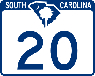
South Carolina Highway 20 (SC 20) is a primary state highway in the U.S. state of South Carolina. The highway connects the cities of Abbeville, Belton, Williamston and Greenville. The 53-mile-long (85 km) highway is signed as a west-east highway though it physically runs south-to-north.

South Carolina Highway 23 (SC 23) is a 47.060-mile (75.736 km) primary state highway in the U.S. state of South Carolina. It serves to connect Edgefield and Batesburg-Leesville with Columbia via U.S. Route 1 (US 1).

South Carolina Highway 97 (SC 97) is a 89.800-mile (144.519 km) state highway in the U.S. state of South Carolina. The highway connects Camden, Great Falls, Chester, and Hickory Grove.

South Carolina Highway 252 (SC 252) is a 35.711-mile-long (57.471 km) state highway in the U.S. state of South Carolina. The highway connects the Anderson and Laurens areas with Honea Path and Ware Shoals. It has a unique feature in that it intersects U.S. Route 76 (US 76) three times along its length.
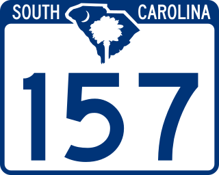
South Carolina Highway 157 (SC 157) is a 10.210-mile-long (16.431 km) state highway in the Sandhills region of the U.S. state of South Carolina. Though it physically travels west to east, it is signed as a north–south highway. Its southern terminus is at SC 346 about two miles (3.2 km) west of Catarrh. Its northern terminus is at SC 341 in Kershaw. This is also the southern terminus of SC 157 Truck and SC 341 Truck.

South Carolina Highway 341 (SC 341) is a 93.870-mile (151.069 km) state highway that travels through the northeastern part of the U.S. state of South Carolina. It travels diagonally from the southeast to northwest from SC 41 and SC 51 in Johnsonville to U.S. Route 521 Business and US 601 Bus. in Kershaw.