Bethune, South Carolina

Last updated

Bethune, South Carolina
Bethune SC.jpg
SCMap-doton-Bethune.PNG
Location of Bethune, South Carolina
Coordinates: 34°24′54″N80°20′51″W / 34.41500°N 80.34750°W / 34.41500; -80.34750
Country United States
State South Carolina
County Kershaw
Area
[1]
  Total1.10 sq mi (2.85 km2)
  Land1.10 sq mi (2.85 km2)
  Water0.00 sq mi (0.00 km2)
Elevation
289 ft (88 m)
Population
 (2020) [2]
  Total315
  Density285.84/sq mi (110.34/km2)
Time zone UTC-5 (Eastern (EST))
  Summer (DST) UTC-4 (EDT)
ZIP code
29009
Area codes 843, 854
FIPS code 45-06040 [3]
GNIS feature ID1246845 [4]

Bethune is a small town in Kershaw County, South Carolina, United States. The population was 334 at the 2010 census. [5] It is part of the Columbia, South Carolina Metropolitan Statistical Area.

Contents

History

Europeans first moved into the area in the early 1800s, finding members of the Kadapaw tribe living in the area. Originally, the settlers named the town "Lynchwood", and in 1828 they established a post office. After the railroads came to the area, the town was officially chartered in 1900 and the name changed to honor Daniel Murdock Bethune. [6]

Geography

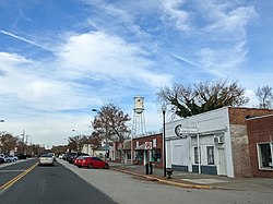
Bethune is located in northeastern Kershaw County at 34°24′54″N80°20′51″W / 34.41500°N 80.34750°W / 34.41500; -80.34750 (34.414881, -80.347414), [7] 20 miles (32 km) northeast of Camden, the county seat, and 35 miles (56 km) southwest of Cheraw along U.S. Route 1. South Carolina Highway 341 (Main Street) crosses US 1 in the center of town; it leads northwest 17 miles (27 km) to Kershaw and south 16 miles (26 km) to Bishopville.

According to the United States Census Bureau, the town of Bethune has a total area of 1.10 square miles (2.85 km2), all land. [5]

The Lynches River passes east of the town, and its tributary the Little Lynches River passes to the southwest. The rivers and the town are part of the watershed of the Great Pee Dee River.

The MAC-Hunter Astronomical Observatory, a cooperative project of South Carolina amateur astronomers in the Midlands Astronomy Club, is sited south of town. [8] [9]

Demographics

Historical population
CensusPop.Note
1910 317
1920 299−5.7%
1930 52274.6%
1940 62018.8%
1950 6393.1%
1960 579−9.4%
1970 506−12.6%
1980 481−4.9%
1990 405−15.8%
2000 352−13.1%
2010 334−5.1%
2020 315−5.7%
U.S. Decennial Census [10] [2]

As of the census [3] of 2000, there were 352 people, 165 households, and 104 families residing in the town. The population density was 309.4 inhabitants per square mile (119.5/km2). There were 193 housing units at an average density of 169.6 per square mile (65.5/km2). The racial makeup of the town was 89.77% White, 9.66% African American, 0.28% Pacific Islander, 0.28% from other races. Hispanic or Latino of any race were 2.84% of the population.

There were 165 households, out of which 21.8% had children under the age of 18 living with them, 49.7% were married couples living together, 10.9% had a female householder with no husband present, and 36.4% were non-families. 34.5% of all households were made up of individuals, and 21.8% had someone living alone who was 65 years of age or older. The average household size was 2.13 and the average family size was 2.72.

In the town, the population was spread out, with 17.3% under the age of 18, 7.1% from 18 to 24, 22.2% from 25 to 44, 29.8% from 45 to 64, and 23.6% who were 65 years of age or older. The median age was 47 years. For every 100 females, there were 83.3 males. For every 100 females age 18 and over, there were 84.2 males.

The median income for a household in the town was $32,083, and the median income for a family was $40,972. Males had a median income of $37,250 versus $26,406 for females. The per capita income for the town was $18,879. About 5.3% of families and 7.2% of the population were below the poverty line, including 15.5% of those under age 18 and 10.7% of those age 65 or over.

Education

Bethune has a public library, a branch of the Kershaw County Library. [11]

Arts and culture

The Bethune Chicken Strut is an annual festival that takes place for three days every August. The festival includes a parade that takes place down Main Street, a classic car show, carnival rides and live musical performances. The festival began in the early 1970s.

The Bethune Christmas Parade is one of many parades that takes place during the Christmas season in Kershaw County. The parade takes place down Main Street.

Related Research Articles

<span class="mw-page-title-main">Lee County, South Carolina</span> County in South Carolina, United States

Lee County is a county located in the U.S. state of South Carolina. As of the 2020 census, its population was 16,531, making it the fifth-least populous county in South Carolina. Its county seat is Bishopville.

<span class="mw-page-title-main">Lancaster County, South Carolina</span> County in South Carolina, United States

Lancaster County is a county located in the U.S. state of South Carolina. As of the 2020 census, its population was 96,016, Its county seat is Lancaster, which has an urban population of 23,979. The county was created in 1785.

<span class="mw-page-title-main">Kershaw County, South Carolina</span> County in South Carolina, United States

Kershaw County is a county located in the U.S. state of South Carolina. As of the 2020 census, its population was 65,403. The county seat and largest city is Camden. The county was created in 1791 from parts of Claremont, Lancaster, Fairfield, and Richland counties. It is named for Col. Joseph Kershaw (1727–1791), an early settler and American Revolutionary War patriot.

<span class="mw-page-title-main">Raymond, Kansas</span> City in Rice County, Kansas

Raymond is a city in Rice County, Kansas, United States. It is named after Emmons Raymond, former Director of the Atchison, Topeka and Santa Fe Railway. As of the 2020 census, the population of the city was 85.

<span class="mw-page-title-main">Lawndale, North Carolina</span> Town in North Carolina, United States

Lawndale is a town in Cleveland County, North Carolina, United States, situated along the First Broad River. The population was 606 at the 2010 census.

<span class="mw-page-title-main">Wagener, South Carolina</span> Town in South Carolina

Wagener is a town in Aiken County, South Carolina, United States. The population was 797 at the 2010 census, making it the largest settlement in the county north of the South Fork Edisto River. It is part of the Augusta, Georgia metropolitan area.

<span class="mw-page-title-main">Williamston, South Carolina</span> Town in South Carolina, United States

Williamston is a town in Anderson County, South Carolina. The population was 4,043 at the 2020 census.

<span class="mw-page-title-main">Elko, South Carolina</span> Town in South Carolina, United States

Elko is a town in Barnwell County, South Carolina, United States. According to the 2010 census the population was 193.

<span class="mw-page-title-main">Jamestown, South Carolina</span> Town in South Carolina, United States

Jamestown is a town in Berkeley County, South Carolina, United States. The population was 72 at the 2010 census.

<span class="mw-page-title-main">Great Falls, South Carolina</span> Town in South Carolina, United States

Great Falls is a town in Chester County, South Carolina, United States and is located fourteen miles southwest of Lancaster, South Carolina. The population was 1,951 at the 2020 census.

<span class="mw-page-title-main">Chesterfield, South Carolina</span> Town in South Carolina, United States

Chesterfield is a town in Chesterfield County, South Carolina, United States. The population was 1,472 at the 2010 census. It is the county seat of Chesterfield County. At the time of the 2010 census, Chesterfield was the least populous of all of South Carolina's county seats.

<span class="mw-page-title-main">Jefferson, South Carolina</span> Town in South Carolina, United States

Jefferson is a town in western Chesterfield County, South Carolina, United States at the junction of SC routes 265 and 151. Jefferson is located in the Piedmont region of South Carolina just in the edge meeting the Sandhills region. Jefferson is located 16 miles northwest of McBee, 8 miles south of Pageland, 50 miles southeast of Charlotte, North Carolina, and 70 miles north-northeast of the state capitol Columbia. As of the 2010 census, the city population was 753.

<span class="mw-page-title-main">Mount Croghan, South Carolina</span> Town in South Carolina, United States

Mount Croghan is a town in Chesterfield County, South Carolina, United States. The population was 195 at the 2010 census, up from 155 in 2000.

<span class="mw-page-title-main">Pageland, South Carolina</span> Town in South Carolina, United States

Pageland is a town in Chesterfield County, South Carolina, United States. It is the second largest town in Chesterfield County. The population was 2,760 at the 2010 census.

<span class="mw-page-title-main">Ruby, South Carolina</span> Town in South Carolina, United States

Ruby is a town in Chesterfield County, South Carolina, United States. The population was 360 at the 2010 census.

<span class="mw-page-title-main">Ridgeway, South Carolina</span> Town in South Carolina, United States

Ridgeway is a town in Fairfield County, South Carolina, United States. The population was 319 at the 2010 census. It is part of the Columbia, South Carolina Metropolitan Statistical Area.

<span class="mw-page-title-main">Lugoff, South Carolina</span> Census-designated place in South Carolina, United States

Lugoff is an unincorporated community and census-designated place (CDP) in Kershaw County, South Carolina, United States. The population was 7,434 at the 2010 census, up from 6,278 at the 2000 census. It is part of the Columbia, South Carolina Metropolitan Statistical Area.

<span class="mw-page-title-main">Kershaw, South Carolina</span> Town in South Carolina, United States

Kershaw is a town in Lancaster County, South Carolina, United States. It was incorporated in 1888. As of the 2010 census, the population was 1,803, and as of 2019 the estimated population was 2,321. The Haile Gold Mine, where gold was discovered in 1825, is 3 miles (5 km) from town and was at one time the largest single producer of gold in the Appalachian region.

<span class="mw-page-title-main">Lancaster, South Carolina</span> City in South Carolina, United States

The city of Lancaster is the county seat of Lancaster County, South Carolina, United States, located in the Charlotte Metropolitan Area. As of the United States Census of 2010, the city population was 8,526. The city was named after the famous House of Lancaster.

<span class="mw-page-title-main">Ridgeway, Virginia</span> Town in Virginia, United States

Ridgeway is a town in Henry County, Virginia, United States. The population was 742 at the 2010 census. It is part of the Martinsville Micropolitan Statistical Area. Martinsville Speedway, a NASCAR racetrack, is located between Ridgeway and the Martinsville city limits.

References

  1. "ArcGIS REST Services Directory". United States Census Bureau. Retrieved October 15, 2022.
  2. 1 2 "Census Population API". United States Census Bureau. Retrieved October 15, 2022.
  3. 1 2 "U.S. Census website". United States Census Bureau . Retrieved January 31, 2008.
  4. "US Board on Geographic Names". United States Geological Survey. October 25, 2007. Retrieved January 31, 2008.
  5. 1 2 "Geographic Identifiers: 2010 Census Summary File 1 (G001), Bethune town, South Carolina". American FactFinder. U.S. Census Bureau. Archived from the original on February 13, 2020. Retrieved April 17, 2019.
  6. "Bethune, South Carolina". SCIWAY.net. Retrieved April 30, 2012.
  7. "US Gazetteer files: 2010, 2000, and 1990". United States Census Bureau. February 12, 2011. Retrieved April 23, 2011.
  8. "The MAC-Hunter Astronomical Observing Site". MAC-Hunter Astronomical Observatory. Retrieved September 12, 2018.
  9. "Midlands Astronomy Club, Inc" . Retrieved September 12, 2018.
  10. "Census of Population and Housing". Census.gov. Retrieved June 4, 2015.
  11. "Locations & Hours". Greenville County Library System. Retrieved June 8, 2019.

External Linke