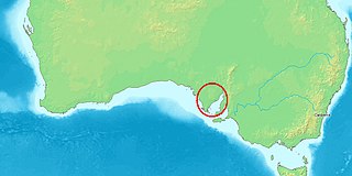
Coffin Bay National Park is a protected area in on the Eyre Peninsula of South Australia, Australia, which is located about 301 km west of Adelaide and about 46 km west of Port Lincoln. The town of Coffin Bay is near the entrance to the national park. The national park occupies the Coffin Bay Peninsula - a long peninsula with a sheltered bay to its north, coastal dunes, swamps and a coastline which overlooks islands, reefs, limestone cliffs and white surf beaches.

The Spencer Gulf is the westernmost and larger of two large inlets on the southern coast of Australia, in the state of South Australia, facing the Great Australian Bight. It spans from the Cape Catastrophe and Eyre Peninsula in the west to Cape Spencer and Yorke Peninsula in the east.

The Yorke Peninsula, known as Guuranda by the original inhabitants, the Narungga people, is a peninsula located northwest and west of Adelaide in South Australia, between Spencer Gulf on the west and Gulf St Vincent on the east. The peninsula is separated from Kangaroo Island to the south by Investigator Strait.

Roebuck Bay is a bay on the coast of the Kimberley region of Western Australia. Its entrance is bounded in the north by the town of Broome, and in the south by Bush Point and Sandy Point. It is named after HMS Roebuck, the ship captained by William Dampier when he explored the coast of north-western Australia in 1699. The Broome Bird Observatory lies on the northern coast of the bay.

Eighty Mile Beach also spelled Eighty-mile Beach or 80-mile Beach, and formerly called 90-mile Beach, lies along the north-west coast of Western Australia about half-way between the towns of Broome and Port Hedland. It is a beach some 220 kilometres (140 mi) in length, forming the coastline where the Great Sandy Desert approaches the Indian Ocean. It is one of the most important sites for migratory shorebirds, or waders, in Australia, and is recognised as a wetland of international importance under the Ramsar Convention on Wetlands.

Gluepot Reserve is a private protected area located in the Australian state of South Australia in the gazetted locality of Gluepot about 40 kilometres north of the town of Waikerie.

The Swan Bay is a shallow, 30-square-kilometre (12 sq mi) marine embayment at the eastern end of the Bellarine Peninsula in Port Phillip, Victoria, Australia. The township of Queenscliff lies at its southern end, and St Leonards at its northern. It is partly separated from Port Phillip by Swan Island, Duck Island and Edwards Point. Most of the area is included in the Port Phillip Heads Marine National Park as well as being listed as a wetland of international importance under the Ramsar Convention as part of the Port Phillip Bay and Bellarine Peninsula Ramsar Site. The bay is part of the Swan Bay and Port Phillip Bay Islands Important Bird Area, identified as such by BirdLife International because of its importance for orange-bellied parrots, waders and seabirds.

Edwards Point is a 4 km long sand spit extending southwards between Swan Bay and Port Phillip Bay, at the eastern end of the Bellarine Peninsula, Victoria, Australia. It is about 115 km by road south-west of Melbourne and 40 km east of Geelong.

The Corner Inlet is a 600-square-kilometre (230 sq mi) bay located 200 kilometres (120 mi) south-east of Melbourne in the South Gippsland region of Victoria, Australia. Of Victoria's large bays it is both the easternmost and the warmest. It contains intertidal mudflats, mangroves, salt marsh and seagrass meadows, sheltered from the surf of Bass Strait by a complex of 40 sandy barrier islands, the largest of which are Snake, Sunday and Saint Margaret Islands.
Goose Island Conservation Park is a protected area in the Australian state of South Australia, located on Goose Island and other islets in the vicinity of Wardang Island in Spencer Gulf. The constituent islands are located within 5 kilometres to 12 kilometres in the sector between west and north west of Port Victoria.

The Gulf St Vincent Important Bird Area comprises land extending along the coast of Gulf St Vincent, north of Adelaide, South Australia.

The Lake Hawdon System Important Bird Area comprises an area of 374 square kilometres covering a series of five coastal lakes in the Limestone Coast of South Australia. They are the most important of a string of regional lakes occupying swale corridors between modern and historical sand dunes.

The Riverland Mallee Important Bird Area comprises a 12,200 square kilometres tract of mallee habitat and riverine woodland extending from near Waikerie in the Riverland region in eastern South Australia north-eastwards into south-western New South Wales.

The Robbins Passage and Boullanger Bay Important Bird Area is a 238 km2 tract of land at the western end of the north coast of Tasmania, south-eastern Australia. It comprises extensive areas of intertidal mudflats and saltmarsh with adjacent farmland. It is an important site for waders, or shorebirds.

The Southern Yorke Peninsula Important Bird Area is a 348 square kilometres tract of land consisting of most of the south-western tip of the Yorke Peninsula in South Australia about 300 kilometres west of Adelaide.

The Swan Bay and Port Phillip Bay Islands Important Bird Area comprises a cluster of disparate sites centred at the eastern end of the Bellarine Peninsula, and the southern end of Port Phillip, in Victoria, south-eastern Australia. As well as providing core wintering habitat for orange-bellied parrots, it is important for waders, or shorebirds, and seabirds.

Tourville and Murat Bays Important Bird Area is an important bird area in South Australia with a combined area of 117 square kilometres, located west to the town of Ceduna on the north-west corner of the Eyre Peninsula in the Great Australian Bight. It is considered to be an important area because of the resident populations of waders, or shorebirds.

The Fog Bay and Finniss River Floodplains comprise the floodplain of the lower reaches of the Finniss River with the adjoining intertidal mudflats of Fog Bay in the Top End of the Northern Territory of Australia. It is an important site for waterbirds.
Torrens Island Conservation Park is a protected area in the Australian state of South Australia located on Torrens Island in the Adelaide metropolitan area about 17 kilometres north-northwest of the state capital of Adelaide and about 3.9 kilometres north-northeast of Port Adelaide.
Butcher Gap Conservation Park is a protected area located in the Limestone Coast of South Australia overlooking Lacepede Bay about 6 kilometres south of the town of Kingston SE. The conservation park was proclaimed under the National Parks and Wildlife Act 1972 in 1990.


