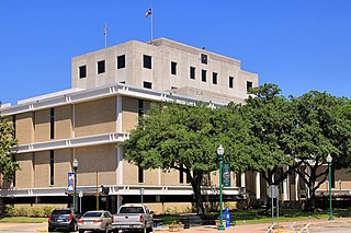
Montgomery County is a county in the U.S. state of Texas. As of the 2010 census, its population was 455,746. A 2019 estimate places the population at 607,391. The county seat is Conroe. The county was created by an act of the Congress of the Republic of Texas on December 14, 1837 and is named for the town of Montgomery. Between 2000 and 2010, its population grew by 55%, the 24th-fastest rate of growth of any county in the United States.

Pasco County is a county located on the west central coast of the U.S. state of Florida. According to the 2010 census, the population was 464,697. Its county seat is Dade City, and its largest city is New Port Richey. The county is named after Samuel Pasco.

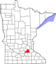
Scott County is a county in the U.S. state of Minnesota. As of the 2010 census, the population was 129,928. Its county seat is Shakopee. Shakopee is also the largest city in Scott County, the twenty-third-largest city in Minnesota, and the sixteenth-largest Twin Cities suburb. The county was organized in 1853 and named in honor of General Winfield Scott. Scott County is part of the Minneapolis-St. Paul-Bloomington, MN-WI Metropolitan Statistical Area. It is a member of the Metropolitan Council, and shares many of the council's concerns about responsible growth management, advocating for progressive development concepts such as clustering, open-space design, and the preservation of open space and rural/agricultural land.

Hennepin County is a county in the U.S. state of Minnesota. As of the 2010 census the population was 1,152,425. It is the most populous county in Minnesota and the 32nd-most populous county in the United States; more than one in five Minnesotans live in Hennepin County. Its county seat is Minneapolis, the state's most populous city. The county is named in honor of the 17th-century explorer Father Louis Hennepin. Hennepin County is included in the Minneapolis-St. Paul-Bloomington Metropolitan Statistical Area. The center of population of Minnesota is in Hennepin County, in the City of Minneapolis.

Azalea Park is a census-designated place and an unincorporated area in Orange County, Florida, United States. The population was 12,556 at the 2010 census. It is part of the Orlando–Kissimmee–Sanford, Florida Metropolitan Statistical Area.

Prior Lake is an exurban city 20 miles (32 km) southwest of Minneapolis seated next to Savage and Shakopee in Scott County in the state of Minnesota. Surrounding the shores of Lower and Upper Prior Lake, the city lies south of the Minnesota River in an area known as RiverSouth and establishes the urban fringe of the south-southwest portion of Minneapolis-St. Paul, the sixteenth largest metropolitan area in the United States. The population of Prior Lake was 22,796 at the 2010 census.

Vermilion Lake Township is a township in Saint Louis County, Minnesota, United States. The population was 278 at the 2010 census.

Bowstring is an unincorporated community in Bowstring Township, Itasca County, Minnesota, United States.

Highway 88 is a designation for five state highways in Arkansas. All routes are maintained by the Arkansas Department of Transportation (ArDOT).

Talmoon is an unincorporated community in Itasca County, Minnesota, United States.

State Route 231 (SR 231) is a 74.97-mile (120.65 km) long state highway in the U.S. state of Washington serving communities in Lincoln and Stevens counties. The highway, located entirely west of Spokane in the Inland Empire, serves Sprague, Edwall, Reardan, Springdale and Chewelah. The route extends from SR 23 north of Sprague to a concurrency with U.S. Route 2 (US 2) near Reardan and an intersection with US 395 south of Chewelah.
State Route 445 is a 41.890-mile-long (67.415 km) state highway in Washoe County, Nevada. The route follows Pyramid Way, a major thoroughfare in the city of Sparks, and connects the Reno metropolitan area to Pyramid Lake. The route is designated a Nevada Scenic Byway.

Poyntelle is a village in Preston Township, Wayne County, Pennsylvania, in the Lake Region of the Poconos. It was once a depot of the Scranton Division of the New York, Ontario & Western (O&W) Railway, but today, when it is known outside of its immediate vicinity, it is largely for being the location of Camps Westmont and Poyntelle, since the reputation and commercial reach of both, like those of most rural American summer camps, extend beyond the community in which the camps are physically located.

Spring Lake is an unincorporated community in North Branch Township, Isanti County, Minnesota, United States.

Max is an unincorporated community in Max Township, Itasca County, Minnesota, United States; located within the Chippewa National Forest and the Leech Lake Indian Reservation.

Wirt is an unincorporated community in Wirt Township, Itasca County, Minnesota, United States; located within the Chippewa National Forest.

Spring Lake is an unincorporated community located in the town of Marion, Waushara County, Wisconsin, United States. It is located at the intersection of County Road F and N.

Jessie Lake is an unincorporated community in Lake Jessie Township, Itasca County, Minnesota, United States, located within the Chippewa National Forest. The community is located between Wirt and Talmoon; along Itasca County Road 4.

Lydia is an unincorporated community in Spring Lake Township, Scott County, Minnesota, United States.

Ward Springs is an unincorporated community in Birchdale Township, Todd County, Minnesota, United States. It is along State Highway 28 near Todd County Roads 2 and 19. Nearby places include Grey Eagle, Melrose, and Sauk Centre.


