Pontotoc County is in the south central part of Oklahoma. As of the 2010 census, the population was 37,492. Its county seat is Ada. The county was created at statehood from part of the Chickasaw Nation in Indian Territory. It was named for a historic Chickasaw tribal area in Mississippi. According to the Encyclopedia of Oklahoma History and Culture, Pontotoc is usually translated "cattail prairie" or "land of hanging grapes."

Union County is a county located in the U.S. state of Mississippi. As of the 2010 census, the population was 27,134. Its county seat is New Albany. According to most sources, the county received its name by being a union of pieces of several large counties, like other Union counties in other states. However, other sources say that the name was meant to mark the re-union of Mississippi and the other Confederate states after the Civil War.
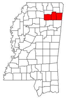
Pontotoc County is a county located in the U.S. state of Mississippi. As of the 2010 census, the population was 29,957. Its county seat is Pontotoc. It was created on February 9, 1836 from lands ceded to the United States under the Chickasaw Cession. Pontotoc is a Chickasaw word meaning "land of hanging grapes". The original Natchez Trace and the current-day Natchez Trace Parkway both pass through the southeast corner of Pontotoc County.

Lee is a county in Mississippi. As of the 2010 census, the population was 82,910. The county seat is Tupelo. Lee County is included in the Tupelo Micropolitan Statistical Area.

Algoma is a town in Pontotoc County, Mississippi. The population was 590 at the 2010 census.

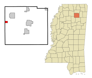
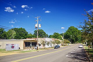
Ecru is a town in Pontotoc County, Mississippi. The population was 895 at the 2010 census. Ecru is home to the largest upholstered furniture plant in the world which manufactures Ashley Furniture.
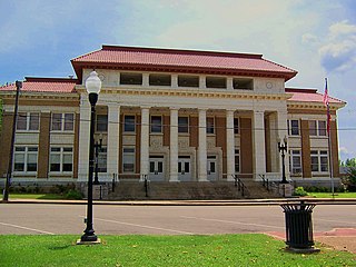
Pontotoc is a city in, and the county seat of, Pontotoc County, Mississippi, located to the west of the much larger city of Tupelo. The population was 5,625 at the 2010 census. Pontotoc is a Chickasaw word that means, “Land of the Hanging Grapes.”
Toccopola is a town in Pontotoc County, Mississippi, United States. The population was 246 at the 2010 census.
Sherman is a town which straddles Lee, Pontotoc, and Union counties in Mississippi. The population was 650 at the 2010 census.

Mississippi Highway 6 (MS 6) runs east–west from MS 161 in Lyon, east to MS 25 near Amory. It travels approximately 136 miles (219 km), serving Coahoma, Quitman, Panola, Lafayette, Pontotoc, Lee, and Monroe Counties. West of Tupelo, it is concurrent with US 278.

Trace State Park is a public recreation area located off Mississippi Highway 6, approximately 7 miles (11 km) east of Pontotoc and 7 miles (11 km) west of Tupelo in the U.S. state of Mississippi. The state park surrounds 565-acre (229 ha) Trace Lake and is named for the nearby Natchez Trace trail. Famed frontiersman Davy Crockett once lived within the area bounded by the park.
Mississippi Highway 9 runs north–south from MS 30 east of New Albany to MS 12 in Ackerman. It runs approximately 105 miles (169 km), serving Choctaw, Webster, Calhoun, Pontotoc, and Union counties. MS 9W veers off to the left in a curve just about 2 miles north of Bruce. It goes north north-west until it merges with MS 7 just south of Oxford.

Mississippi Highway 15 is a state highway in Mississippi. At almost 324 miles (521 km), it is the longest highway in the Mississippi Highway System. MS 15 is divided into two sections due to a large gap between Stone County and Perry County. The southern section begins at Interstate 10 (I-10) and I-110 in Biloxi and ends at a junction with MS 26 near Wiggins, and the northern section begins at a junction with U.S. Route 98 near Beaumont and ends as a continuation as SR 125 near Walnut. It serves a total of 15 counties.
The Tupelo Micropolitan Statistical Area is a micropolitan area in northeastern Mississippi that covers three counties—Itawamba, Lee and Pontotoc. As of the 2000 census, the μSA had a population of 125,251.
The Pontotoc County School District is a public school district based in Pontotoc County, Mississippi (USA).
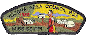
The Yocona Area Council of Boy Scouts of America serves 12 counties in northeast Mississippi including Alcorn, Benton, Itawamba, Lafayette, Lee, Marshall, Prentiss, Pontotoc, Tippah, Tishomingo, Union, and Yalobusha. The council headquarters is in Tupelo, Mississippi. The Yocona Area Council, supported by 1,100 volunteers, and 130 chartered partners, serves approximately 6,500 youth annually in one of five programs: Boy Scouts, Cub Scouts, Venturing, Learning for Life, and Exploring.

The Gulf and Ship Island Railroad (G&SI) was constructed in the state of Mississippi, USA, at the turn of the 20th century to open a vast expanse of southern yellow pine forests for commercial harvest. In spite of economic uncertainty, entrepreneurs William H. Hardy and Joseph T. Jones successfully completed railroad construction. The railroad resulted in the development of a seaport and expansion of cities along its route.
Rough Edge is an unincorporated community in Pontotoc County, Mississippi.
Mississippi Highway 41 (MS 41) is a state highway in northeastern Mississippi. The route starts at U.S. Route 45 and US 278 north of Wren and travels westwards. It then intersects US 45 Alt. east of Okolona. The road enters Okolona, and intersects MS 32 and MS 245. MS 41 then turns northwest and travels toward Pontotoc. Once inside the city, the route turns north at MS 15 and travels through downtown Pontotoc. MS 41 ends at its intersection with MS 9 and MS 338. The route that became MS 41 was first used as an Indian trail. The route was designated by 1932 from Amory to Pontotoc, and it was truncated from Amory to US 45 by 1955. The entirety of MS 41 was paved by 1958.