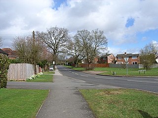
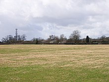
Booker is a hamlet within the parish of West Wycombe in Buckinghamshire, England, which has absorbed into the expanding suburbs of High Wycombe. There are several housing areas in Booker, mainly modern estates. At the 2011 Census the hamlet was included in the High Wycombe Ward of Booker and Cressex.

Bourne End is a village mostly in the parish of Wooburn, but partly in that of Little Marlow in Buckinghamshire, England. It is about five miles (8 km) south-east of High Wycombe and three miles (5 km) east of Marlow, near the boundary with Berkshire and close to where the Buckinghamshire River Wye empties into the Thames.

Great Kingshill is a small village in the parish of Hughenden in Buckinghamshire, England. It is located in the Chiltern Hills, about five miles west of Amersham and two and a half miles south of Great Missenden.

Handy Cross is a hamlet in the parish of Little Marlow, Buckinghamshire, England. It is located on Marlow Hill, on the old road between Marlow and High Wycombe. At the 2011 Census the population of the hamlet was included in the civil parish of Great Marlow. Today the hamlet consists of a farm, several households and a Harvester pub & restaurant.

Holmer Green is a village in the civil parish of Little Missenden, in Buckinghamshire, England. It is next to Hazlemere, about 3 miles (5 km) south of Great Missenden.

Horton is a hamlet in the parish of Ivinghoe, in Buckinghamshire, England. It is in the civil parish of Slapton.

Wheeler End is a hamlet in the parish of Piddington and Wheeler End, in Buckinghamshire, England. The hamlet is located close to the main A40 between West Wycombe and Stokenchurch.
Widmer End is a hamlet in the parish of Hughenden, in Buckinghamshire, England.
BBC Three Counties Radio is the BBC's local radio station serving the counties of Bedfordshire, Hertfordshire and Buckinghamshire.
Hyde End is a small hamlet, in the civil parish of Great Missenden. it is located between the hamlets of Hyde Heath and South Heath along the B485 road between Chesham and Great Missenden, in the Chiltern Hills, Buckinghamshire. It comprises a small number of dwellings, including a row of early 1900s cottages, a row of 1930s cottages and larger houses and farm properties.

Coombe is a place in the London Borough of Croydon, situated south-east of central Croydon, between Addiscombe, Selsdon and Upper Shirley. Formerly a hamlet, since the growth of suburban development the area has become swallowed into the London conurbation and often does not appear on modern map.

Beaconsfield is a constituency in Buckinghamshire represented in the House of Commons of the UK Parliament since 2019 by Joy Morrissey of the Conservative Party. She succeeded Independent and former Conservative Dominic Grieve, whom she defeated following his suspension from the party. The constituency was established for the February 1974 general election.

Piddington is a hamlet in the parish of Piddington and Wheeler End in Buckinghamshire, England. It is located on the main A40 between Stokenchurch and West Wycombe.

Binfield Heath is a village and civil parish in South Oxfordshire, England, 2+1⁄2 miles (4 km) south-southwest of Henley-on-Thames and 3+1⁄2 miles (6 km) northeast of Reading on a southern knoll of the Chiltern Hills. The 2011 Census recorded the parish population as 709. The village has a Congregational Church, ground for polo, Michelin star chef-run restaurant, and public house. 12 of its 294 homes are listed buildings.

Flackwell Heath Football Club is a football club based in Flackwell Heath, near High Wycombe in Buckinghamshire, England. Affiliated to the Berks & Bucks Football Association, they are currently members of the Combined Counties League Premier Division North and play at Wilks Park.

Hackney Road is a London arterial route running from Shoreditch Church in London Borough of Hackney to Cambridge Heath in the London Borough of Tower Hamlets. The route runs along the northern edge of Bethnal Green and southern edge of Hoxton and Haggerston. It lies close to the border between the boroughs of London Boroughs of Hackney and Tower Hamlets.

Great Missenden railway station serves the village of Great Missenden in Buckinghamshire, England and the neighbouring villages of Prestwood, Little Hampden and Little Missenden. The station lies on the London Marylebone - Aylesbury line and is served by Chiltern Railways trains. It is between Amersham and Wendover stations.

Heath End is a hamlet in the parish of Great Missenden in Buckinghamshire, England. At the 2011 Census the population of the hamlet was included in the civil parish of Little Missenden. During the 20th century, it became attached to Great Kingshill to the south west. The old centre of the hamlet is where Spurlands End Road meets Heath End Road. Although Heath End is now attached to Great Kingshill there are still road signs indicating to the hamlet.

Bolter End is a hamlet 5 mi (8.0 km) to the west of High Wycombe in Buckinghamshire, England.

Moorend Common is a 28-hectare (69-acre) Site of Special Scientific Interest in the hamlet Moor End, west of High Wycombe in Buckinghamshire. It is in the Chilterns Areas of Outstanding Natural Beauty, and it is owned and managed by Lane End Parish Council.


