St. Mullin's Upper Tigh Moling Uachtarach (Irish) | |
|---|---|
 | |
 | |
| Country | Ireland |
| Province | Leinster |
| County | Carlow |
| Area | |
| • Land | 32 km2 (12 sq mi) |
St. Mullin's Upper (Irish : Tigh Moling Uachtarach) is a barony in County Carlow, Ireland.
St. Mullin's Upper Tigh Moling Uachtarach (Irish) | |
|---|---|
 | |
 | |
| Country | Ireland |
| Province | Leinster |
| County | Carlow |
| Area | |
| • Land | 32 km2 (12 sq mi) |
St. Mullin's Upper (Irish : Tigh Moling Uachtarach) is a barony in County Carlow, Ireland.
The original St. Mullin's barony took its name from the village of St. Mullin's (Irish : Tigh Moling). [1] The area now called St. Mullin's Upper was formerly an exclave until the two parts were separated in 1841.
St. Mullin's Upper is found in east County Carlow, east of the River Slaney and west of the River Derry. It does not border St. Mullin's Lower.
St. Mullin's Upper is bordered to the west by Forth, County Carlow; to the east and north by Shillelagh, County Wicklow; and to the south by Scarawalsh, County Wexford.
Very early this area was referred to as Fearann Uí Néill, or the country of Farren O'Neale, lords of Tully. This may refer to the Uí Néill sept of Magh Dá Chonn in Leinster. [2]
Below is a list of settlements in St. Mullin's Upper:

County Carlow is a county located in the Southern Region of Ireland, within the province of Leinster. Carlow is the second smallest and the third least populous of Ireland's 32 traditional counties. Carlow County Council is the governing local authority.

Meath was a kingdom in Ireland from the 1st to the 12th century AD. Its name means "middle," denoting its location in the middle of the island.
The kingdom of Uí Fháilghe, Uí Failge or Uíbh Fhailí, was a Gaelic-Irish kingdom which existed to 1550, the name of which is preserved in the name of County Offaly, Ireland.
The Battle of Confey or Cenn Fuait was fought in Ireland in 917 between the Vikings of Dublin and the Irish King of Leinster, Augaire mac Ailella. It led to the recapture of Dublin by the Norse dynasty that had been expelled from the city fifteen years earlier by Augaire's predecessor, Cerball mac Muirecáin of Uí Fáeláin, and his ally Máel Finnia mac Flannacáin, the King of Brega.
The Castlecomer Plateau, or 'South Leinster Coalfield', is an upland area in the North of County Kilkenny, Ireland, extending into County Laois and County Carlow at its northern edge. The plateau is bounded on the east and south by the R448 regional road, on the west by the N77. The River Nore flows southward past the plateau's western flank, the River Barrow past its eastern flank and it is dissected by the River Dinin, which flows through Castlecomer itself.

St Mullins is a village, civil parish and townland on the eastern bank of the River Barrow in the south of County Carlow, Ireland. A smaller part of the civil parish is in County Wexford. The village is 10 km (6 mi) north of New Ross, near the R729 road.
Ballyhide is a rural townland and village in the extreme south eastern corner of County Laois, Ireland at the border with County Carlow. The nearest urban centre is Carlow town which is 3 kilometres to the north east. It is located in the Luggacurren Local Electoral District.
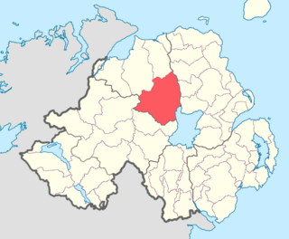
Loughinsholin is a barony in County Londonderry, Northern Ireland. Its southeast borders the northwest shore of Lough Neagh, and itself is bordered by seven other baronies: Dungannon Upper to the south; Strabane Upper to the west; Keenaght and Coleraine to the north; Kilconway, Toome Upper, and Toome Lower to the east. It was formed largely on the extent of the northern part of the medieval Irish túath of Uí Tuirtri.
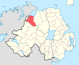
Tirkeeran is a barony in County Londonderry, Northern Ireland. It connects to the north-Londonderry coastline, and is bordered by four other baronies: Keenaght to the east; Strabane Lower to the south-east; North West Liberties of Londonderry to the west; and Strabane Upper to the south.

Magheraboy is a barony in County Fermanagh, Northern Ireland. To its east lies Lower Lough Erne, and it is bordered by three other baronies in Northern Ireland: Lurg to the north; Tirkennedy to the east; and Clanawley to the south It also borders two baronies in the Republic of Ireland: Tirhugh to the north; and Rosclogher to the south. The westernmost point of Magheraboy is also the westernmost point of Northern Ireland..
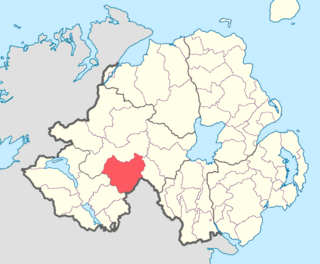
Clogher is a barony in County Tyrone, Northern Ireland. It is bordered by four other baronies in Northern Ireland: Omagh East to the north; Dungannon Lower to the east; Magherastephana to the south; and Tirkennedy to the south-west. It also borders two baronies in the Republic of Ireland: Trough and Monaghan both to the south-east.
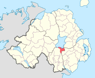
Oneilland East is a barony in the north-east of County Armagh, Northern Ireland. It is also called Clanbrasil. It lies in the north-east corner of the county, on the south-eastern shore of Lough Neagh and the boundary with County Down. Oneilland East is bordered by three other baronies: Oneilland West to the west; Iveagh Lower to the east; and Orior Lower to the south.

Saint Gobhan has long been linked with the parish of Seagoe – recorded for instance as Teach dho-Ghobha – in County Armagh, Ireland.

Carlow is a barony in County Carlow, Ireland.
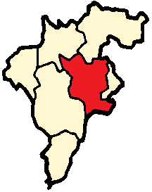
Forth is a barony in County Carlow, Ireland.
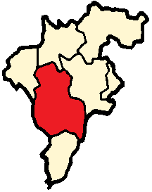
Idrone East is a barony in County Carlow, Ireland. The early barony of Idrone was split into East and West in 1799.

Idrone West is a barony in County Carlow, Ireland. The early barony of Idrone was split into East and West in 1799.

Rathvilly is a barony in County Carlow, Ireland.

St. Mullin's Lower is a barony in County Carlow, Ireland.