The common merganser or goosander (Eurasian) is a large seaduck of rivers and lakes in forested areas of Europe, Asia, and North America.

Killyleagh is a village and civil parish in County Down, Northern Ireland. It is on the A22 road between Belfast and Downpatrick, on the western side of Strangford Lough. It had a population of 2,483 people in the 2001 Census. It is best known for its twelfth century Killyleagh Castle. Killyleagh lies within the Newry, Mourne and Down district.

Killiney is an affluent seaside resort and suburb in Dún Laoghaire–Rathdown, Ireland. It lies south of neighbouring Dalkey, and north of Shankill. The place grew around the 11th century Killiney Church, and became a popular seaside resort in the 19th century. It is part of the Dáil Éireann constituency of Dún Laoghaire.

Cill Chiaráin is a coastal village in the Connemara area of County Galway, in the Republic of Ireland. The R340 passes through Cill Chiaráin.

The River Slaney is a large river in the southeast of Ireland. It rises on Lugnaquilla Mountain in the western Wicklow Mountains and flows west and then south through counties Wicklow, Carlow and Wexford for 117.5 km (73 mi), before entering St George's Channel in the Irish Sea at Wexford town. The estuary of the Slaney is wide and shallow and is known as Wexford Harbour. The catchment area of the River Slaney is 1,762 km2. The long term average flow rate of the River Slaney is 37.4 Cubic Metres per second (m3/s)

Kilkelly is a small village in Kilmovee parish County Mayo, Ireland. It is just south of Ireland West Airport Knock on the N17, a national primary road running between Galway and Sligo.

Kilmaine or Kilmain is a barony and village in County Mayo, Ireland.
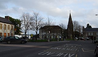
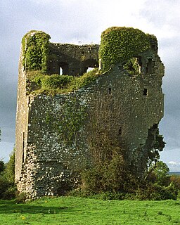
Kildorrery is a village in north County Cork, Ireland. It lies at the crossroads of the N73 road from Mallow to Mitchelstown and the R512 from Kilmallock to Fermoy.

Killowen, alternatively spelt Cill Abhainn is a small village in County Down, Northern Ireland. It is near Rostrevor and on the shore of Carlingford Lough. In the 2001 Census it had a population of 159 people. It lies within the Newry and Mourne District Council area.

Kilcummin is a beachhead and civil parish on the northern coast of County Mayo in Ireland. Traditionally a fishing community, the Kilcummin area is sparsely populated. The "Tír Sáile - North Mayo Sculpture Trail" and "Tour d'Humbert" tourist route lead through the area. Kilcummin overlooks Killala Bay, the blue flag beach "An Trá nRoss", "Bartra Island" and lies on the opposite shore to Enniscrone and its beach in County Sligo.

The N80 road is a national secondary road in Ireland that runs southeastwards from its junction with the N52 and R443 in the town of Tullamore in County Offaly, to the N30 at Ballynahallin, just north of Enniscorthy in County Wexford, a distance of 114.683 km. Total length is 114.683 km (71.261 mi).

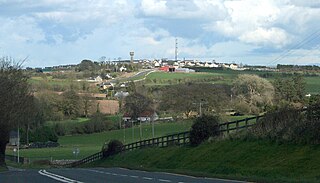
Kilmacrennan is a large village in County Donegal, Ireland. The village population was 753, as of the 2016 census. The village's population has increased steadily over the last decade with many new housing developments catering, in particular, for overspill population from Letterkenny. Kilmacrennan was historically the caput of its eponymous Barony of Kilmacrennan, of the eight Baronies of Donegal.
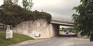
Kilworth is a village in north County Cork, located about 2 kilometres north of Fermoy near the river Funcheon. The M8 Cork–Dublin motorway passes nearby. Kilworth has an army camp, located on the R639 regional road between Mitchelstown and Fermoy. Kilworth is part of the Cork East Dáil constituency.
The R724 road is a regional road in County Carlow, Ireland. From its junction with the R448 at Royal Oak on the western edge of Muine Bheag Town it takes an easterly route crossing the River Barrow, the R705 regional road and the Dublin – Kilkenny railway line in the town.

Killeigh is a village in County Offaly, Ireland. It is located around 8 kilometres (5 mi) south of the county town of Tullamore, on the N80 national secondary road; the Slieve Bloom Mountains lie a similar distance further south.
Killea is a village in County Tipperary, Ireland. The village lies off the N62 road, 5 km from Templemore. The local Gaelic Athletic Association club is Cill Aodha. It is one of eleven civil parishes in the historical barony of Ikerrin. It is also part of the ecclesiastical parish of Templemore, Clonmore and Killea in the Roman Catholic Archdiocese of Cashel and Emly.

The South Leinster Way is a long-distance trail in Ireland. It is 104 kilometres long and begins in Kildavin, County Carlow and runs through County Kilkenny before ending in Carrick-on-Suir, County Tipperary. It is typically completed in five days. It is designated as a National Waymarked Trail by the National Trails Office of the Irish Sports Council and is jointly managed by Carlow County Council, Kilkenny County Council, Tipperary County Council, Carlow Local Sports Partnership, Kilkenny Trails and Coillte. It was opened on 30 November 1985 by Donal Creed, Minister of State for Sport.
Kilfintinan is a civil parish in County Clare, Ireland. It is part of the Catholic parish of Cratloe.
Killuran is a civil parish in County Clare, Ireland. It contains the village of O'Callaghans Mills. It is united with the civil parish of Kilkishen in the Catholic parish of O'Callaghans Mills.
Leitrim is a barony in Ireland that lies partly in County Galway and partly in County Clare. It is located in the extreme south-east of County Galway and the north-East of County Clare. Under the Local Government (Ireland) Act 1898, part of the barony was transferred from Galway to the administrative county of Clare. Leitrim is bounded, clockwise from the southwest, by the Clare baronies of Tulla Upper and Tulla Lower; the Galway baronies of Loughrea to the west, Kilconnell to the north, and Longford to the east; and by Lough Derg to the south and southeast. It measures 20 miles (32 km) from north to south and 9.5 miles (15.3 km) from east to west.