Ballinabranna Baile na mBreatnach | |
|---|---|
Village | |
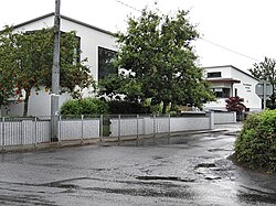 Ballinabranna National School | |
 Ballinabranna Location in Ireland | |
| Coordinates: 52°47′08″N6°59′06″W / 52.785608°N 6.984882°W | |
| Country | Ireland |
| Province | Leinster |
| County | County Carlow |
| Elevation | 90 m (300 ft) |
| Population | 557 |
| Time zone | UTC+0 (WET) |
| • Summer (DST) | UTC-1 (IST (WEST)) |
Ballinabranna or Ballinabrannagh (Irish : Baile na mBreatnach) [2] is a small village in County Carlow, Ireland. It is located approximately 8 kilometres south of Carlow and 5 kilometres from Junction 6 of the M9 motorway. It is within the townland of Ballinabrannagh, and is in the barony of Idrone West. As of the 2022 census, the population of the village was 557. [3]
