
Calais is a city in Washington County, Maine, United States. As of the 2020 census, it had a population of 3,079, making Calais the third least-populous city in Maine. The city has three Canada–US border crossings over the St. Croix River connecting to St. Stephen, New Brunswick, Canada.

The St. Croix River is a river in northeastern North America, 71 miles (114 km) in length, that forms part of the Canada–United States border between Maine (U.S.) and New Brunswick (Canada). The river rises in the Chiputneticook Lakes and flows south and southeast, between Calais and St. Stephen. It discharges into Passamaquoddy Bay, in the Bay of Fundy.

Passamaquoddy Bay is an inlet of the Bay of Fundy, between the U.S. state of Maine and the Canadian province of New Brunswick, at the mouth of the St. Croix River. Most of the bay lies within Canada, with its western shore bounded by Washington County, Maine. The southernmost point is formed by West Quoddy Head on the U.S. mainland in Lubec, Maine; and runs northeasterly through Campobello Island, New Brunswick, engulfing Deer Island, New Brunswick, to the New Brunswick mainland head at L'Etete, New Brunswick in Charlotte County, New Brunswick.
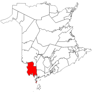
Saint Croix is a provincial electoral district for the Legislative Assembly of New Brunswick, Canada. The district includes the Town of St. Stephen and the Town of St. Andrews.

Saint-Léonard is a community in Madawaska County, New Brunswick, Canada. It held town status prior to 2023.

CHTD-FM is a radio station broadcasting at 98.1 FM in St. Stephen, New Brunswick, Canada. The station plays a classic hits format and is branded on-air as 98.1 Charlotte FM. The station is owned by Acadia Broadcasting.
Chamcook is an unincorporated area in Charlotte County, New Brunswick, Canada. It lies between the eastern bank of Chamcook Lake and the western edge of Passamaquoddy Bay.
The Milltown Dam is a hydroelectric dam built on the St. Croix River between St. Stephen, New Brunswick, Canada and Calais, Maine, USA, and operated by NB Power. Its power house has a capacity of 4 megawatts with its 7 turbines. Built in 1881 and modernised in the early-1900s, it is the oldest hydroelectric dam in Canada, as well as the first hydroelectric facility built by NB Power. Electricity generated by the Milltown Dam is also exported to the United States, connected to a 69,000 volt transmission circuit owned by the Eastern Maine Electric Cooperative, an electric utility serving Calais.
McAdam High School is a grades 6–12 school located in southwestern McAdam, New Brunswick. It was founded in 1924, and 1984, a more modern building was constructed. McAdam High is known for its cooperative education program. The town, and its high school, are named for late-19th-century politician John McAdam.
Route 630 is a 59.4-kilometre (36.9 mi) long mostly north–south secondary highway in McAdam Parish, New Brunswick, Canada.
Route 725 is a 19.2-kilometre (11.9 mi) long mostly north–south secondary highway in the southwestern portion of New Brunswick, Canada. Most of the route is in Charlotte County.
Route 735 is a 19.4-kilometre (12.1 mi) long mostly north–south secondary highway in the southwestern portion of New Brunswick, Canada. Most of the route is in Charlotte County.
Route 740 is a 14-kilometre (8.7 mi) long mostly north–south secondary highway in the southwestern portion of New Brunswick, Canada. Most of the route is in Charlotte County.
Route 750 is a 19-kilometre (12 mi) long mostly north–south secondary highway in the southwestern portion of New Brunswick, Canada. Most of the route is in Charlotte County.

Saint Andrews Parish is a civil parish in Charlotte County, New Brunswick, Canada, located east of St. Stephen.

Dufferin is a civil parish in Charlotte County, New Brunswick, Canada, located east of St. Stephen.

Saint Stephen is a civil parish in Charlotte County, New Brunswick, Canada, located in the southwestern corner of the province.

Saint James is a civil parish in Charlotte County, New Brunswick, Canada, located north of St. Stephen.

Saint David is a civil parish in Charlotte County, New Brunswick, Canada, located northeast of St. Stephen and northwest of Saint Andrews.
Blackland is a rural unincorporated settlement in Charlotte County, New Brunswick, Canada, that is just north of St. Stephen.
