| St Mark's Church | |
|---|---|
| St Mark's | |
 St Mark's Church, Westfield | |
 | |
| 51°18′01″N0°33′40″W / 51.3004°N 0.56107°W | |
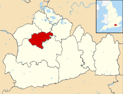
| Location | Woking |
| Country | England |
| Denomination | Church of England |
| Weekly attendance | Around 30-40 |
| Website | St Mark's website |
| Architecture | |
| Functional status | Active |
| Completed | 1849 |
| Administration | |
| Province | Canterbury |
| Diocese | Guildford |
| Parish | Parish of St Peter Woking |
| Clergy | |
| Vicar | Jonathan Thomas [1] |
St Mark's Church is located in Westfield, Woking, England. The church is in the Parish of the South Woking Team Ministry and the Diocese of Guildford.