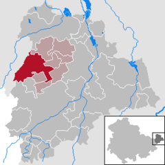
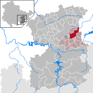
Dingelstädt is a town in the district of Eichsfeld in Thuringia, Germany. It is situated on the upper course of the river Unstrut, 8 km (5 mi) south of Leinefelde-Worbis and 15 km (9 mi) northwest of Mühlhausen. The former municipalities Helmsdorf, Kefferhausen, Kreuzebra and Silberhausen were merged into Dingelstädt in January 2019. In January 2023 Dingelstädt absorbed the villages Bickenriede and Zella from the former municipality Anrode, and Beberstedt and Hüpstedt from the former municipality Dünwald. In January 2024 it absorbed the village Struth from the former municipality Rodeberg.
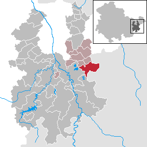
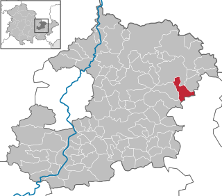
Geismar is a municipality in the district of Eichsfeld in Thuringia, Germany.
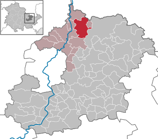
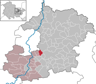
Uder is a municipality in the district of Eichsfeld in Thuringia, Germany. On 1 January 2024, the former municipality Uder was merged with the former municipalities Birkenfelde, Eichstruth, Lenterode, Lutter, Mackenrode, Röhrig, Schönhagen, Steinheuterode, Thalwenden and Wüstheuterode to form the current municipality Uder.

Dobitschen is a municipality in the Altenburger Land district, in the far eastern part of Thuringia, Germany. It borders on the municipalities Schmölln, Göllnitz, Mehna and Starkenberg. It is subdivided into the Ortsteile Dobitschen, Meucha, Pontewitz and Rolika.

Schmölln is a town in Thuringia, Germany, landkreis of Altenburger Land. It lies on the river Sprotte.
Sulza is a municipality in the district Saale-Holzland, in Thuringia, Germany.

Königsee is a town and a municipality in the district of Saalfeld-Rudolstadt, in Thuringia, Germany. It is situated 12 kilometres (7.5 mi) east of Ilmenau, and 35 kilometres (22 mi) south of Erfurt. The present municipality was formed on 31 December 2012 by the merger of the former municipalities Königsee and Rottenbach, under the name Königsee-Rottenbach. On 1 January 2019 the former municipalities Dröbischau and Oberhain were absorbed, and the name was changed to Königsee.
Dittersdorf is a municipality in the district Saale-Orla-Kreis, in Thuringia, Germany. On 1 December 2010 it absorbed the former municipality Dragensdorf.

Georgenthal is a municipality in the district of Gotha, in Thuringia, Germany. The former municipalities Leinatal, Hohenkirchen and Petriroda were merged into Georgenthal in December 2019. The former municipality Herrenhof was merged into Georgenthal in January 2024.
Seelingstädt is a municipality in the district of Greiz, in Thuringia, Germany. It is the seat of the municipal association of Ländereck.

Graitschen bei Bürgel is a municipality in the district Saale-Holzland, in Thuringia, Germany.

Waltersdorf is a municipality in the district Saale-Holzland, in Thuringia, Germany.

Bremsnitz is a municipality in the district Saale-Holzland, in Thuringia, Germany.
Frauenprießnitz is a municipality in the district Saale-Holzland, in Thuringia, Germany.
Kleinbockedra is a municipality in the district Saale-Holzland, in Thuringia, Germany. With 34 inhabitants at the end of 2019, it is the least populous municipality in what used to be East Germany, although there are 23 municipalities with lesser or equal population in what used to be West Germany. All of the Western municipalities are in either Rhineland-Palatinate (17), or Schleswig-Holstein (6).
Laasdorf is a municipality in the district Saale-Holzland, in Thuringia, Germany.

Oberbodnitz is a municipality in the district Saale-Holzland, in Thuringia, Germany.
Tautenhain is a municipality in the district Saale-Holzland, in Thuringia, Germany.

Tegau is a municipality in the district Saale-Orla-Kreis, in Thuringia, Germany and has a last reported population of 382 people.
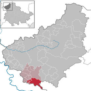
Altenburger Land I is an electoral constituency represented in the Landtag of Thuringia. It elects one member via first-past-the-post voting. Under the current constituency numbering system, it is designated as constituency 43. It covers the western part of Altenburger Land.