Heukewalde

Last updated
Heukewalde
Wappen Heukewalde.png
Location of Heukewalde within Altenburger Land district
Heukewalde in ABG.pngGöhrenHaselbach
Germany adm location map.svg
Red pog.svg
Heukewalde
Thuringia location map.svg
Red pog.svg
Heukewalde
Coordinates: 50°50′10″N12°16′3″E / 50.83611°N 12.26750°E / 50.83611; 12.26750 Coordinates: 50°50′10″N12°16′3″E / 50.83611°N 12.26750°E / 50.83611; 12.26750
Country Germany
State Thuringia
District Altenburger Land
Municipal assoc. Oberes Sprottental
Government
   Mayor (202228) Maik Piewak [1]
Area
  Total5.89 km2 (2.27 sq mi)
Elevation
275 m (902 ft)
Population
 (2020-12-31) [2]
  Total191
  Density32/km2 (84/sq mi)
Time zone UTC+01:00 (CET)
  Summer (DST) UTC+02:00 (CEST)
Postal codes
04626
Dialling codes 034496
Vehicle registration ABG
Website www.heukewalde.de

Heukewalde is a German municipality in the Thuringian Landkreis of Altenburger Land. It belongs to the Verwaltungsgemeinschaft of Oberes Sprottental.

Contents

Geography

Neighboring Municipalities

Communities near Heukewalde include: Jonaswalde, Posterstein, and Vollmershain in the Landkreis of Altenburger Land; as well as Rückersdorf und Paitzdorf in the Landkreis of Greiz.

History

Heukewalde was first mentioned in writing on December 9, 1152. From 1826 to 1920, it belonged to Saxe-Altenburg.

Mayors

Bernhard Göpel, mayor from 1892 to 1917.[ citation needed ]

Related Research Articles

Altenburger Land is a district in Thuringia, Germany. It is bounded by the district of Greiz, the Burgenlandkreis (Saxony-Anhalt), and the districts Leipzig, Mittelsachsen and Zwickau in Saxony. The district is a member of the Central German Metropolitan Region.

Greiz is a Kreis (district) in the east of Thuringia, Germany. Neighboring districts are Saale-Holzland, Saale-Orla, district-free city Gera, the Burgenlandkreis in Saxony-Anhalt, Altenburger Land, and the two Saxon districts Zwickau and Vogtlandkreis.

<span class="mw-page-title-main">Göllnitz</span> Municipality in Thuringia, Germany

Göllnitz is a municipality in the district Altenburger Land, in Thuringia, Germany.

<span class="mw-page-title-main">Lucka</span> Town in Thuringia, Germany

Lucka is a town in the Thuringian landkreis of Altenburger Land.

<span class="mw-page-title-main">Schmölln</span> Town in Thuringia, Germany

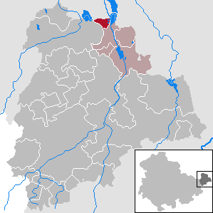
Schmölln is a town in Thuringia, Germany, landkreis of Altenburger Land. It lies on the river Sprotte.

<span class="mw-page-title-main">Jonaswalde</span> Municipality in Thuringia, Germany

Jonaswalde is a municipality in the Thuringian district of Altenburger Land. It belongs to the Verwaltungsgemeinschaft of Oberes Sprottental.

<span class="mw-page-title-main">Rückersdorf, Thuringia</span> Municipality in Thuringia, Germany

Rückersdorf is a municipality in the eastern part of the Thuringian landkreis of Greiz and belongs to the Verwaltungsgemeinschaft of Wünschendorf/Elster.

<span class="mw-page-title-main">Heyersdorf</span> Municipality in Thuringia, Germany

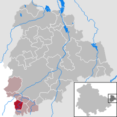
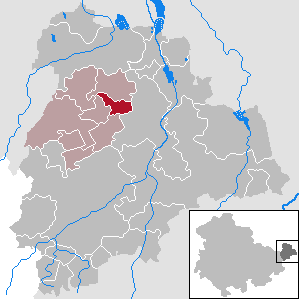
Heyersdorf is a municipality in the Thuringian district of Altenburger Land.

<span class="mw-page-title-main">Vollmershain</span> Municipality in Thuringia, Germany

Vollmershain is a municipality in the Verwaltungsgemeinschaft of Oberes Sprottental in the Thuringian landkreis of Altenburger Land in Germany.

<span class="mw-page-title-main">Posterstein</span> Municipality in Thuringia, Germany

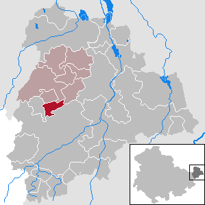
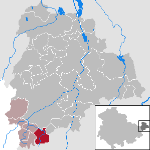
Posterstein is a German municipality in the Thuringian Landkreis of Altenburger Land.

<span class="mw-page-title-main">Paitzdorf</span> Municipality in Thuringia, Germany

Paitzdorf is a German municipality in the Thuringian Landkreis of Greiz. It belongs to the Verwaltungsgemeinschaft of Wünschendorf/Elster.

<span class="mw-page-title-main">Thonhausen</span> Municipality in Thuringia, Germany

Thonhausen is a municipality in the district of Altenburger Land in Thuringia, Germany. It belongs to the Verwaltungsgemeinschaft of Oberes Sprottental.

<span class="mw-page-title-main">Göhren, Thuringia</span> Municipality in Thuringia, Germany

Göhren is a municipality in the district of Altenburger Land, in Thuringia, Germany.

<span class="mw-page-title-main">Haselbach, Thuringia</span> Municipality in Thuringia, Germany

Haselbach is a municipality in the district Altenburger Land, in Thuringia, Germany.

<span class="mw-page-title-main">Fockendorf</span> Municipality in Thuringia, Germany

Fockendorf is a municipality in the district Altenburger Land, in Thuringia, Germany.

<span class="mw-page-title-main">Gerstenberg</span> Municipality in Thuringia, Germany

Gerstenberg is a municipality in the district of Altenburger Land, in Thuringia, Germany. Gerstenberg was first mentioned in a document in 1227. The line of knights "von Gerstenberg" died out in 1710. As early as 1181, a fortification was mentioned in the district of Pöschwitz. This later manor passed into civil ownership in 1798. Members of the families served the dukes of Saxe-Gotha and Saxe-Altenburg. After the expropriation in 1951, what was once the largest farm was just a residential property with MTS and a small new farmer.

<span class="mw-page-title-main">Lödla</span> Municipality in Thuringia, Germany

Lödla is a municipality in the district Altenburger Land, in Thuringia, Germany.

<span class="mw-page-title-main">Windischleuba</span> Municipality in Thuringia, Germany

Windischleuba is a municipality in the district Altenburger Land, in Thuringia, Germany.

Altenburger Land I is an electoral constituency represented in the Landtag of Thuringia. It elects one member via first-past-the-post voting. Under the current constituency numbering system, it is designated as constituency 43. It covers the western part of Altenburger Land.

Altenburger Land II is an electoral constituency represented in the Landtag of Thuringia. It elects one member via first-past-the-post voting. Under the current constituency numbering system, it is designated as constituency 44. It covers the eastern part of Altenburger Land.

References

  1. Gewählte Bürgermeister - aktuelle Landesübersicht, Freistaat Thüringen, accessed 10 November 2022.
  2. "Bevölkerung der Gemeinden, erfüllenden Gemeinden und Verwaltungsgemeinschaften in Thüringen Gebietsstand: 31.12.2020". Thüringer Landesamt für Statistik (in German). June 2021.