Altenburger Land is a district in Thuringia, Germany. It is bounded by the district of Greiz, the Burgenlandkreis (Saxony-Anhalt), and the districts Leipzig, Mittelsachsen and Zwickau in Saxony. The district is a member of the Central German Metropolitan Region.
Greiz is a Kreis (district) in the east of Thuringia, Germany. Neighboring districts are Saale-Holzland, Saale-Orla, district-free city Gera, the Burgenlandkreis in Saxony-Anhalt, Altenburger Land, and the two Saxon districts Zwickau and Vogtlandkreis.

Dobitschen is a municipality in the Altenburger Land district, in the far eastern part of Thuringia, Germany. It borders on the municipalities Schmölln, Göllnitz, Mehna and Starkenberg. It is subdivided into the Ortsteile Dobitschen, Meucha, Pontewitz and Rolika.
Göllnitz is a municipality in the district Altenburger Land, in Thuringia, Germany.

Lucka is a town in the Thuringian landkreis of Altenburger Land.
Crimmitschau is a town in the district of Zwickau in Saxony, Germany.

Schmölln is a town in Thuringia, Germany, landkreis of Altenburger Land. It lies on the river Sprotte.

Jonaswalde is a municipality in the Thuringian district of Altenburger Land. It belongs to the Verwaltungsgemeinschaft of Oberes Sprottental.

Rückersdorf is a municipality in the eastern part of the Thuringian landkreis of Greiz and belongs to the Verwaltungsgemeinschaft of Wünschendorf/Elster.

Heyersdorf is a municipality in the Thuringian district of Altenburger Land.

Vollmershain is a municipality in the Verwaltungsgemeinschaft of Oberes Sprottental in the Thuringian landkreis of Altenburger Land in Germany.
Heukewalde is a German municipality in the Thuringian Landkreis of Altenburger Land. It belongs to the Verwaltungsgemeinschaft of Oberes Sprottental.
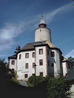
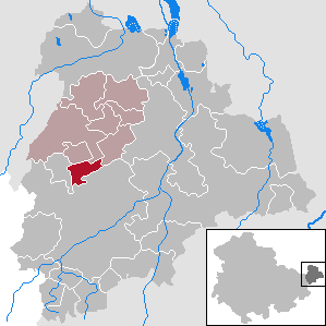
Posterstein is a German municipality in the Thuringian Landkreis of Altenburger Land.

Paitzdorf is a German municipality in the Thuringian Landkreis of Greiz. It belongs to the Verwaltungsgemeinschaft of Wünschendorf/Elster.

Göhren is a municipality in the district of Altenburger Land, in Thuringia, Germany.
Haselbach is a municipality in the district Altenburger Land, in Thuringia, Germany.

Göpfersdorf is a municipality in the district of Altenburger Land, in Thuringia, Germany. Göpfersdorf consists of two districts.
Oberes Sprottental is a Verwaltungsgemeinschaft in the district Altenburger Land, in Thuringia, Germany. The seat of the Verwaltungsgemeinschaft is in Nöbdenitz, which is part of the town Schmölln.
Altenburger Land I is an electoral constituency represented in the Landtag of Thuringia. It elects one member via first-past-the-post voting. Under the current constituency numbering system, it is designated as constituency 43. It covers the western part of Altenburger Land.
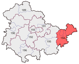
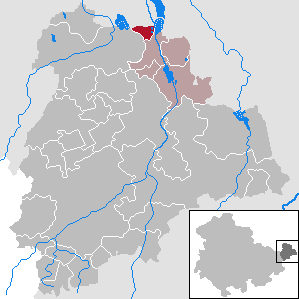
Gera – Greiz – Altenburger Land is an electoral constituency represented in the Bundestag. It elects one member via first-past-the-post voting. Under the current constituency numbering system, it is designated as constituency 194. It is located in eastern Thuringia, comprising the city of Gera and the districts of Altenburger Land and Greiz.


