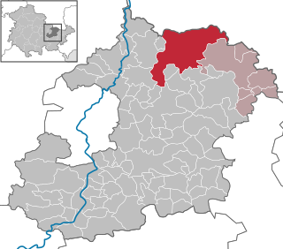
Burgwalde is a municipality in the district of Eichsfeld in Thuringia, Germany, part of the Verwaltungsgemeinschaft Hanstein-Rusteberg.
Freienhagen is a municipality in the district of Eichsfeld in Thuringia, Germany. It is part of the Verwaltungsgemeinschaft Hanstein-Rusteberg.

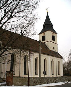
Kirchgandern is a municipality in the district of Eichsfeld in Thuringia, Germany. It is part of the Verwaltungsgemeinschaft Hanstein-Rusteberg. Kirchgandern was first mentioned in documentary in 1118.
Asbach-Sickenberg is a municipality in the district of Eichsfeld, in Thuringia, Germany. As a result of the 1945 Wanfried agreement, formerly Hessian Asbach-Sickenberg became part of the Soviet occupation zone and the later German Democratic Republic.

Schmölln is a town in Thuringia, Germany, landkreis of Altenburger Land. It lies on the river Sprotte.

Buttstädt is a municipality in the district of Sömmerda, in Thuringia, Germany. It is situated 16 km northeast of Weimar. The former municipalities Ellersleben, Eßleben-Teutleben, Großbrembach, Guthmannshausen, Hardisleben, Kleinbrembach, Mannstedt, Olbersleben and Rudersdorf were merged into Buttstädt in January 2019.
Schkölen is a town in the Saale-Holzland district, in Thuringia, Germany. It is situated 12 km south of Naumburg. The village Zschorgula is part of the municipality.

Stadtilm is a town in the Ilm-Kreis district, in Thuringia, Germany. It is situated on the river Ilm, 15 km northeast of Ilmenau, and 11 km southeast of Arnstadt. In July 2018 the former municipality of Ilmtal was merged into Stadtilm.

Steinbach-Hallenberg is a town in the Schmalkalden-Meiningen district, in Thuringia, Germany. It is situated in the Thuringian Forest, 8 km east of Schmalkalden, and 13 km northwest of Suhl. The former municipalities Altersbach, Bermbach, Oberschönau, Unterschönau, Rotterode and Viernau were merged into Steinbach-Hallenberg in January 2019.

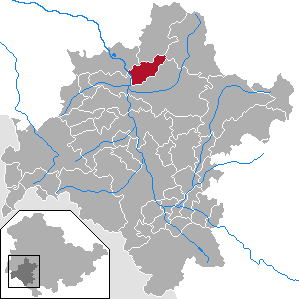
Hohenfelden is a municipality in the Weimarer Land district of Thuringia, Germany.

Tonndorf is a municipality in the Weimarer Land district of Thuringia, Germany. The nearest train station is the village München at the railway from Kranichfeld to Weimar, about four kilometers east of Tonndorf.

Windischleuba is a municipality in the district Altenburger Land, in Thuringia, Germany.

Georgenthal is a municipality in the district of Gotha, in Thuringia, Germany. The former municipalities Leinatal, Hohenkirchen and Petriroda were merged into Georgenthal in December 2019. The former municipality Herrenhof was merged into Georgenthal in January 2024.

Ilmtal-Weinstraße is a municipality in the district Weimarer Land, in Thuringia, Germany. It was named after the river Ilm, that flows through the municipality. It was formed on 31 December 2013 by the merger of the former municipalities Liebstedt, Mattstedt, Niederreißen, Niederroßla, Nirmsdorf, Oberreißen, Oßmannstedt, Pfiffelbach and Willerstedt. Before, these municipalities had cooperated in the Verwaltungsgemeinschaft Ilmtal-Weinstraße, which was disbanded. The seat of the municipality and of the former Verwaltungsgemeinschaft is in Pfiffelbach. The former municipalities Kromsdorf, Rohrbach and Leutenthal were merged into Ilmtal-Weinstraße in January 2019.

Langenwetzendorf is a municipality in the district of Greiz, in Thuringia, Germany.

Tissa is a municipality in the district Saale-Holzland, in Thuringia, in the eastern part of Germany.

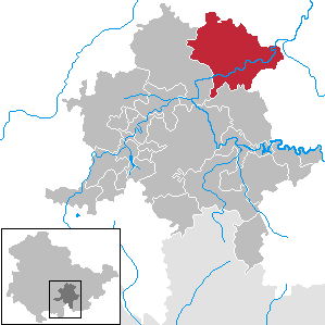
Unterwellenborn is a municipality in the district Saalfeld-Rudolstadt, in Thuringia, Germany. It was created on 1 February 2006 by fusion of the municipalities Birkigt, Goßwitz, Könitz, Lausnitz bei Pößneck and Unterwellenborn itself which had cooperated earlier as Verwaltungsgemeinschaft Unterwellenborn. Already on 9 April 1994, the municipalities Dorfkulm, Langenschade and Oberwellenborn had become part of the municipality of Unterwellenborn. In July 2018 the former municipality of Kamsdorf was merged into Unterwellenborn.
Fambach is a municipality in the district Schmalkalden-Meiningen, in Thuringia, Germany. Since 1 December 2008 it has incorporated the former municipality of Heßles.
Uhlstädt-Kirchhasel is a municipality in the district Saalfeld-Rudolstadt, in Thuringia, Germany. On 1 December 2007, the former municipalities Großkochberg and Heilingen were incorporated by Uhlstädt-Kirchhasel. The valley of the river Saale is the centre of Uhlstädt-Kirchhasel. Both Uhlstädt and Kirchhasel are villages inside this valley, which divides the municipality into a northern and a southern part. The nearest bigger towns are Rudolstadt, Saalfeld and Jena.
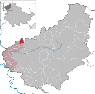
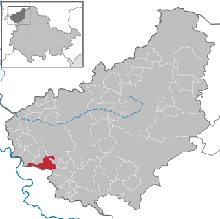
Altenburger Land II is an electoral constituency represented in the Landtag of Thuringia. It elects one member via first-past-the-post voting. Under the current constituency numbering system, it is designated as constituency 44. It covers the eastern part of Altenburger Land.