Stewartsville, Virginia

Last updated

Stewartsville, Virginia
USA Virginia location map.svg
Red pog.svg
Stewartsville
Usa edcp location map.svg
Red pog.svg
Stewartsville
Coordinates: 37°16′15″N79°47′34″W / 37.2708°N 79.7927°W / 37.2708; -79.7927
Country United States
State Virginia
County Bedford
Area
[1]
  Total2.531 sq mi (6.56 km2)
  Land2.528 sq mi (6.55 km2)
  Water0.003 sq mi (0.008 km2)
Population
 (2020) [2]
  Total533
  Density210/sq mi (81/km2)
Time zone UTC-5 (Eastern (EST))
  Summer (DST) UTC-4 (EDT)
ZIP Codes
24095 (Goodview)
24179 (Vinton)
Area code(s) 540 and 826
FIPS code 51-75504
GNIS feature ID2807405 [3]

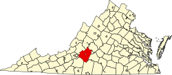
Stewartsville is a census-designated place (CDP) in southwestern Bedford County, Virginia, United States. The population as of the 2020 census was 533. [2] The CDP is located along State Route 24, between Vinton and Chamblissburg. It is part of the Lynchburg Metropolitan Statistical Area.

Contents

Geography

According to the United States Census Bureau, the CDP has a total area of 2.531 square miles (6.56 km2).

Demographics

Historical population
CensusPop.Note
2020 533
Source: U.S. Census Bureau

2020 census

The community was delineated by the US Census Bureau for the first time in 2020.

As of the census of 2020, there were 533 people residing in the CDP. There were 245 housing units. The racial makeup of the CDP was 95.3% White, 1.7% African American or Black, 0.0% American Indian, 0.2% Asian, 0.0% Pacific Islander, 0.0% from other races, and 2.8% from two or more races. Hispanic or Latino of any race were 1.1% of the population.

Government

The United States Postal Service does not operate a post office within the CDP. Addresses use a Vinton or Goodview ZIP Code.

Education

The CDP is served by Bedford County Public Schools. Public school students residing in Stewartsville are zoned to attend either Goodview Elementary School or Stewartsville Elementary School, Staunton River Middle School, and Staunton River High School.

The closest higher education institutions are located in Roanoke.

Infrastructure

Public safety

Law enforcement is provided by the Bedford County Sheriff's Office. Fire protection is provided by the Stewartsville-Chamblissburg Volunteer Fire Department, which operates two fire stations, including one within the CDP. Emergency medical services are provided by the Bedford County Department of Fire and Rescue and the Stewartsville Volunteer Rescue Squad, which operate from a station within the CDP.

Transportation

Air

The Roanoke-Blacksburg Regional Airport is the closest airport with commercial service to the CDP.

Highways

Rail

The Norfolk Southern operated Altavista District is located south of the CDP. The closest passenger rail service is located in Roanoke.

Related Research Articles

<span class="mw-page-title-main">Roanoke County, Virginia</span> County in Virginia, United States

Roanoke County is a county located in the U.S. state of the Commonwealth of Virginia. As of the 2020 census, the population was 96,929. Its county seat is Salem, but the county administrative offices are located in the unincorporated Cave Spring area of the county.

<span class="mw-page-title-main">Botetourt County, Virginia</span> County in Virginia, United States

Botetourt County is a US county that lies in the Roanoke Region of the Commonwealth of Virginia. Located in the mountainous portion of the state, the county is bordered by two major ranges, the Blue Ridge Mountains and the Appalachian Mountains.

<span class="mw-page-title-main">Bedford County, Virginia</span> County in Virginia, United States

Bedford County is a United States county located in the Piedmont region of the Commonwealth of Virginia. Its county seat is the town of Bedford, which was an independent city from 1968 until rejoining the county in 2013.

<span class="mw-page-title-main">Forest, Virginia</span> Census-designated place in Virginia, United States

Forest is a census-designated place (CDP) in eastern Bedford County, Virginia, United States. The population was 11,709 at the 2020 census. It is part of the Lynchburg Metropolitan Statistical Area.
<span class="mw-page-title-main">Blue Ridge, Virginia</span> Census-designated place in Virginia, United States

Blue Ridge is a census-designated place (CDP) in southern Botetourt County, Virginia, United States. The population was 3,185 at the 2020 census. The CDP is located along U.S. Route 460. It is part of the Roanoke Metropolitan Statistical Area.

Cloverdale is a census-designated place (CDP) in southern Botetourt County, Virginia, United States. The population was 3,410 at the 2020 census. The community is located along State Route 654. It is part of the Roanoke Metropolitan Statistical Area.

Daleville is a census-designated place (CDP) in southern Botetourt County, Virginia, United States. The population was 3,070 at the 2020 census. The CDP is located along U.S. Route 220. It is part of the Roanoke Metropolitan Statistical Area.

Laymantown is a census-designated place (CDP) in southern Botetourt County, Virginia, United States. The population was 1,867 at the 2020 census. The community is located along State Route 658. It is part of the Roanoke Metropolitan Statistical Area.

<span class="mw-page-title-main">Troutville, Virginia</span> Town in Virginia, United States

Troutville is a town in Botetourt County, Virginia, United States. The population was 458 at the 2020 census. The town is located along the U.S. Route 11 between Cloverdale and Buchanan. It is part of the Roanoke Metropolitan Statistical Area.

North Shore is a census-designated place (CDP) in Franklin County, Virginia, United States. The community lies along State Route 616. It is part of the Roanoke Metropolitan Statistical Area.

<span class="mw-page-title-main">Vinton, Virginia</span> Town in Virginia, United States

Vinton is a town in eastern Roanoke County, Virginia, United States. The population was 8,059 at the 2020 census. Vinton is part of the Roanoke Metropolitan Statistical Area and the Roanoke Region of Virginia.

<span class="mw-page-title-main">Hardy, Virginia</span> Unincorporated community in Virginia, United States

Hardy is an unincorporated community in southwestern Bedford County and northeastern Franklin County, Virginia, United States. The community lies along State Route 634 and is approximately nine miles southeast of Roanoke.

Thaxton is an unincorporated community in western Bedford County, Virginia, United States. The community is located along U.S. Route 460 between Bedford and Montvale. It is part of the Lynchburg Metropolitan Statistical Area.

<span class="mw-page-title-main">Moneta, Virginia</span> Unincorporated community in Virginia, United States

Moneta is a census-designated place (CDP) in southern Bedford County, Virginia, United States. The community is located along Route 122 between the towns of Bedford and Rocky Mount. It is part of the Lynchburg Metropolitan Statistical Area.

Glen Wilton is a census-designated place (CDP) in northern Botetourt County, Virginia, United States. The population was 129 at the 2020 census. The CDP is located along the James River, between Eagle Rock and Iron Gate. It is part of the Roanoke Metropolitan Statistical Area.

Bedford County Public Schools is a school district based in Bedford, Virginia, United States. It serves Bedford County, Virginia, United States.

<span class="mw-page-title-main">Big Island, Virginia</span> Census-designated place in Virginia, United States

Big Island is a census-designated place (CDP) in northern Bedford County, Virginia, United States. The population as of the 2020 United States census was 300. The CDP is located along the James River and U.S. Route 501, between Glasgow and Coleman Falls. It is part of the Lynchburg Metropolitan Statistical Area.

<span class="mw-page-title-main">Montvale, Virginia</span> Census-designated place in Virginia, United States

Montvale is a census-designated place (CDP) in western Bedford County, Virginia, United States. The population as of the 2020 census was 635. The community is located between Roanoke and Bedford. It is part of the Lynchburg Metropolitan Statistical Area.

<span class="mw-page-title-main">Chamblissburg, Virginia</span> Unincorporated community in Virginia, United States

Chamblissburg is an unincorporated community in southwestern Bedford County, Virginia, United States. It lies along State Route 24, east of Stewartsville. It is part of the Lynchburg Metropolitan Statistical Area.

Villamont is an unincorporated community in western Bedford County, Virginia, United States. Villamont is located along U.S. Route 460 between Blue Ridge and Montvale. It is part of the Lynchburg Metropolitan Statistical Area.

References

  1. "2020 U.S. Gazetteer Files – Virginia". United States Census Bureau. Retrieved October 22, 2021.
  2. 1 2 "Stewartsville CDP, Virginia: 2020 DEC Redistricting Data (PL 94-171)". U.S. Census Bureau. Retrieved October 22, 2021.
  3. "Stewartsville Census Designated Place". Geographic Names Information System . United States Geological Survey, United States Department of the Interior.