
Helsinki is the capital, primate, and most populous city of Finland. Located on the shore of the Gulf of Finland, it is the seat of the region of Uusimaa in southern Finland, and has a population of 656,250. The city's urban area has a population of 1,268,296, making it by far the most populous urban area in Finland as well as the country's most important center for politics, education, finance, culture, and research; while Tampere in the Pirkanmaa region, located 179 kilometres (111 mi) to the north from Helsinki, is the second largest urban area in Finland. Helsinki is located 80 kilometres (50 mi) north of Tallinn, Estonia, 400 km (250 mi) east of Stockholm, Sweden, and 300 km (190 mi) west of Saint Petersburg, Russia. It has close historical ties with these three cities.
Vantaa is a city and municipality in Finland. It is part of the inner core of the Finnish Capital Region along with Helsinki, Espoo, and Kauniainen. With a population of 238,033, Vantaa is the fourth most populated city in Finland after Helsinki, Espoo and Tampere. Its administrative center is the Tikkurila district. Vantaa is bordered by Helsinki, the Finnish capital, to the south; Espoo to the southwest; Nurmijärvi to the northwest; Kerava and Tuusula to the north; and Sipoo to the east. The city encompasses 240.35 square kilometres (92.80 sq mi), of which 1.97 km2 (0.76 sq mi) is water.

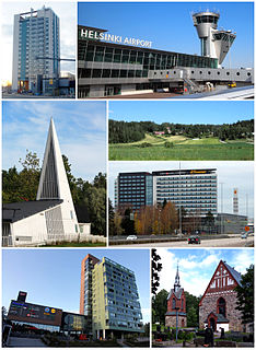
Tampere is a city in the Pirkanmaa region, located in the western part of Finland. Tampere is the most populous inland city in the Nordic countries; it has a population of 238,140 with the urban area holding 334,112 people and the metropolitan area, also known as the Tampere sub-region, holding 385,301 inhabitants in an area of 4,970 km2 (1,920 sq mi). Tampere is the second-largest urban area and third most-populous individual municipality in Finland, after the cities of Helsinki and Espoo and the most populous Finnish city outside the Greater Helsinki area, within which both Helsinki and Espoo are located. Today, Tampere is one of the major urban, economic, and cultural hubs in the whole inland region.

Finland attracted over 6.8 million foreign tourists in 2018, with 53 percent coming from other European Union states. In 2017, the value added by tourism was about 4.6 billion euros, or 2.6% of the Finnish GDP, providing approximately 140,200 jobs.

Oulu is a city, municipality and a Seaside resort of 208,939 inhabitants in the region of North Ostrobothnia, Finland. It is the most populous city in Northern Finland and the fifth most populous in the country after: Helsinki, Espoo, Tampere and Vantaa, and the fourth largest urban area in the country after Helsinki, Tampere and Turku. Oulu's neighbouring municipalities are: Hailuoto, Ii, Kempele, Liminka, Lumijoki, Muhos, Pudasjärvi, Tyrnävä and Utajärvi.
Tampere University of Technology (TUT) was Finland's second-largest university in engineering sciences. The university was located in Hervanta, a suburb of Tampere. It was merged with the University of Tampere to create the new Tampere University on 1 January 2019.

Kokemäki is a town and municipality in the Satakunta Region of Finland. The town has a population of 6,990 and covers an area of 531.27 square kilometres (205.12 sq mi) of which 50.04 km2 (19.32 sq mi) is water. The population density is 14.53 inhabitants per square kilometre (37.6/sq mi).

Orivesi is a town and a municipality of Finland. It is part of the Pirkanmaa region. The municipality has a population of 8,987 and covers an area of 960.09 square kilometres (370.69 sq mi) of which 160.53 km2 (61.98 sq mi) is water. The population density is 11.24 inhabitants per square kilometre (29.1/sq mi). The municipality official language is monolingually Finnish.

Pispala is a city area 2.5 km from the centre of Tampere, Finland. It is located on the northern slope of Pispalanharju, the highest esker in Finland.
Kaukajärvi is a district in Tampere, Finland, located between the Highway 9 (E63) and the three-kilometer-long Lake Kaukajärvi, where district gets its name. The district is also located right on the border of the Kangasala town.

Santalahti is a district in the western part of Tampere, Finland. It borders Lake Näsijärvi in the north, the Särkänniemi district in the east, Ylä-Pispala and Ala-Pispala in the south and Lielahti in the west. The town plan of Santalahti was confirmed in 1945.

Takahuhti is a district in Tampere, Finland. It is located in eastern part of the city, close to Atala, Linnainmaa, Kissanmaa and Messukylä. There are many prehistoric residences and finds in the area. Takahuhti was the largest village in Messukylä from the Middle Ages to the 20th century. The Battle of Tampere was also fought in Takahuhti during the 1918 civil war. The area is dominated by detached houses and there is a school built in 1939.
Iides is one of the main districts in the city center of Tampere in Pirkanmaa, Finland. The so-called planning area of Iides includes the statistical areas of Viinikka, Nekala, Vihioja, Jokipohja and Muotiala.

Hyhky is a district in the northwestern part of Tampere, Finland. It is bordered on the north by Lielahti, on the east by Ala-Pispala, on the south by Kaarila and on the west by Epilä.

Tahmela is a district in Tampere, Finland. It is located between Ylä-Pispala and Pyynikki on the shores of Lake Pyhäjärvi. There is a Varala Sports College in Tahmela. There are rental agricultural plots on the shore of Tahmela, and Kurpitsaliike ry was founded in 1998 to defend the continuation of land cultivation in Tahmela.

Tuomiokirkonkatu is a north–south street located in the center of Tampere, Finland, which runs through the districts of Jussinkylä and Kyttälä. The street is about a kilometer long. In the north it ends at Lapintie, in the south Vuolteenkatu. In Kyttälä, part of Tuomiokirkonkatu has been turned into a pedestrian street. In the future, the pedestrian section will be expanded so that it will eventually extend south from Kyttälänkatu to Suvantokatu and the Sori Square.
The Sori Square is a square located in the center of Tampere, Finland, in the southern part of the Kyttälä district. It is located in the area bounded by the Hatanpää Highway, Suvantokatu, Tuomiokirkonkatu and Vuolteenkatu. At the eastern end of the square is the Tampere Orthodox Church from 1898. There is a terminus at Tampere Tram Line 1 on the west side.

Pyynikinrinne is a district of Tampere, Finland. It is located west of the city center. Pyynikinrinne is bordered on the south by the Pyynikki Esker nature reserve, on the north by Pirkankatu and on the east by Mariankatu. The western boundary of the district is the former border between Tampere and Pohjois-Pirkkala municipalities. The neighboring parts of the city are Pyynikki, Ylä-Pispala, Amuri, partly Särkänniemi and Kaakinmaa.

Pirkankatu is a busy, east–west street located in Tampere, Finland, which forms the southern border of the Amuri district. The districts of Kaakinmaa and Pyynikinrinne are located south of the street. To the east, the end of Pirkankatu is the Hämeenpuisto park, in the middle stages of which it connects to Hämeenkatu. In the west, on the border of Pispala, Pirkankatu becomes the Pispala Highway.

Epilä is a district in Tampere, Finland. The area is bordered on the north by the Tampere–Pori railway and Lielahti, on the east by Hyhky's Vaakonkatu, on the west by Rahola and on the south by Kaarila.
