
The city of Tampere, the second largest city and urban area of Finland after Helsinki, can be divided into various sorts of subdivisions. The subdivisions include neighbourhoods, districts, major districts and postal code areas. The plethora of different official ways to divide the city is a source of some confusion to the inhabitants, as different kinds of subdivisions often share similar or identical names.
Teiskontie is a street and highway in Tampere, Finland. As its name implies, it runs from the center of Tampere towards Teisko, a former municipality connected to Tampere in 1972. To the east of the highway junction of Hervanta, it is part of Highway 12 leading in the direction of Lahti and Kouvola. On the east side of Lake Alasjärvi, Teiskontie has a connection to Highway 9 (E63) leading in the direction of Jyväskylä and Kuopio.

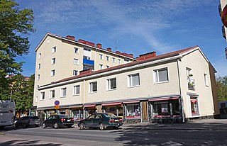
Kalevanrinne is a district of Tampere, Finland. It is located in the Sampo area between the districts of Kaleva and Järvensivu, bordering Liisankallio and Kalevanharju in the west, Hakametsä and Vuohenoja in the east. The city plan of Kalevanrinne was confirmed in 1951 and supplemented in 1955 and 1960. Kalevanrinne has a hypermarket Prisma, a pet store Musti ja Mirri and a electronics store Gigantti. There are also 13 planned apartment buildings in the area, which means that the Kalevanrinne residential area, located between Kalevantie and Sammonkatu, is planned to have about 1,360 inhabitants. The planned area is about 3,5 hectares in size.

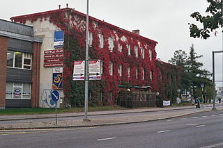
Särkänniemi is a district of the city centre of Tampere, Finland, located on the shores of Lake Näsijärvi, north of the districts of Amuri and Finlayson. The most famous sights of the district are Näsinneula and Särkänniemi Amusement Park, but in addition to that, the district also houses the Haarla's old paper mill building. The Amuri railway stop has also ceased operations in Särkänniemi. The Särkänniemi district also includes the Siilinkari islet in Lake Näsijärvi. Särkänniemi is bordered on the south by Paasikivenkatu, on the other side of which is the Amuri district, and on the west by the Santalahti district. The district includes the Onkiniemi residential area.

Santalahti is a district in the western part of Tampere, Finland. It borders Lake Näsijärvi in the north, the Särkänniemi district in the east, Ylä-Pispala and Ala-Pispala in the south and Lielahti in the west. The town plan of Santalahti was confirmed in 1945.
Hatanpää is a district in Tampere, Finland, located in the southern part of the city center on the shores of Lake Pyhäjärvi. Hatanpää is actually a peninsula that protrudes towards the lake, leaving the waters of Viinikanlahti Bay to the north and Vihilahti Bay to the south. The area is named after Hatanpää Manor, whose land from Härmälä to Sääksjärvi and Nekala was bought for the city in 1913. Administratively, the area has belonged to the city since 1920. In 2014, the population of the area was measured as 2,686 inhabitants.

Hervantajärvi is the southernmost district of the Tampere city in Pirkanmaa, Finland, located about eight kilometers southeast of the city center. It is bordered on the west by Vuores and on the north by Ruskontie, on the north by Hervanta and Rusko. In the east the border is between Kangasala and in the south against Lempäälä. The district is named after Lake Hervanta in the area, which is partly on the Lempäälä side.

Rautaharkko is a district of Tampere, Finland, located about three kilometers from the city center. Rautaharkko is bordered on the west by Rantaperkiö, on the east by Taatala and Nirva, on the south by Lakalaiva and on the north by Vihioja and Hatanpää. As of 31 December 2014, Rautaharkko had 533 inhabitants.

Kämmenniemi is a district, a statistical area and an urban area of Tampere, Finland, located in the area of the former municipality of Teisko. The regional road 338 between Tampere and Ruovesi runs through Kämmenniemi. The distance from the village to the city center of Tampere is about 25 kilometers. The most important sights and buildings in Kämmenniemi are, for example, the Aunessilta arch bridge and Kämmenniemi School. Among other things, the annual Teisko market is organized in Kämmenniemi. Kämmenniemi also has a library and fire station of the Teisko's volunteer fire department. The Paarlahti bay is also located in Kämmenniemi, which is called the only fjord in Finland; however, according to official definitions, it does not quite meet the characteristics of a fjord.

Tahmela is a district in Tampere, Finland. It is located between Ylä-Pispala and Pyynikki on the shores of Lake Pyhäjärvi. There is a Varala Sports College in Tahmela. There are rental agricultural plots on the shore of Tahmela, and Kurpitsaliike ry was founded in 1998 to defend the continuation of land cultivation in Tahmela.

Lentävänniemi is a district in the western part of Tampere on the shores of Lake Näsijärvi in Pirkanmaa, Finland. It belongs to the northwestern part of the city and borders the Niemi and Niemenranta borders on the southwest. There are jogging paths along the lake and its shores surrounding the apartment-based Lentävänniemi. In 2014, the population of Lentävänniemi was 4,309.

Viinikka is a district of Tampere, Finland, located 1,5 kilometers southeast of its city center on the west side of Lake Iides. Its neighboring district is Nekala. Its construction began in 1914 on the former lands of Hatanpää Manor. The stone church, opened in 1932, is located in Viinikka.
Linnainmaa is a district of about 6,000 inhabitants in the eastern part of Tampere, Finland, about six kilometers from the city center. Tampere's eastern bypass borders Linnainmaa in the west, and Highway 12 in the north. The building stock of Linnainmaa consists mainly of detached houses built in the 1950s and 1960s, as well as newer detached, multi-storey and terraced houses. The average age of those living in Linnainmaa is 40.9 years. The largest age group is 30-49 years old. The majority of the residents of the district are employed, the second largest are pensioners.

Sarankulma is a district located in the southern part of Tampere, Finland. It borders Härmälä in the north, Peltolammi in the east and the Pirkkala's municipal border in the west. There is industry in the area and former editorial office of Aamulehti was previously located in Sarankulma. The Pärrinkoski's nature conservation area is located on the southern border of Sarankulma.

Pyynikinrinne is a district of Tampere, Finland. It is located west of the city center. Pyynikinrinne is bordered on the south by the Pyynikki Esker nature reserve, on the north by Pirkankatu and on the east by Mariankatu. The western boundary of the district is the former border between Tampere and Pohjois-Pirkkala municipalities. The neighboring parts of the city are Pyynikki, Ylä-Pispala, Amuri, partly Särkänniemi and Kaakinmaa.

Kaakinmaa is a district in Tampere, Finland, located in the city center. It includes the area south of Pyynikki Church Park between the Hämeenpuisto park and the Mariankatu street. To the south, the area extends to Eteläpuisto on the shores of Lake Pyhäjärvi. The neighboring parts of the city are Nalkala in the east, Amuri in the north and Pyynikki and Pyynikinrinne in the west. Sometimes Kaakinmaa is incorrectly considered to belong to Pyynikki and Pyynikinrinne; however, Kaakinmaa has its own district.

Pirkankatu is a busy, east–west street in Tampere, Finland, which forms the southern border of the Amuri district. The districts of Kaakinmaa and Pyynikinrinne are located south of the street. To the east, the end of Pirkankatu is the Hämeenpuisto park, in the middle stages of which it connects to Hämeenkatu. In the west, on the border of Pispala, Pirkankatu becomes the Pispala Highway.

Satakunnankatu is an east–west, busy street in the center of Tampere, Finland, which is one of the city's main streets. It starts from the vicinity of Tampere Cathedral on the east side of Tammerkoski, where it separates the Jussinkylä and Kyttälä Districts. The street crosses the rapids along the Satakunta Bridge (Satakunnansilta) and runs on the west side between Finlayson and the Hämeenpuisto park. From there it continues through the Amuri area to the Pirkankatu street.
Epilänharju is a district of Tampere, Finland. The district is bordered on the north by Lamminpää, on the east by Lielahti, on the south by Epilä and on the west by Tohloppi and Ristimäki. The Epilänharju district is home to the former Epilä Spa, which has now been abandoned and left to decay, as well as Abloy Oy's former factory.

Paasikiven–Kekkosentie, or Rantaväylä, is a busy car traffic route located in Tampere, Finland, which serves as a regional transit road and a significant access route to the city center. It is a four-lane highway owned by the Finnish state and part of Highway 12. Paasikiven–Kekkosentie is located between the Nokia's motorway and the Teiskontie street junction.

