 | |
|---|---|
 | |
| Route information | |
| Length | 910 km[ citation needed ] (570 mi) |
| Major junctions | |
| West end | Mo i Rana, Norway |
| East end | Helsinki, Finland |
| Location | |
| Countries | Norway, Sweden, Finland |
| Highway system | |
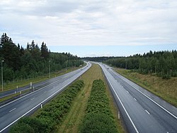

European route E12 is a road that is part of the International E-road network. It begins in Mo i Rana, Norway, transverses Sweden and ends in Helsinki, Finland, with a ferry line between Sweden and Finland. The part within Finland is Finnish national highway 3. The road is about 910 kilometres (570 miles) in length.
Contents
The ferry service between Holmsund and Vaasa is operated by Wasa Line using the M/S Aurora Botnia , with up to two daily departures in each direction taking about three and a half hours.
A road bridge, known as the Kvarken Bridge has been proposed by parties on both sides of the Gulf, along which the E12 could continue without ferry connections. No commitment has been made to build such a fixed link. [1]
