The international E-road network is a numbering system for roads in Europe developed by the United Nations Economic Commission for Europe (UNECE). The network is numbered from E1 up and its roads cross national borders. It also reaches Central Asian countries like Kyrgyzstan, since they are members of the UNECE.
European route E30 is an A-Class European route from the port of Cork in Ireland in the west to the Russian city of Omsk, near the border with Kazakhstan in the east. For much of the Russian stretch, it follows the Trans-Siberian Highway and, east of the Ural Mountains, with AH6 of the Asian Highway Network, which continues to Busan, South Korea. The total length is 6,530 km (4,060 mi)—3,300 km (2,100 mi) from Cork to Moscow, and 3,230 km (2,010 mi) from Moscow to Omsk. The naming is by the United Nations Economic Commission for Europe (UNECE).
European route E47 is a road connecting Lübeck in Germany to Helsingborg in Sweden via the Danish capital Copenhagen. It is also known as the Vogelfluglinie (German) or Fugleflugtslinjen (Danish). The road is of motorway standard all the way except for 28 km (17 mi) in Germany and 6 km of city roads in Helsingør, Denmark; there are also two ferry connections.

The European route E24 is part of the United Nations international E-road network. It runs for 254 km (158 mi) from Birmingham to Ipswich.

European route E20 is a part of the United Nations International E-road network. It runs roughly west–east through Ireland, the United Kingdom, Denmark, Sweden, Estonia, and Russia.

European route E18 runs between Craigavon in Northern Ireland and Saint Petersburg in Russia, passing through Scotland, England, Norway, Sweden and Finland. It is about 1,890 kilometres in length.
The European route E5 is part of the United Nations international E-road network. It is the westernmost north–south "reference road", running from Greenock in Scotland, south through Great Britain and France to Algeciras, Spain. The route is 1,900 miles (3,100 km) long.
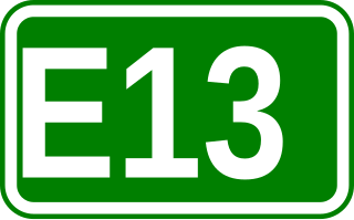
European route E13 is part of the International E-road network. It runs most of the length of the M1 motorway in the United Kingdom, from South Yorkshire to London. The E13 follows the route Doncaster – Sheffield – Nottingham – Leicester – Northampton – Luton – London, and is 277 km (172 mi) long.

European route E28 is a west-east intermediate road in the international E-road network. Beginning at the Bundesautobahn 10 in Germany, it runs west-east for a length of 1,230 km (760 mi) to Minsk, Belarus. The section between Kaliningrad and Minsk is part of the Pan-European Corridor IX.

The A120 is an A-road in England, which runs between Puckeridge in Hertfordshire and Harwich in Essex.

European route E73 forms part of the United Nations International E-road network, connecting Hungary and eastern Croatia to Bosnia and Herzegovina and the Adriatic Sea in the vicinity of the port of Ploče. This 679-kilometre (422 mi) route is also designated as the Pan-European Corridor Vc, a branch of the fifth Pan-European corridor. The route largely consists of two-lane roads with at-grade intersections, although in the 2000s, about a third of the route was upgraded to motorway standards. The remainder of the route is currently being upgraded in all the countries spanned. The longest part of this corridor goes through Bosnia and Herzegovina and is widely touted as a road instrumental to the development of the country. The road also serves as the shortest connection of the eastern and southern parts of Croatia.

European route E31 is an international Class-A road in Europe, part of the United Nations E-road network. It has a north–south reference, running from Rotterdam, Netherlands to Ludwigshafen, Germany.

European route E33 is a series of roads in Italy, part of the United Nations International E-road network.
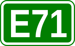
European route E 71 is a north-south Class-A intermediate European road route. It begins in Košice, Slovakia, passes through Budapest in Hungary, Zagreb in Croatia, and ends at Split in Croatia on the Adriatic Sea coast. The total length of the route is 1,016 km (631 mi). The E71 mostly consists of motorways, but considerable sections are either expressways or two-lane roads with at-grade intersections. Nearly all motorway sections of the E71 are tolled, using various toll collection systems including Electronic toll collection (ETC) and ticket systems. Individual segments of the E71 route are shared with several other European routes. The E71 section between Karlovac and Split is inconsistently physically signposted or marked on maps and route planning software. The E71 route has gradually been upgraded from a regular two-lane road to motorway standards since the 1970s; upgrades are still being carried out in some areas.

European route E38 is a road part of the International E-road network. It runs between Hlukhiv, Ukraine and Shymkent, Kazakhstan. It is 3,400 km (2,100 mi) long.

E 003 is a European B class road in Turkmenistan and Uzbekistan, connecting the cities Uchkuduk – Daşoguz – Ashgabat – Gaudan. This route is not signposted in any form.

E 006 is a European B class road in Tajikistan and Uzbekistan, connecting the cities Ayni – Kokand. Since European routes are not signposted in Tajikistan and Uzbekistan, the E006 has never seen in a direction sign in any form.

E 008 is a European B class road in Tajikistan, connecting the cities Dushanbe - Kulob - Kalaikhumb - Khorugh – Murghab - Kulma - border of China. The border is located at the Kulma Pass, at an elevation of 4,362 metres (14,311 ft), the highest elevation of any E-route.

E404 was supposed to be a European B class road in Belgium, connecting the cities Jabbeke and Zeebrugge. However, the road was not built according to the original plans. The number is nevertheless given to a route between the two cities, but it is not signposted or on any maps.