E89 | |
---|---|
Route information | |
Length | 130 km (80 mi) |
Major junctions | |
North end | Gerede |
South end | Ankara |
Location | |
Countries | |
Highway system | |
International E-road network |
The European route E89 is a road part of the International E-road network, running from Gerede in Turkey to Ankara in Turkey.
The international E-road network is a numbering system for roads in Europe developed by the United Nations Economic Commission for Europe (UNECE). The network is numbered from E 1 up and its roads cross national borders. It also reaches Central Asian countries like Kyrgyzstan, since they are members of the UNECE.
Gerede is a town and a district of Bolu Province in the Black Sea region of Turkey. It is located on the highway from Istanbul to Ankara. It covers an area of 1,255 km2 (484.56 sq mi), and the population (2000) is 41,391 of which 25,200 live in the town of Gerede. Elevation is about 1,450 m. The mayor is Ömer Baygın (AKP).
Turkey, officially the Republic of Turkey, is a transcontinental country located mainly in Western Asia, with a smaller portion on the Balkan Peninsula in Southeast Europe. East Thrace, located in Europe, is separated from Anatolia by the Sea of Marmara, the Bosphorous strait and the Dardanelles. Turkey is bordered by Greece and Bulgaria to its northwest; Georgia to its northeast; Armenia, the Azerbaijani exclave of Nakhchivan and Iran to the east; and Iraq and Syria to the south. Istanbul is the largest city, but more central Ankara is the capital. Approximately 70 to 80 per cent of the country's citizens identify as Turkish. Kurds are the largest minority; the size of the Kurdish population is a subject of dispute with estimates placing the figure at anywhere from 12 to 25 per cent of the population.
It is a Class A North-South connection road connecting Gerede - Kizilcahamam - Ankara (according to the UNECE).
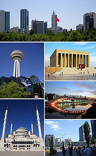
Ankara, historically known as Ancyra and Angora, is the capital of Turkey. With a population of 4,587,558 in the urban center (2014) and 5,150,072 in its province (2015), it is Turkey's second largest city after Istanbul, having outranked İzmir in the 20th century.
This European road or road transport-related article is a stub. You can help Wikipedia by expanding it. |
Bolu Province is a province in northwestern Turkey. It's an important midpoint between the capital, Ankara and the largest city in the country, Istanbul. It covers an area of 7,410 km², and the population is 271,208.
Mount Bolu Tunnel is a 3.1-kilometre-long (1.9 mi) highway tunnel constructed through the Bolu Mountain in Turkey between Kaynaşlı, Düzce and Yumrukaya, Bolu.
Asian Highway 1 (AH1) is the longest route of the Asian Highway Network, running 20,557 km (12,774 mi) from Tokyo, Japan via Korea, China, Southeast Asia, Bangladesh, India, Pakistan, Afghanistan and Iran to the border between Turkey and Bulgaria west of Istanbul where it joins end-on with European route E80.
European route E 80, also known as Trans-European Motorway or TEM, is an A-Class West-East European route, extending from Lisbon, Portugal to Gürbulak, Turkey, on the border with Iran. The road connects 10 countries and has a length of approximately 6,102 kilometres (3,792 mi). At its eastern end it joins end-on with Asian Highway AH1 which continues all the way to Japan.
European route E 90 is an A-Class West–East European route, extending from Lisbon in Portugal in the west to the Turkish–Iraqi border in the east.
Hacılar is a town and district of Kayseri Province, Turkey.
Aktaş is a Turkish name that may refer to:
Otoyol 20, abbreviated as
Asian Highway 5 (AH5) is an east-west route of the Asian Highway Network, running 10,380 km (6,450 miles) from Shanghai, China via Kazakhstan, Kyrgyzstan, Uzbekistan, Turkmenistan, Azerbaijan, Georgia to the border between Turkey and Bulgaria west of Istanbul where it connects to AH1 and
Hüsrev Gerede was a Turkish career officer, who served in the Ottoman Army and the Turkish Army. He was also a politician and diplomat of the Republic of Turkey.
The Roman Road of Ankara or Cardo Maximus is an ancient Roman road in Ankara, the capital of Turkey. The road was found in 1995 by Turkish archaeologist Cevdet Bayburtluoğlu. It is 216 metres (709 ft) long and 6.7 metres (22 ft) wide. Many ancient artifacts were discovered during the excavations along the road and most of them are currently displayed at the Museum of Anatolian Civilizations.
Balcılar is a Turkish place name that may refer to the following places in Turkey:
Akbaş is a Turkish name that may refer to:
European route E 88 is part of the international E-road network.
Beşkonak may refer to the following places in Turkey:
Dikmen is a town and district of Sinop Province, Turkey.
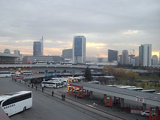
AŞTİ is the intercity bus terminal of Ankara, Turkey.
E 982 is a European B class road, connecting the cities Mersin and Tarsus on the southern coast of Turkey. It lies ~380 kilometres south east of Ankara. It runs from the junction with the D400 near the town of Hürriyet, south west of Mersin, to the junction with E90 and the O-21, near the town of Çamtepe, north east of Tarsus. It has a length of 67 kilometres, and consists entirely of motorway. It is part of the road with the Turkish national designation O-51.