Washington is a village and civil parish in the Horsham District of West Sussex, England. It is located five miles west of Steyning and three miles east of Storrington on the A24 between Horsham and Worthing. The parish covers an area of 1,276 hectares. In the 2001 census 1,930 people lived in 703 households, of whom 820 were economically active. At the 2011 Census the population of the civil parish was 1,867.

Sullington is a village and former civil parish, now in the parish of Storrington and Sullington, in the Horsham district of West Sussex, England. The village lies on the A283 road west of the A24 road, 20 miles (32 km) south of Horsham. In 1961 the parish had a population of 1354. On 1 April 2003 the parish was abolished and merged with Storrington to form "Storrington & Sullington".

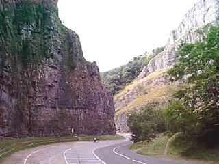
The Cheddar Complex is a 441.3-hectare (1,090-acre) biological Site of Special Scientific Interest near Cheddar around the Cheddar Gorge and north east to Charterhouse in the Mendip Hills, Somerset, England, notified in 1952.

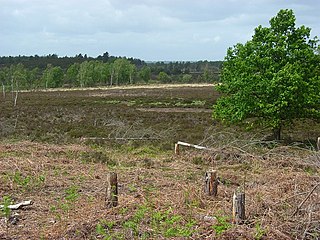
Street Heath is a 12.5 hectare biological Site of Special Scientific Interest 4 km west of Glastonbury in Somerset, notified in 1966. It next to the Glastonbury Canal and Ham Wall nature reserve. Street Heath has itself been designated as a Local Nature Reserve.

Sheepleas is a 99.9-hectare (247-acre) biological and geological Site of Special Scientific Interest east of Guildford in Surrey. It is a Geological Conservation Review site and a Local Nature Reserve. It is owned by Surrey County Council and managed by the Surrey Wildlife Trust.

Clayton to Offham Escarpment is a 422.5-hectare (1,044-acre) linear biological Site of Special Scientific Interest (SSSI) which runs from Clayton in West Sussex to Lewes in East Sussex. Its ownership and management is divided between over fifteen landowners and farmers. Parts of Ditchling's Downs, e.g. TQ 323 133, and the scarp between Blackcap and Mount Harry, e.g. TQ 378 124, are owned by the National Trust. What remains of Ditchling Tenantry Down common at Ditchling Beacon is leased to the Sussex Wildlife Trust.

Castor Hanglands is an 89.8-hectare (222-acre) biological Site of Special Scientific Interest west of Peterborough in Cambridgeshire. The site is also a National Nature Reserve, and it is a Nature Conservation Review site, Grade I for its woodlands and Grade 2 for its grassland. It is common land managed by Natural England.

Lewes Downs is a 165-hectare (410-acre) biological Site of Special Scientific Interest east of Lewes in East Sussex. It is a Nature Conservation Review site, Grade I and a Special Area of Conservation. Part of it is a national nature reserve, part is Malling Down nature reserve, which is managed by the Sussex Wildlife Trust, and part is Mount Caburn, an Iron Age hill fort which is a Scheduled Monument.

Eridge Green is a 8.4-hectare (21-acre) biological Site of Special Scientific Interest north-east of Crowborough in East Sussex. It is part of the 44 hectares Eridge Rocks nature reserve, which is managed by Sussex Wildlife Trust.

Woolmer Forest is a 1,298.5-hectare (3,209-acre) biological Site of Special Scientific Interest south of Bordon in Hampshire and West Sussex. It is also a Special Area of Conservation and part of the Wealden Heaths Phase II Special Protection Area. Two areas are Nature Conservation Review sites, Grade I.

Decoy Pit, Pools and Woods is a 17.7-hectare (44-acre) biological Site of Special Scientific Interest south of Aldermaston in Berkshire. An area of 8 hectares is a nature reserve called Decoy Heath, which is managed by the Berkshire, Buckinghamshire and Oxfordshire Wildlife Trust.

Crickley Hill and Barrow Wake is a 56.8-hectare (140-acre) biological and geological Site of Special Scientific Interest in Gloucestershire, notified in 1974.

Leiston - Aldeburgh is a 534.8-hectare (1,322-acre) biological Site of Special Scientific Interest which stretches from Aldeburgh to Leiston in Suffolk. Part of it is The Haven, Aldeburgh Local Nature Reserve, and another area is the North Warren RSPB nature reserve. There is also a prehistoric bowl barrow on Aldringham Common, which is a Scheduled Monument. The site is in the Sandlings Special Protection Area under the European Union Directive on the Conservation of Wild Birds, and the Suffolk Coast and Heaths Area of Outstanding Natural Beauty.

Burton Park SSSI is a 57.7-hectare (143-acre) biological Site of Special Scientific Interest west of Pulborough in West Sussex. A larger area of 63 hectares, including Chingford Pond to the west, is designated a Local Nature Reserve called Burton and Chingford Ponds, which is managed by the Sussex Wildlife Trust and West Sussex County Council. The site is adjacent to Burton Park, a Grade I listed building.

Iping and Stedham Commons is a nature reserve owned and managed by the Sussex Wildlife Trust. It is a 125.4-hectare (310-acre) biological Site of Special Scientific Interest near the villages of Iping and Stedham, west of Midhurst in West Sussex. It is also a Local Nature Reserve and a Nature Conservation Review site, Grade 2.

Lavington Common is a 31.2-hectare (77-acre) biological Site of Special Scientific Interest south-west of Petworth in West Sussex. It is a National Trust property.

St Leonard's Forest SSSI is an 85.4-hectare (211-acre) biological Site of Special Scientific Interest east of Horsham in West Sussex. The SSSI is in two separate areas, with the western part being in the 289-hectare (710-acre) Forestry Commission managed St Leonard's Forest.

St Leonard's Park Ponds is a 3.9-hectare (9.6-acre) biological Site of Special Scientific Interest east of Horsham in West Sussex.

Hurston Warren is a 69.1-hectare (171-acre) biological Site of Special Scientific Interest south-east of Pulborough in West Sussex.


