Summit Airport (Delaware)

Last updated • 3 min readFrom Wikipedia, The Free Encyclopedia
Summit Airport
Summary
Airport typePublic
OwnerSummit Aviation, Inc.
Location Middletown, Delaware, United States
Elevation  AMSL 70 ft / 21 m
Coordinates 39°31′13″N075°43′14″W / 39.52028°N 75.72056°W / 39.52028; -75.72056
Website Summit Aviation
Map
USA Delaware location map.svg
Airplane silhouette.svg
EVY
Location of airport in Delaware/United States
Usa edcp relief location map.png
Airplane silhouette.svg
EVY
EVY (the United States)
Runways
Direction LengthSurface
ftm
17/354,4871,368 Asphalt
11/293,6001,097Turf
Statistics (2016)
Aircraft operations31,390
Based aircraft21

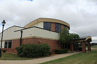
Summit Airport( ICAO : KEVY, FAA LID : EVY) is a public-use airport located 5 miles (8.0 km) north of the central business district of Middletown, in New Castle County, Delaware, United States. It is privately owned by Summit Aviation, Inc. [1] It is included in the Federal Aviation Administration (FAA) National Plan of Integrated Airport Systems for 2017–2021, in which it is categorized as a reliever general aviation facility. [2]

Contents

Many U.S. airports use the same three-letter location identifier for the FAA and IATA . However, this airport is assigned EVY by the FAA but has no designation from the IATA. [3]

The airport hosts a variety of aviation-related events throughout the year. It hosts a multi-week Women in Aviation and Law Enforcement Seminar sponsored by the Delaware State Police. [4] [5] [6]

The airport has hosted training missions for medivac helicopter crews. [7] It is also a maintenance base for military Chinook helicopters. [8]

The airport has been a source of controversy for storing an ATR 42 purchased to serve in drug enforcement efforts in Afghanistan. The plane is unairworthy and unable to fly, and it thus is taking up space and rent. [9]

Facilities and aircraft

Summit Airport covers an area of 209 acres (85  ha ) which contains two runways. [1] Runway 17/35 measures 4,488 x 65 ft (1,368 x 20 m) with an asphalt surface. Runway 11/29 measures 3,601 x 200 ft (1,098 x 61 m) with a turf surface. [10] [11]

For the 12-month period ending December 31, 2016, the airport had 31,390 aircraft operations, an average of 86 per day: 99% general aviation and less than 1% military. This is down from 89,600 aircraft operations in 2002. In 2016, there were 21 aircraft based at the airport, all single engine airplanes. This was down from 103 based aircraft in 2002. [1] [10] [11]

Accidents and incidents

See also

Related Research Articles

<span class="mw-page-title-main">Bolton Field</span> Airport

<span class="mw-page-title-main">Akron Executive Airport</span> Airport

Akron Fulton Intl Airport is in Akron, Summit County, Ohio, United States. It is owned by the City of Akron; FAA's National Plan of Integrated Airport Systems for 2011–2015 called it a general aviation airport.

<span class="mw-page-title-main">Dayton–Wright Brothers Airport</span> Airport in Montgomery County / Clearcreek Township, Warren County

<span class="mw-page-title-main">Cuyahoga County Airport</span> Airport in Richmond Heights, Willoughby Hills

Cuyahoga County Airport, also known as Robert D. Shea Field, is a public use airport in northeastern Cuyahoga County, Ohio, United States. Owned and operated by Cuyahoga County since 1946, it also serves Lake County and Geauga County. The airport is located 10 nautical miles east of downtown Cleveland and sits on the border of three cities: Highland Heights, Richmond Heights and Willoughby Hills. It is included in the National Plan of Integrated Airport Systems for 2011–2015, which categorized it as a general aviation reliever airport for Cleveland Hopkins International Airport.

<span class="mw-page-title-main">Delaware Coastal Airport</span> Airport in Delaware, United States

Delaware Coastal Airport is a public use airport in unincorporated Sussex County, Delaware, United States. Owned by the Sussex County Council, it is located two nautical miles (4 km) southeast of the central business district of Georgetown. It is included in the Federal Aviation Administration (FAA) National Plan of Integrated Airport Systems for 2017–2021, in which it is categorized as a regional general aviation facility.

<span class="mw-page-title-main">Ohio State University Airport</span> Airport in Columbus, United States of America

<span class="mw-page-title-main">Gordon K. Bush Airport</span> Airport

Campbell Airport is a public-use airport located two miles (3 km) southwest of the central business district of Grayslake, a village in Lake County, Illinois, United States. It is privately owned by Kane Illinois Properties, Inc.

Chorman Airport is a public use airport located two nautical miles (4 km) southwest of the central business district of Farmington, a town in Kent County, Delaware, United States. It is privately owned by Allen Chorman.

Lorain County Regional Airport is a public airport in Lorain County, Ohio, owned by the Lorain County Board of Commissioners and located in New Russia Township. The airport is about 7 miles south of Lorain and 5 miles southwest of Elyria. The National Plan of Integrated Airport Systems for 2011–2015 categorized it as a general aviation reliever airport.

Paul C. Miller–Sparta Airport is a public airport located 3 mi (5 km) southeast of Sparta, Michigan. Established in 1941, the airport is currently owned and operated by the Village of Sparta and is self-supporting, requiring no public funding. It is included in the Federal Aviation Administration (FAA) National Plan of Integrated Airport Systems for 2017–2021, in which it is categorized as a regional general aviation facility.

Bluffton Airport is a public use airport located one nautical mile (1.85 km) southeast of the central business district of Bluffton, in Hancock County, Ohio, United States. It is owned by the Village of Bluffton. According to the FAA's National Plan of Integrated Airport Systems for 2009–2013, it is categorized as a general aviation facility.
<span class="mw-page-title-main">Brooklyn Airport</span> Airport

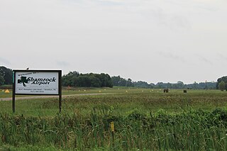
Brooklyn Airport, also known as Shamrock Field, is a privately-owned, public-use airport located in Brooklyn, Michigan, United States. It is at an elevation of 987 feet.

Jack Barstow Airport, also known as Jack Barstow Municipal Airport, is a city-owned, public-use airport located three nautical miles (6 km) northwest of the central business district of Midland, a city in Midland County, Michigan, United States. It is included in the Federal Aviation Administration (FAA) National Plan of Integrated Airport Systems for 2017–2021, in which it is categorized as a local general aviation facility.

Jerry Tyler Memorial Airport is a privately owned airport in Niles, Michigan, United States. It is included in the Federal Aviation Administration (FAA) National Plan of Integrated Airport Systems for 2017–2021, in which it is categorized as a local general aviation facility. It is used primarily by general aviation (GA) traffic.

The Ashland County Airport is a public-use airport in Ashland County, Ohio, United States. It is located three nautical miles northeast of the central business district of the City of Ashland. It is included in the FAA's National Plan of Integrated Airport Systems for 2011–2015, which categorized it as a general aviation facility.

Dalton Airport is a privately owned, public use airport located two nautical miles (4 km) east of the central business district of Flushing, in Genesee County, Michigan, United States. It is named after its founder, Edwin P. Dalton, who opened it in 1946 on the former site of the Marsa farm.

Prickett–Grooms Field, is a privately owned, public use airport located 1 mile (2 km) northeast of the central business district of Sidnaw, Michigan, a community in Houghton County, Michigan, United States.

Maple Grove Airport is a privately owned, public-use airport located 3 miles north of Fowlerville, Michigan. The airport is on an elevation of 906 ft.

Ottawa Executive Airport is a privately owned, public use airport located 3 miles east of Zeeland, Michigan.

References

  1. 1 2 3 4 FAA Airport Form 5010 for EVY PDF , effective 2023-09-07
  2. "List of NPIAS Airports" (PDF). FAA.gov. Federal Aviation Administration. 21 October 2016. Retrieved 27 November 2016.
  3. Airport information for KEVY at Great Circle Mapper.
  4. "Women in Aviation and Law Enforcement Seminar To Be Held In Delaware". The Crime Report. 2022-12-29. Retrieved 2023-04-22.
  5. jasonhatchell (2022-12-27). "Delaware State Police Announce "Women in Aviation and Law Enforcement Seminar"". Delaware State Police - State of Delaware. Retrieved 2023-04-22.
  6. Twinkle, Tanjeen. "Delaware State Police's Women in Aviation and Law Enforcement Seminar". WRDE Coast TV. Retrieved 2023-04-22.
  7. "Reserve medics train with Delaware State Police aero-medical unit". 512th Airlift Wing. Retrieved 2023-04-22.
  8. "Chinook helicopters getting overhaul in Delaware County, Middletown". Delaware Business Now. 2017-08-24. Retrieved 2023-04-22.
  9. Duvernay, Adam. "Plane stored in Delaware cost taxpayers $86 million". The News Journal. Retrieved 2023-04-22.
  10. 1 2 "AirNav: KEVY - Summit Airport". www.airnav.com. Retrieved 2023-04-22.
  11. 1 2 "EVY - Summit Airport | SkyVector". skyvector.com. Retrieved 2023-04-22.
  12. "RANDALL AMANDA Rotorway crash in Delaware (N103DE) | PlaneCrashMap.com". planecrashmap.com. Retrieved 2023-04-22.
  13. Stamm, Dan. "Experimental Copter Crashes in Delaware". NBC10 Philadelphia. Retrieved 2023-04-22.
  14. "Piper PA-32R-300 crash in Delaware (N276) | PlaneCrashMap.com". planecrashmap.com. Retrieved 2023-04-22.
  15. "1 killed, 1 hurt in small-plane crash in Delaware". Philadelphia Inquirer. Retrieved 2023-04-22.
  16. "Cessna 172S crash in Delaware (N647SP) | PlaneCrashMap.com". planecrashmap.com. Retrieved 2023-04-22.