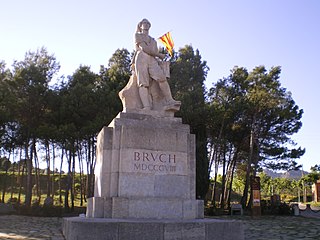
El Bruc is a municipality in the comarca of the Anoia in Catalonia, Spain. It is situated on the side of Montserrat, of which the north-western third is within the municipality. A local road connects the village with the main N-II road from Barcelona to Lleida, and to Monistrol de Montserrat via the monastery.

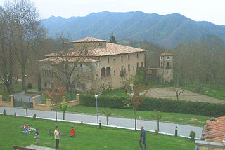
Massanes, also called Maçanes, is a municipality of the province of Girona, in the comarca of the Selva in Catalonia, Spain. It is situated on the left bank of the Tordera river. Local roads link the town with the A-7 autopista, the C-251 road and the RENFE railway station shared with Maçanet de la Selva.

Argençola is a municipality in the comarca of the Anoia in Catalonia, Spain. It is situated in the east of the comarca, bordering the Segarra and the Conca de Barberà. The Anoia river has its source on the territory of the municipality. A local road links the municipality with the main N-II road from Barcelona to Lleida.

Alins is a municipality in the comarca of the Pallars Sobirà in Catalonia, Spain. It adjoins France and Andorra. It covers the valleys of the Noguera de Vallferrara and Tor rivers in the north of the comarca. The Pica d'Estats is part of the Montcalm Massif on the frontier between this municipality and Ariège, France. A local road links the municipality with the L-504 road.

Saldes is a municipality in the comarca of the Berguedà in Catalonia, Spain. It is situated at the foot of the Pedraforca mountain (2497 m) in the north of the comarca. Deposits of lignite are extracted commercially. The village is linked to Guardiola de Berguedà by a local road. The monastery Sant Sebastià del Sull is located in Saldes.

Corbins is a municipality in the comarca of the Segrià in Catalonia, Spain. It is situated at the confluence of the Segre and Noguera Ribagorçana rivers and is linked to Lleida by a local road running parallel to the Segre.

Seròs is a municipality in the comarca of the Segrià in Catalonia, Spain. It is situated on the right bank of the Segre river in the south-west of the comarca. The Aragon and Catalonia canal provides irrigation water for growing fruit. The municipality is linked to the rest of the comarca and to Fraga by the C-242 road.

Arbolí is a municipality in the comarca of the Baix Camp in Catalonia, Spain. It is situated in the west of the comarca in the Prades mountains. A local road links the village with the C-242 road.

Masllorenç is a municipality in the comarca of the Baix Penedès in Catalonia, Spain. It is situated on the slopes of the Miramar range (864 m). A local road links the municipality with El Pla de Santa Maria, and with the A-2 autopista and the T-200 road. Masllorenç became part of the Baix Penedès in the comarcal revision of 1990: previously it formed part of the Alt Camp.

La Molsosa is a municipality in the comarca of the Solsonès in Catalonia, Spain. It is situated in the south of the comarca in the Castelltallat range. It is linked to Calaf by a local road. The municipality is split into two parts, the bigger eastern part having nearly all the population. La Molsosa became part of the Solsonès in the comarcal revision of 1990: previously it formed part of the Anoia.

La Portella is a municipality in the comarca of the Segrià in Catalonia, Spain. It is situated on the right bank of the Noguera Ribagorçana river. A local road links the municipality with Lleida.

Santa Maria de Besora is a municipality in the comarca of Osona in Catalonia, Spain. It is situated on the north side of the Bellmunt range in the north of the comarca. It is linked to Sant Quirze de Besora and to Vidrà by a local road. Besora castle has an eleventh-century Romanesque church: there is also a preroman chapel at Sant Moí. Santa Maria de Besora became part of Osona in the comarcal revision of 1990: previously it formed part of the Ripollès.
Vidrà is a municipality in the comarca of Osona in Catalonia, Spain. It is situated in the valley of the Ges river, between the Bellmunt and Milany ranges, in the north of the comarca. It is linked to Sant Quirze de Besora by a local road. There are the roman churches of Sant Bartomeu de Covildases and of Santa Margarida de Cabagès in the municipal territory. Vidrà became part of Osona in the comarcal revision of 1990: previously it formed part of the Ripollès.

Renau is a municipality in the comarca of the Tarragonès in Catalonia, Spain. It is situated on the right bank of the Gaià river, which is dammed to form the Gaià reservoir. A local road links the village with Vilabella and with the N-240 road between Tarragona and Valls.

Sant Vicenç de Montalt, is a municipality in the comarca of the Maresme in Catalonia, Spain. It is situated on the coast between Sant Andreu de Llavaneres and Arenys de Mar, below the el Corredor range, with the main settlement slightly inland. The main N-II road along the coast passes through the municipality, linked to the town by a local road. There are also roads to Arenys de Munt and to Mataró, and a station on the RENFE railway line at Caldes d'Estrac.

Vallgorguina is a municipality in the comarca of Vallès Oriental in Catalonia, Spain. It is situated in the hollow between the ranges of el Corredor and Montnegre. It is linked to Sant Celoni and to Arenys de Munt by a local road.

Espinelves is a municipality in the comarca of Osona in Catalonia, Spain. It is situated in the Guilleries in the east of the comarca. Forestry is the main economic activity of the municipality, particularly the cultivation of the local species Abies masjoanensis for Christmas trees. The Romanesque church of Sant Vincenç d'Espinelves dates from the 11th and 12th centuries. The village is linked to Arbúcies and to Vic by the GI-543 road.

Viladrau is a municipality in the comarca of Osona in Catalonia, Spain. It is situated in the south-east of the comarca, beneath the massifs of the Guilleries and the Montseny, and is served by the GE-520 road, which links the municipality with the comarca of the Selva and with the N-152 road at Tona. The local mineral water is well known.

Fogars de la Selva is a municipality in the comarca of the Selva in Catalonia, Spain. It is situated to the north of the Montnegre range, and is linked to Tordera by a local road. The village used to be called Fogars de Tordera, and is the only municipality in the Selva to be part of the province of Barcelona rather than the province of Girona.

Begues is a municipality in the comarca of Baix Llobregat in Catalonia, Spain. It is situated in the south-west of the comarca, and its municipal territory covers most of the Garraf massif including the peaks of el Montau (658 m) and La Morella (594 m).


