Saldes is a municipality in the comarca of the Berguedà in Catalonia, Spain. It is situated at the foot of the Pedraforca mountain in the north of the comarca. Deposits of lignite are extracted commercially. The village is linked to Guardiola de Berguedà by a local road. The monastery Sant Sebastià del Sull is located in Saldes.

Seròs is a municipality in the comarca of the Segrià in Catalonia, Spain. It is situated on the right bank of the Segre river in the south-west of the comarca. The Aragon and Catalonia canal provides irrigation water for growing fruit. The municipality is linked to the rest of the comarca and to Fraga by the C-242 road.

Susqueda is a municipality in the comarca of the Selva in Catalonia, Spain. It is located in the Guilleries Massif area, on the left bank of the Ter river in the north-west of the comarca. The Susqueda reservoir is on the municipal territory, and the associated hydroelectric power station is an important source of local income. A local road links the municipality with the C-152 road to Santa Coloma de Farners.

Arbolí is a municipality in the comarca of the Baix Camp in Catalonia, Spain. It is situated in the west of the comarca in the Prades mountains. A local road links the village with the C-242 road.

×
Vidrà is a municipality in the comarca of Osona in Catalonia, Spain. It is situated in the valley of the Ges river, between the Bellmunt and Milany ranges, in the north of the comarca. It is linked to Sant Quirze de Besora by a local road. There are the roman churches of Sant Bartomeu de Covildases and of Santa Margarida de Cabagès in the municipal territory. Vidrà became part of Osona in the comarcal revision of 1990: previously it formed part of the Ripollès.

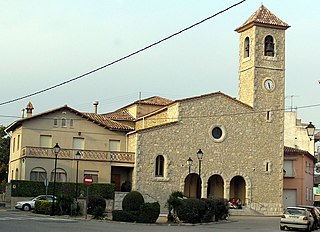
Prats de Lluçanès is a municipality in the comarca of Lluçanès in Catalonia, Spain. It is situated in the west of the comarca, on a plain between the Lluçanès and Merlès rivers, and is served by the C-154 road between Vic and Gironella.
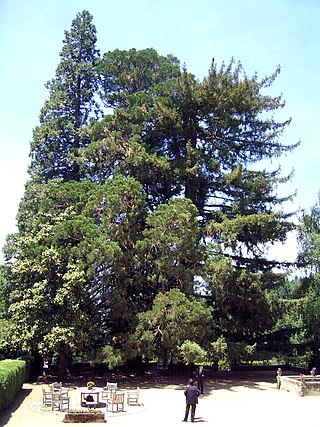
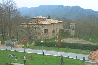
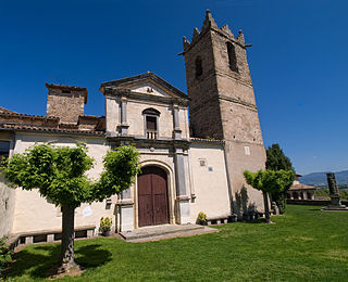
Viladrau is a municipality in the comarca of Osona in Catalonia, Spain. It is situated in the south-east of the comarca, beneath the massifs of the Guilleries and the Montseny, and is served by the GE-520 road, which links the municipality with the comarca of the Selva and with the N-152 road at Tona. The local mineral water is well known.

Borredà is a municipality in the comarca of the Berguedà in Catalonia, Spain. It is situated in the upper valley of the Margençol river in the east of the comarca. There are several notable houses from the 17th and 18th centuries. The Romanesque church of Sant Sadurní de Rotgers, a protected historico-artistic monument, can be reached by a mountain track. The village is served by the C-149 road between Berga and Sant Quirze de Besora. The municipality surrounds an exclave of Les Llosses.

Nalec is a municipality in the comarca of the Urgell in Catalonia, Spain. It is situated in the valley of the Corb in the south of the comarca.
Balenyà is a municipality in the comarca of Osona in Catalonia, Spain.
Gurb is a municipality in the comarca of Osona in Catalonia, Spain.

Oristà is a municipality in the comarca of Lluçanès in Catalonia, Spain. It includes an exclave within Sant Feliu Sasserra.

Perafita is a municipality in the comarca of Lluçanès in Catalonia, Spain.

Sant Agustí de Lluçanès is a municipality in the comarca of Osona in Catalonia, Spain.
Sant Boi de Lluçanès is a municipality in the comarca of Osona in Catalonia, Spain.

Sant Martí d'Albars is a municipality in the comarca of Lluçanès in Catalonia, Spain.

Santa Cecília de Voltregà is a municipality in the comarca of Osona, Catalonia, Spain.

Sobremunt is a municipality in the comarca of Lluçanès in Catalonia, Spain.

Els Pallaresos is a municipality in the comarca of the Tarragonès in Catalonia, Spain.