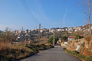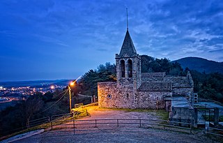
Sant Cugat del Vallès is a town and municipality north of Barcelona, Catalonia. Known as Castrum Octavianum in antiquity and as Pins del Vallès during the Second Spanish Republic, it is named after Saint Cucuphas, who is said to have been martyred on the spot now occupied by its medieval monastery. The final part of its toponym, del Vallès, is a reference to the historical county where the town is situated, Vallès.

Piera is a municipality that covers a large portion of the southeastern corner of the comarca of Anoia in Catalonia, Spain, on the left bank of the Anoia river. The agricultural land, mostly non-irrigated, is used for the cultivation of cereals, grapes, olives and almonds. The town itself hosts a number of light industries: textiles, plastics and construction materials. Tourism during the summer months is also relatively important for the local economy.

Pavelló Municipal Font de Sant Lluís is an indoor arena that is located in Valencia, Spain. Built in 1983, it is primarily used for basketball games, and it is the home arena of the Spanish Liga ACB club Valencia Basket. The arena has a seating capacity of 9,000 people.

Sant Esteve Sesrovires is a municipality in the northern part of the comarca of Baix Llobregat in Catalonia, Spain. It is situated on the left bank of the Anoia river, close to the A-2 highway, and is served by the FGC railway line R6 from Barcelona and Martorell to Igualada.

Olius is a municipality in the comarca of Solsonès in Catalonia, Spain. It is situated on the Cardener River above the reservoir of Sant Ponç. The village is served by the C-149 road between Solsona and Berga. The church of Sant Esteve d'Olius is a protected historico-artistic monument.

Clariana de Cardener is a municipality in the comarca of the Solsonès in Catalonia, Spain. It is situated on the Cardener river below the reservoir of Sant Ponç. The village is served by the C-1410 road between Cardona and Solsona.

Coll de Nargó is a municipality in the comarca of the Alt Urgell in Catalonia, a region of Spain. It is situated in the Segre valley by the Oliana reservoir. The municipality is served by the C-14 road between Ponts and La Seu d'Urgell, the L-511 road to Isona and the L-401 road to Sant Llorenç de Morunys. The Romanesque church of Sant Climent dates from the eleventh century, and has a rectangular pre-Romanesque bell-tower.

Sant Feliu de Codines is a municipality in the comarca of Vallès Oriental, Catalonia, Spain. It is located in the north-west corner of the comarca, on the border with comarca of Moianès to the north, and the comarca of Vallès Occidental to the west.

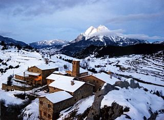
Sant Jaume de Frontanyà is a municipality in the comarca of the Berguedà in Catalonia, Spain. It is situated in the Pyrenees below the peak of Pedró de Tubau (1543 m). The village was the smallest municipality in Catalonia in terms of population but in 2018 lost the title to Gisclareny after the village grew. The monumental Romanesque church of Sant Jaume is a protected historic-artistic monument from the 11th century. The village is served by a local road to Borredà and it is well known for its peace and tranquility.

L'Esquirol known as Santa Maria de Corcó until 4 June 2014, is a municipality in the comarca of Osona in Catalonia, Spain.

Gisclareny is a municipality in the comarca of Berguedà, Catalonia, located in Cadí-Moixeró Natural Park. In 2018 it became again the smallest village in Catalonia after the village of Sant Jaume de Frontanyà grew by 3 families. The altitude of the inhabited space varies between 800 meters in the neighborhood of Bagà and 1430 in the neighborhood of Coll de la Bena. It is bounded on the north by the Cerdanya, reaching the peaks of the Serra del Cadí, and by Bagà, on the south and west by Saldes and Vallcebre, and on the east by Bagà and Guardiola de Berguedà. The alpine forests and meadows are the usual landscape of the municipality as well as a multitude of farmhouses scattered throughout the territory.

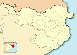
Cruïlles, Monells i Sant Sadurní de l'Heura is a Spanish municipality of the Province of Girona, situated in the comarca (county) of Baix Empordà (Catalonia), formed in 1973 by merging the municipalities of Cruïlles, Monells, and Sant Sadurní de l'Heura. Sant Sadurní is the capital of the municipality. According to the 2014 census, the municipality has a population of 1,284 inhabitants.

Sant Antoni de Vilamajor is a village in the comarca of Vallès Oriental in the province of Barcelona and autonomous community of Catalonia, Spain. The municipality covers an area of 13.7 square kilometres (5.3 sq mi) and the population in 2014 was 5,708.

Sant Pere de Vilamajor is a village in the province of Barcelona and autonomous community of Catalonia, Spain. The municipality covers an area of 13.8 square kilometres (5.3 sq mi) and the population in 2014 was 4,248.

Sant Salvador de Guardiola is a village in the comarca of Bages of the province of Barcelona and autonomous community of Catalonia, Spain. The municipality covers an area of 13.2 square kilometres (5.1 sq mi) and the population in 2014 was 3,130.

Sant Feliu de Buixalleu is a village in the province of Girona and autonomous community of Catalonia, Spain. The village is situated in the southeast of the ancient Catalan comarca of Selva. The municipality covers an area of 61.94 square kilometres (23.92 sq mi) and the population in 2014 was 776.

Sant Feliu de Pallerols is a village in the province of Girona and autonomous community of Catalonia, Spain. The municipality covers an area of 34.8 square kilometres (13.4 sq mi) and the population in 2014 was 1,353.

Sant Julià de Ramis is a village in the province of Girona and autonomous community of Catalonia, Spain. The municipality covers an area of 18.76 square kilometres (7.24 sq mi).

Vall-llobrega is a village and municipality in the province of Girona and autonomous community of Catalonia, Spain.

Sant Ramon is a municipality in the county of Segarra, in Catalonia. It includes the villages of Gospí(ca), Portell(ca) and Viver de Segarra(ca). The name references Saint Raymond Nonnatus because he was born in Portell.


