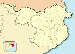
Camprodon is a small town in the comarca of Ripollès in Girona, Catalonia, Spain, located in the Pyrenees, near the French border.
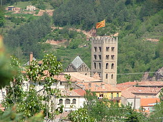
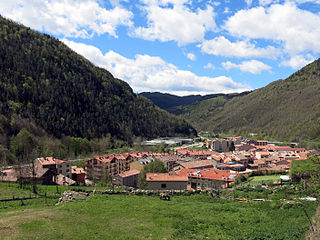
Ripoll is the capital of the comarca of Ripollès, in the province of Girona, Catalonia, Spain. It is located on confluence of the Ter River and its tributary Freser, next to the Pyrenees near the French border. The population was 11,057 in 2009.
La Jonquera is a municipality in the comarca of l'Alt Empordà, in Catalonia, Spain. It is situated next to the border with Northern Catalonia, nowadays France, opposite the municipality of Le Perthus.

Puigcerdà is the capital of the Catalan comarca of Cerdanya, in the province of Girona, Catalonia, northern Spain, near the Segre River and on the border with France.

Cerdanya or often La Cerdanya is a natural comarca and historical region of the eastern Pyrenees divided between France and Spain. Historically it was one of the counties of Catalonia.

Llívia is a town in the comarca of Cerdanya, province of Girona, Catalonia, Spain. It is a Spanish exclave surrounded by the French département of Pyrénées-Orientales.

The Province of Lleida is one of the four provinces of Catalonia. It lies in northeastern Spain, in the western part of the autonomous community of Catalonia, and is bordered by the provinces of Girona, Barcelona, Tarragona, Zaragoza and Huesca and the country of France and the principality of Andorra. It is often popularly referred to as Ponent.

The Treaty of the Pyrenees was signed on 7 November 1659 and ended the Franco-Spanish War that had begun in 1635.

The Canigó is a mountain located in the Pyrenees of southern France.

Cerdanya is a comarca in northern Catalonia, in the Pyrenees, on the border of Catalonia with France and Andorra. Within Catalonia, Cerdanya is divided between Catalan provinces of Girona and Lleida. Cerdanya's neighbouring comarques are Alt Urgell, Berguedà, and Ripollès.

Catalans are a Romance ethnic group native to Catalonia, who speak Catalan. The current official category of "Catalans" is that of the citizens of Catalonia, a nationality and autonomous community in Spain and the inhabitants of the Roussillon historical region in southern France, today the Pyrénées Orientales department, also called Northern Catalonia and Pays Catalan in French.

Northern Catalonia, North Catalonia or French Catalonia is the formerly Catalan-speaking and cultural territory ceded to France by Spain through the signing of the Treaty of the Pyrenees in 1659 in exchange of France's effective renunciation on the formal protection that it had given to the recently founded Catalan Republic. The area corresponds roughly to the modern French département of the Pyrénées-Orientales which were historically part of Catalonia since the old County of Barcelona, and lasted during the times of the Crown of Aragon and the Principality of Catalonia until they were given to France by Spain.

The Reapers' War, also known as the Catalan Revolt or Catalan Revolution, was a conflict that affected the Principality of Catalonia between 1640 and 1659, in the context of the Franco-Spanish War of 1635-1659. Being the result of a revolutionary process carried out by Catalan peasantry and institutions, as well as French diplomatic movements, it saw the brief establishment of a Catalan Republic and the clash of Hasbsburg and Bourbon armies on Catalan soil over more than a decade.

Gavà is a municipality in the Baix Llobregat comarca, in the province of Barcelona in Catalonia, Spain. It borders the coast of the Mediterranean Sea between Viladecans and Castelldefels.

Prats-de-Mollo-la-Preste is a commune in the Pyrénées-Orientales department in southern France, near the border with Spain and the Autonomous Community of Catalonia. The name Prats-de-Mollo comes from Catalan "meadows of Molló". Molló is a town just across the border and the Col d'Ares. La Preste is a spa resort town that was a separate village but is now included as part of the municipality. Prats-de-Mollo-la-Preste was the capital of the eponymous former canton. It forms part of the historical comarca of Vallespir and is part of Northern Catalonia.

Col d'Ares or Coll d'Ares is a mountain pass in the Pyrenees on the border between France and Spain.

Pyrénées-Orientales, also known as Northern Catalonia, are a department of the region of Occitania, Southern France, adjacent to the northern Spanish frontier and the Mediterranean Sea. It borders the departments of Ariège to the northwest and Aude to the north, the Mediterranean Sea to the east and the Spanish province of Girona in Catalonia to the south and the country of Andorra to the west. It also surrounds the tiny Spanish exclave of Llívia, and thus has two distinct borders with Spain. In 2019, it had a population of 479,979. Some parts of the Pyrénées-Orientales are part of the Iberian Peninsula. It is named after the Pyrenees mountain range.

La Granadella is a Spanish town (municipi) in the autonomous community of Catalonia. It is situated in the county of Garrigues, in the province of Lleida.
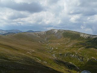
Roca Colom or Roc Colom is a mountain of Catalonia. It is located in the Pyrenees, at the border between Spain and France in the area of the Circ del Concròs in the Mentet, Setcases and Prats de Molló municipal terms. The mountain has an elevation of 2,506 metres above sea level.

Camí de la Retirada refers to routes and paths in the eastern Pyrenees used by Republican exiles at the end of the Spanish Civil War. One of the best known paths, today signposted as a trail for hiking or biking, runs for 14 kilometres (8.7 mi) from Molló to Prats de Molló via Col d'Ares at 1,513 metres (4,964 ft) above sea level. It is estimated that about 100,000 people of all ages used this path in January and February, 1939.